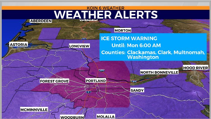
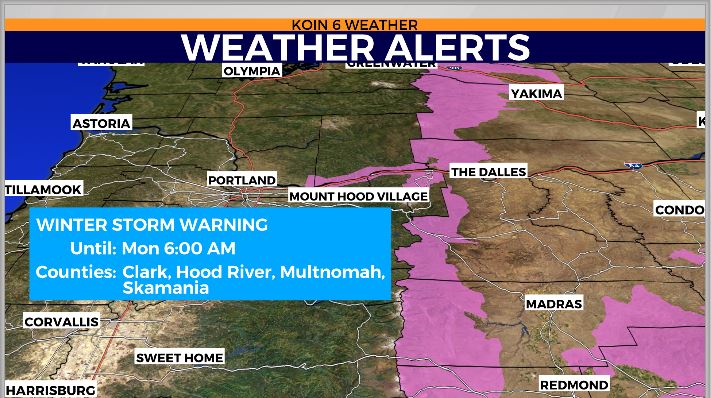
PORTLAND, Ore. (KOIN) – An ice storm warning is in effect for the Portland metro area, with winter storm warnings and winter weather advisories in effect elsewhere in the region.
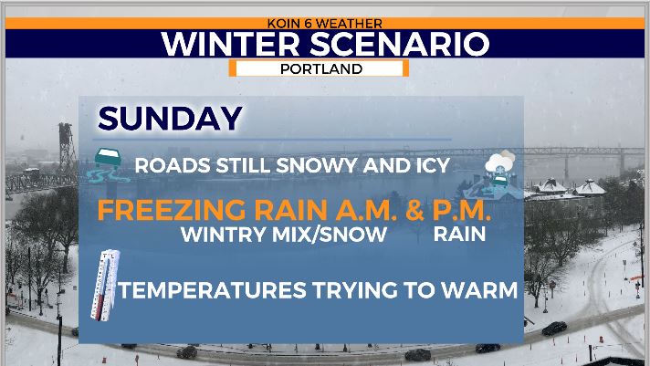
Rain will be turning into glaze on the Eastside, in the West Hills, and at times around Salem. Portland saw light snow through the morning as did parts of Columbia, Clark and Cowlitz counties.
We had a short wave of precipitation through the morning, and are expecting more to build in later this afternoon into this evening and overnight.
East winds are still firing cold air into the Metro area, keeping us in “the freezer” so to speak until later Monday afternoon when warmer air finally is able to override it thanks to a stronger onshore push.
BIGGEST AREAS OF CONCERN
On the east end of the Gorge, residents will see more snow changing to sleet and freezing rain Monday as the cold air is gradually scoured out, resulting in the same issues as those on the west end of the Gorge.
The west end of the Columbia Gorge could see heavy mixed precipitation and is still dealing with biting east winds. It could see up to 3/4 inch of ice (and 2-8 inches snow), which could result in Interstate 84 re-closing during to dangerous driving conditions after lanes in both directions re-opened this morning. Residents in the Gorge could also see more power outages with the ice accumulation.


For those living east of Interstate 205 and in the Southeast Metro area, like Lake Oswego, Oregon City, the glaze is happening Sunday morning and will likely continue through the day. Unfortunately, there’s no escape from the sub-freezing, icy conditions until late Monday. Some icy conditions possible in Washington County, too. Just because they’re the “lowlands” doesn’t mean it’s not still sub-freezing and slick.
West Hills, Mt. Scott, Council Crest, other higher elevations will have the same deal with glaze happening this morning, likely to continue through the day. Need East wind to cut off, and temps to warm.
POSITIVE NOTES
Yes, there is light at at the end of this very cold tunnel: We should switch out gradually Monday to all rain. Temperatures are expected to warm to low 40s in Metro area on Monday as well. We return to all rain and mountain snow this week, with temps. in the lowlands in the mid to upper 40s through the rest of the week. Wednesday looks to be the driest day of the week ahead. Overnight lows will not drop below freezing in the Metro and Valley.
However, there are concerns about where all the snow and ice will go. In other words, could we see some flooding? We will likely see high river and stream levels, urban flooding possibly if rain amounts are heavy and melting is quick. It’s certainly going to be a slushy, sloppy mess, and not a time to let your guard down as we break out of this.