Editor’s note: The KOIN 6 Weather team is presenting weather and science lessons to help serve our teachers and students. Click here for more lessons.
PORTLAND, Ore. (KOIN) – The mighty mountains of the Pacific Northwest are more than just snow-covered hills: we are living amongst the famous Cascade volcanoes!
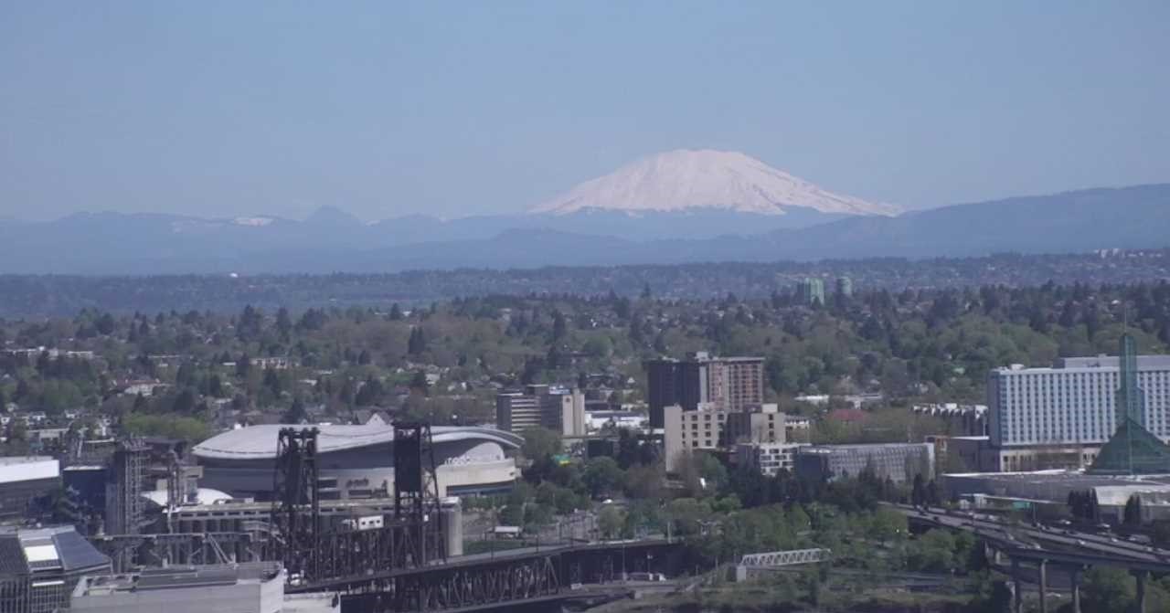
You know Mount St. Helens and Mount Hood in the scenery of our backyards, meanwhile Mount Adams, Mount Jefferson, Mount Rainier are all just a clear sky view in the distance. Many of these famous peaks are just a short distance away or they may be in view from your house depending on where you’re located.

In today’s weather kids lesson, we are learning the difference between volcano types. You can even watch a video from Chief Meteorologist Natasha Stenbock about how to create one.
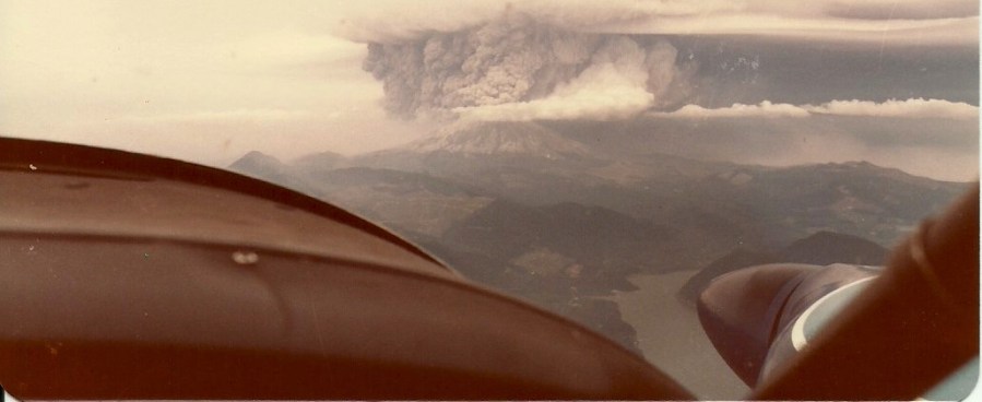
Tuesday is equally special because it is the anniversary of the eruption of Mount St. Helens. Some of your parents or grandparents likely experienced the eruption in some sort of way. If not, I’m sure they have stories or could tell you all about it. You can actually see a few photos from the event in the lesson below. Have you noticed that the top of the mountain doesn’t quite look like the top of some of the other mountains? That is because it was essentially blown off due to the extreme force of the eruption back on May 18, 1980.
You want to know what it looked like? Well Chief Meteorologist Natasha Stenbock got the chance to experience it from her dad’s plane. Look at the view! You’re probably asking yourself how did this happen and what is actually going on? That is a good question, why don’t we learn about some of the science.
HOW VOLCANOES WORKS
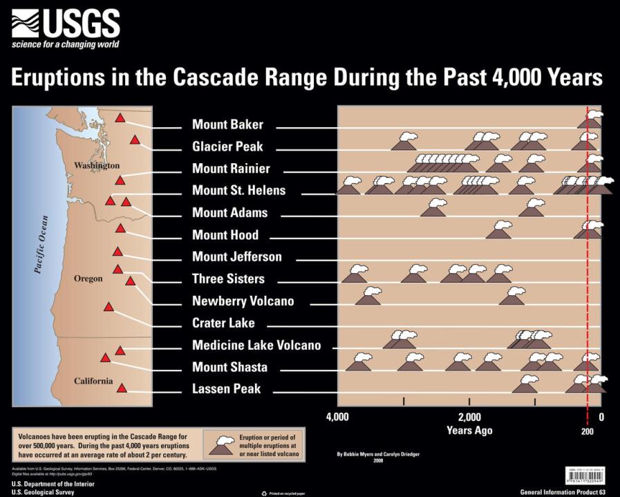
First, volcanoes form around here because of a process called subduction. In our case, the crust of the ocean floor is essentially sliding under the plate that we will call the United States. This is has created a scenario where volcanoes have formed because of deformation from the plate that is sliding underneath. That process is what formed our Cascade volcanoes, which is also known as the ring of fire. Below is a list of the volcanoes from northern Washington south into Northern California. You can see the location of Mount Baker and some of the other volcanoes like Mount Shasta and Crater Lake. What is also interesting, the United States Geological Survey (USGS) also offers the last time each had erupted during the past 4,000 years. There are about 2 eruptions per a century. Mt. St. Helens has been the busiest in our lifetime.
STUDY THE GRAPHIC BELOW
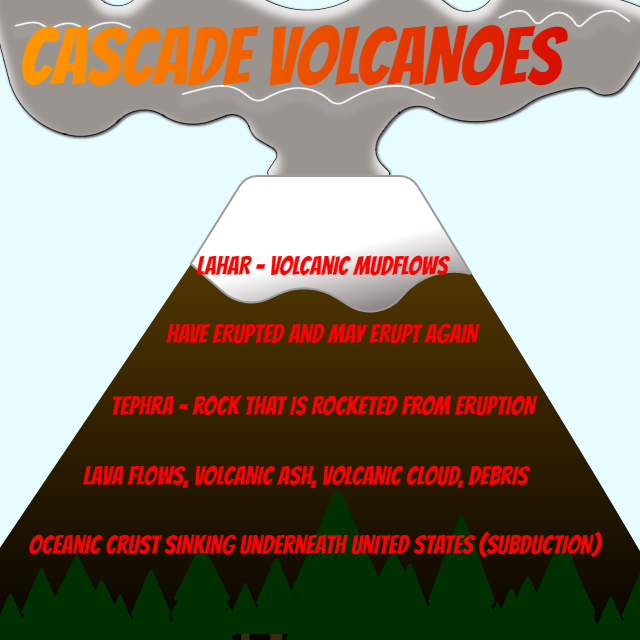
There are a few terms you should know when learning about volcanoes.
Lahar – Also called a volcanic mudflow. A mixture of water and volcanic debris that moves rapidly downstream.
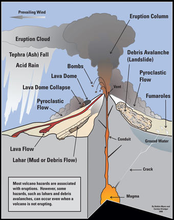
Tephra – Rock that is shot out of the volcano, in any size, during an eruption. This does include ash.
Pyroclastic Flow – Extremely hot mixture of rock, ash, and gas that travels rapidly away from a volcanic vent (photo to the side).
Magma – Extremely hot liquid of molten rock under the surface of the earth.

Lava – Essentially this is magma that has now reached and traveled on the surface. It is molten rock that has been erupted continues as the liquid substance it was under the earth’s surface.
Eruption Cloud – Plume of erupting debris and volcanic gas that rises directly above a volcano during the eruption.
VOLCANO TYPES
There are different types of volcanoes. The volcanoes that we are familiar with in the Pacific Northwest are composite volcanoes. You may also hear the term stratovolcano when you’re discussing composite volcanoes. The other volcano that is common is known as a shield volcano. Study the graphic below to learn about the traits that each possess and how they differ from one another.
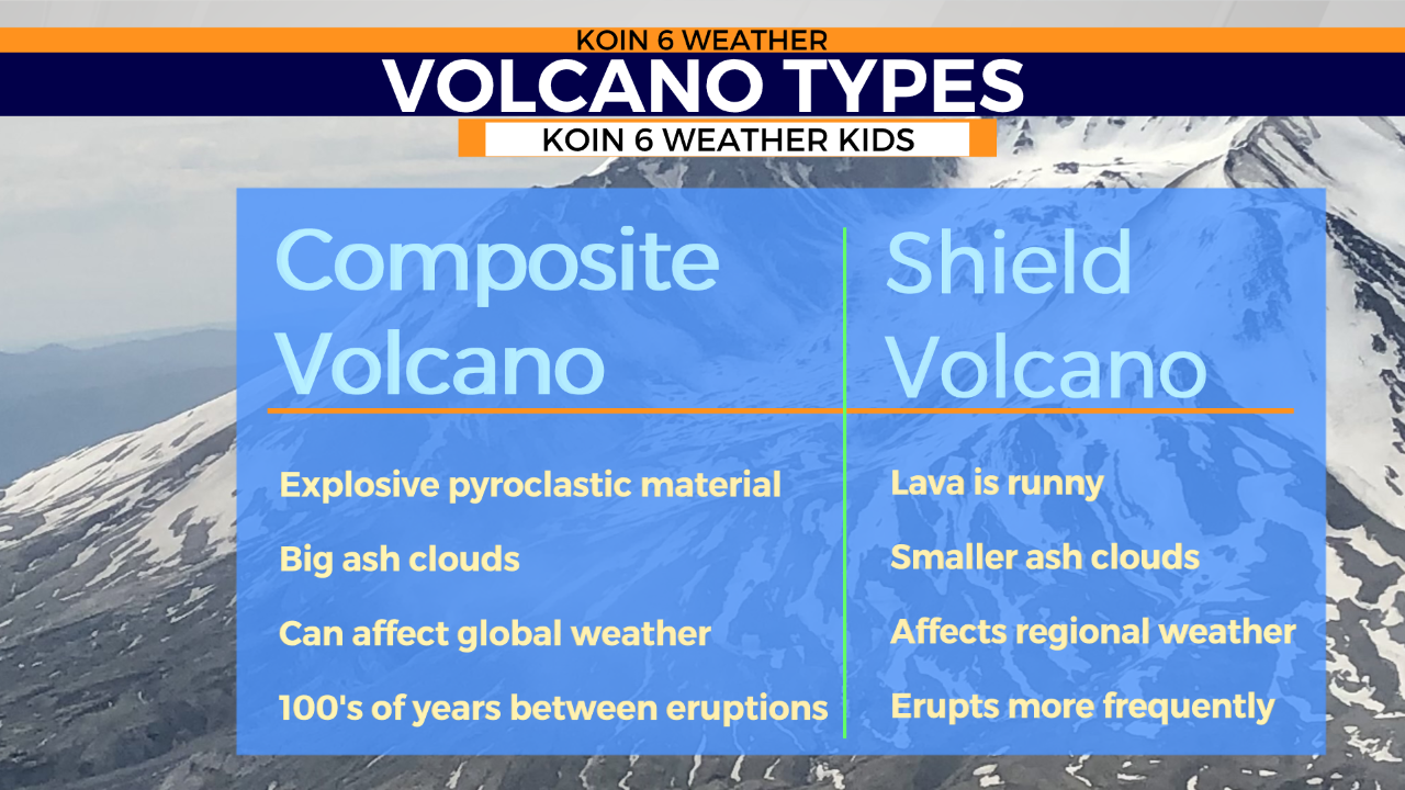
Composite volcanoes are the aggressive explosive type that you may imagine when you picture a volcano. If you’re envisioning a slow moving lava, you’re thinking more of a shield volcano. Both can affect the weather, but the one that spews an eruption cloud way up into the sky, that one is going to impact folks on a global scale because. Massive clouds can block the sun out and it also distributes a lot of particles into the air.
What is the best way to help prepare or measure activity? Well scientists are doing their best to come up with a system that allows for seismic monitoring. This is a way to keep in touch with the movements that are happening under these volcanoes. This is a technology that continues to improve and one of the ways to stay alert.
Now that you know a little more about volcanoes, you can picture our mountains in a new way!