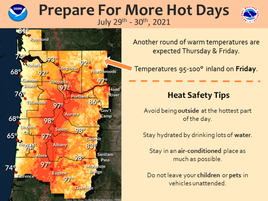
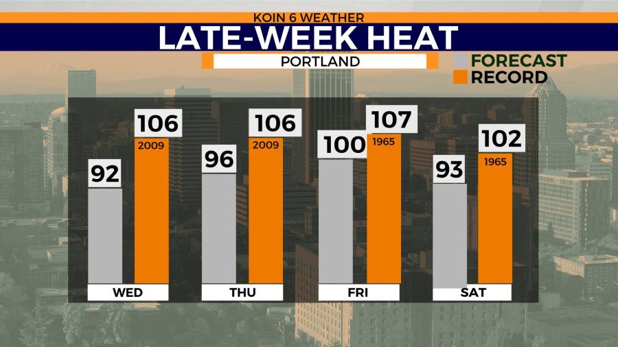
PORTLAND, Ore. (KOIN) — We’ve had warmer days this summer, a lot warmer. We’re not trying to go back to the June heat wave, and we aren’t, but we have another heat wave coming to finish the month of July. This is going to be a summer heat wave that we are more accustomed to out here. Temperatures pushing the upper 90s, potentially hitting 100 on Friday. It is absolutely going to be hot the next 4 days (all expected to be over 90 degrees). Although, the summer is free game for excessive heat, we know that this time of the year is when Portland hits the high end for our daytime maximum temperature. We are technically in the warmest pocket of the year right now. It’s also fair game that we may have cooler spells in the summer, but the next 5 days aren’t going to reflect that.
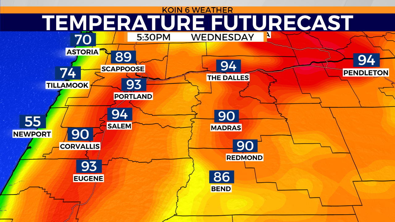
Real quick, you can see an update to the temperature futurecast below for your Wednesday late afternoon and early evening. Expect temperatures in the lower to mid 90s. There is no change in the forecast from early this morning. Take your breaks this afternoon, find shade, wear sun protection, and drink water.
Let’s move on.
Again, this is the top of mountain for us this summer. We are at the peak of our maximum high average for the year. We start our hike back down to cooler temperatures after August 2. That means our average high temperature will go from 83.7 degrees down to 83.6 degrees on August 3! That’s not saying much, but by the time we finish the month of August, it’s down to 80.4 degrees. This is also the case for the minimum temperatures too. You can expect those to start cooling, almost down to the mid-50s by August 31. Are you ready for summer to slowly transition to fall? Below is a graphic that has the summary of daily normals from 1991-2020 for the Portland International Airport. I’ve highlighted the window that we are in right now (July 26-August 2).

Knowing that we are in that last hurrah interval, it seems fitting that we are entering one of our warmest moments this summer. Temperatures are going to be running around 10 to 15 degrees above average by the time the week wraps up. High pressure continues to expand to the northwest and a ridge strengthens over the next two days. We aren’t expecting a strong east wind to come in, but we are expecting warm air to take over. Temperatures into the 80s even for the higher elevations, like Government Camp.
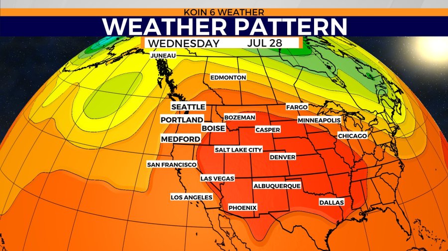
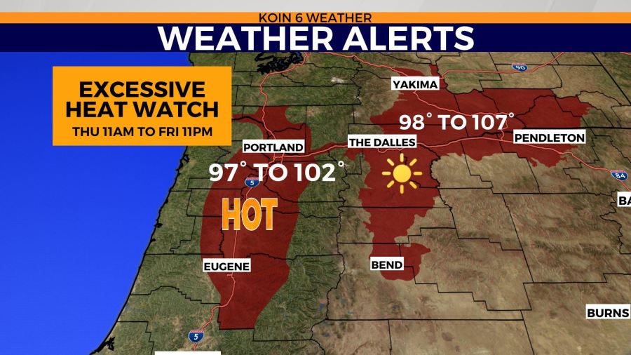
We were waiting out weather alerts earlier in the week, but now it looks like the National Weather Service in Portland has issued an Excessive Heat Watch for the Willamette Valley from Thursday morning at 11 a.m. until Friday night at 11 p.m. Temperatures inland are going to run around 97 to 102 degrees. It will be even warmer to the east for areas of the I-84 corridor. That means areas like The Dalles, Hermiston, and Pendleton should see temperatures in the triple-digits, potentially topping off around 105 to 107 degrees. Will this actually be our last forecast that brings in excessive heat here in Oregon? Right now, the weather pattern hasn’t favored cooler air, I would still expect temperatures to run a little warm. We are watching for a change in the first part of August, but it is definitely not solidified at this time.
We have updated our forecast for Friday, now taking our temperature up to 100 degrees. Although very hot, these are not record temperatures for these dates in July. Those records are sitting at 106 and 107 degrees. No doubt it will still be aggravating heat and we need to be safe, but it is a step below where we have been in the past.
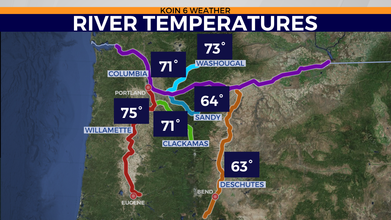
Lastly, we’ve had plenty of time sunny and warm days to get out on the water. This is going to be a stretch of days that the sun will be beating down and you will want to make sure if you are heading out on the water to exercise all the safety measures. The sun can really pull the energy from you and so can the water. Make sure you have your life vest on if you even think about approaching activities on the water. River temperatures are now in the 70s, with the warmest spot right at the Willamette river in Portland. The Sandy and Deschutes rivers are going to be your cooler spots, but most have warmed up to summer temperatures at this time.
