PORTLAND, Ore. (KOIN) – The Northwest Avalanche Center is warning people of dangerous avalanche conditions on Mt. Hood and in the Washington Cascades Monday.
These areas all had a “high” risk of avalanche danger Monday morning, according to the NWAC’s scale.
In a statement released at 6 p.m. Sunday, NWAC said very dangerous avalanche conditions developed overnight and will extend through Monday in the Mt. Hood area. Heavy snow and extreme winds are expected and natural and human-triggered avalanches are very likely.
“What we’re experiencing right now is a really big change in the weather and oftentimes when we see big changes in the weather, we oftentimes have big changes with avalanches,” said Dallas Glass, deputy director of the Northwest Avalanche Center.
Glass said last week, and earlier this week, people were reporting light, dry cold snow all over Mt. Hood. Now, with this warmer snow moving in and several feet of it dropping at once, it creates unstable snowpack conditions.
NWAC said stay out and away from any slope where large avalanches can run.
“This includes a lot of the big canyons on Mount Hood, like Clark and Newton, White Salmon canyons, those are places where avalanches can run and stop,” Glass explained.
On Mt. Hood, the danger extends from above the treeline to below the treeline.
“With large to very large avalanches very likely on Monday, it’s a good day to steer clear of avalanche terrain and let the storm pass. Whiteout conditions will make travel dangerous above treeline regardless of the avalanche hazard. Be prepared if you venture out on Monday,” NWAC wrote on its website.
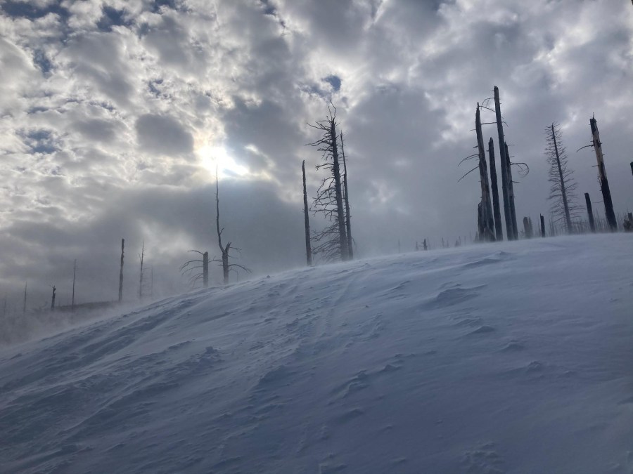
Winds crank and move low-density snow, creating textured snow surfaces ahead of the snowstorm on Jan. 2, 2022. Photo by Andrew Kiefer, courtesy Northwest Avalanche Center 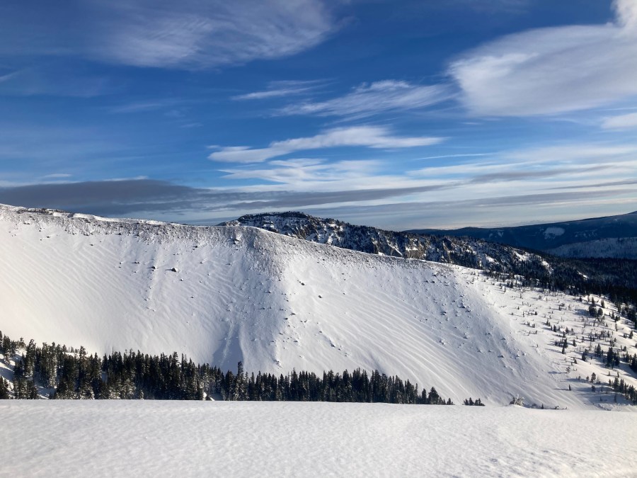
Evidence of recent wind loading seen above the treeline on Mt. Hood on New Year’s Day. Pea Gravel Ridge was stripped of snow along ridgetop with textured and wind-pressed surfaces on the west aspect. Photo by Andrew Kiefer, courtesy Northwest Avalanche Center, Jan. 1, 2022 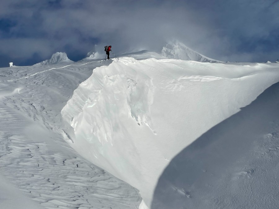
A small cornice drop with debris in motion above Timberline Lodge on the south side of Mt. Hood on Jan. 1, 2022. Photo by Paige Baugher, courtesy Northwest Avalanche Center
NWAC said there is also high avalanche danger on the east and west slopes of the Cascades in Washington, the Olympics, in Stevens Pass and in Snoqualmie Pass.
Glass said the weather recipe occurring on Washington slopes is similar to what’s occurring on Mt. Hood. The one difference is that the storm is hitting Mt. Hood in the daylight hours, and that makes them more concerned about people venturing out on the backcountry slopes.
Mt. Hood Meadows ski area said it is operating Monday in the midst of a major snow storm. They said anyone heading to the mountain Monday should be prepared for a slow drive.
Dave Tragethon, vice president of marketing for Mt. Hood Meadows, said with a stretch of I-84 closed, there are more people traveling on Highway 26 and Highway 35. He said people visiting the ski are will need snow tires or chains and must put chains on at the appropriate chain-up station.
He also recommends people bring a shovel with them to dig their vehicles out from the snow at the end of the day. Two feet of snow could fall at Mt. Hood Meadows Monday.
“Those coming up are reminding to follow deep snow safety practices – ride with a buddy, keep them in sight and avoid tree wells and other deep snow immersion suffocation hazards,” Tragethon wrote in an email.
Glass said skiing within designated ski area terrain should be safe. Its the area outside of runs that are open that people should avoid and be concerned about.
For Tuesday, NWAC expects avalanche conditions will drop from “high” danger to “considerable” near and below the treeline, but will remain “high above the treeline. Glass said they expect the conditions will change every day during the week and anyone who plans to venture into the backcountry should be checking the latest conditions frequently.