
PORTLAND, Ore. (KOIN) – Falling snow could be intermixed with heavier periods of rain around the greater Portland-Vancouver metro area and throughout the Willamette Valley on Thursday.
Portland’s National Weather Service office said in a special weather statement that Thursday’s snow levels may drop below 500 feet during the afternoon hours. However, these periods of snow are expected to be fleeting with no snow sticking to the ground.
“Bands of showers will move over the area through this afternoon, each bringing periods of rain and snow,” the NWS said. “As it stands, most of the interior valleys will see mainly rain, but with heavier showers may see some light snowfall. At elevations below 500 feet, snow will be short-lived, and accumulations will be minimal as temperatures remain above freezing.”
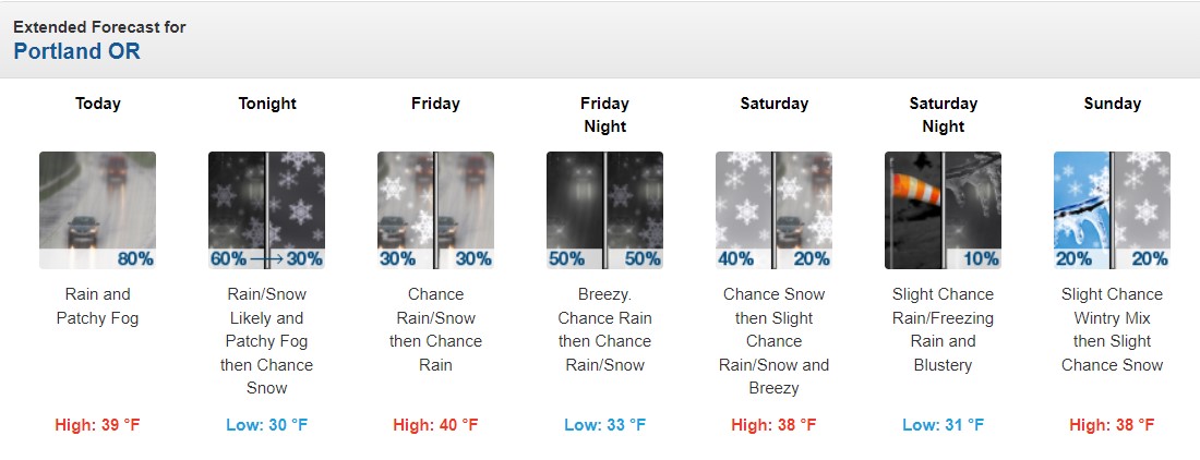
As previously forecast, areas at 500 feet of elevation could see up to a quarter of an inch of accumulated snow. Larger snow totals are expected in higher-elevation areas like Mount Hood, where 3 to 5 inches will be possible.
Coastal areas of Northwest Oregon and Southwest Washington saw snow sticking to the sections of Highway 101 Wednesday night. This snow has mostly melted away by Thursday morning. However, Oregon Department of Transportation cameras show that roadways are still slushy in Astoria. Highways through the coastal range passes remain snowy and hazardous.
“Drive carefully,” the Benton County Sheriff’s Office said today. “We are experiencing icy roads and multiple weather-related crashes around the county.”