
PORTLAND, Ore. (KOIN) — Central and Eastern Oregon have undergone significant drought improvements in recent months following rounds of late winter and early spring precipitation that buried parts of the Western U.S. in 10 to 20 feet of snow. But it’s unclear how long the recovery will last.
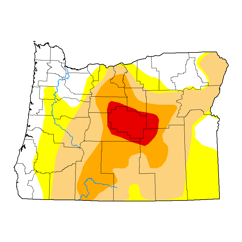
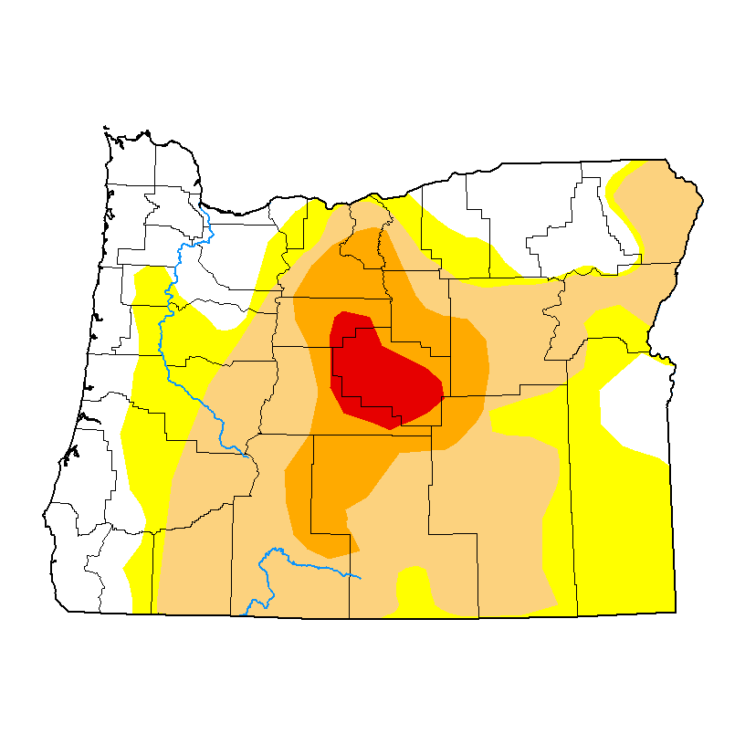
The latest U.S. Drought Monitor map showed further improvement in Eastern Oregon on Thursday, as the red and orange blotches representing states of “extreme” and “severe” drought continue to shrink. However, on the same day, the National Oceanic and Atmospheric Administration’s Climate Prediction Center issued a prediction that the Northern Hemisphere has a 90% chance of experiencing an El Niño next winter.
This shift in weather patterns could mean a relapse for the region’s drought recovery, Oregon state climatologist Larry O’Neill told KOIN 6 News.
“This region does tend to be slightly warmer and drier during El Niño winters and thus experiences smaller snowpacks and quicker melt-outs during the winter and spring,” O’Neill said. “Given that this region has not fully recovered from the recent multi-year drought, we are somewhat concerned that drought could re-strengthen next winter, although it is far too early to make any firm predictions.”
El Niño weather impacts aren’t as severe for Central and Eastern Oregon as they are for other parts of the U.S., however. As a result, a “very strong” El Niño could actually improve drought severity across the state.
“To confuse matters, years of Very Strong El Nino, the highest intensity, actually favors much wetter than normal winter seasons throughout Oregon, which contrasts with lower intensity El Ninos, which favor drier conditions,” he said. “However, there have only been three very strong El Ninos since 1970, and none since 2016, so confidence in that outcome is not as great.”
KOIN 6 News will continue to monitor drought and El Niño conditions as they develop.