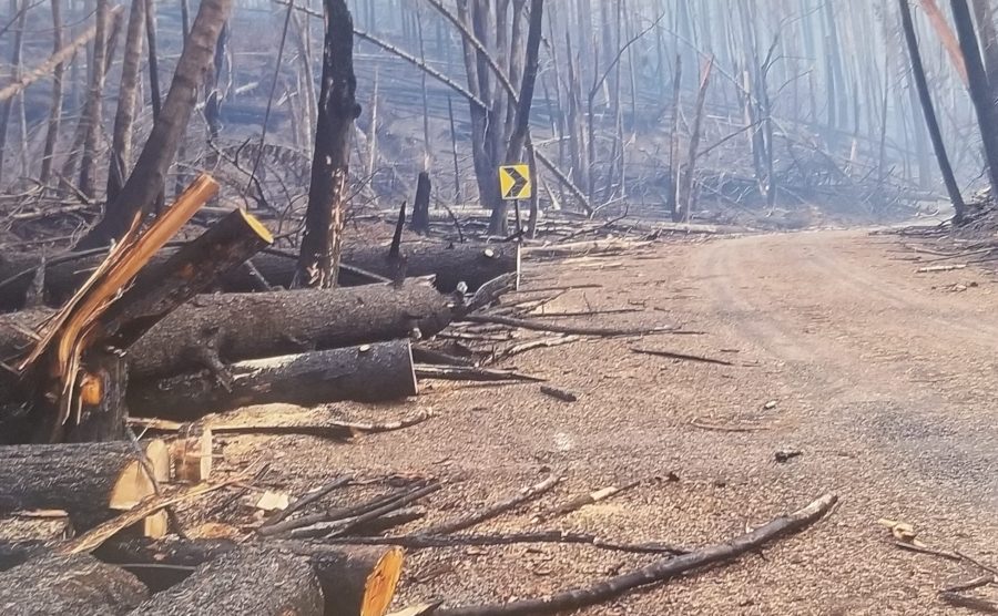
PORTLAND, Ore. (KOIN) –– Although rain will help firefighters battle the Lionshead and Beachie Creek infernos, officials in Marion County are concerned heavy rains could cause runoffs and mudslides in burned areas, and that winds accompanying the rain may topple burned trees.
Evacuation zones remain significantly downgraded since last week but the heart of the burn zones for the Beachie Creek and Lionshead fires remain closed, and photos released by Marion County officials show a completely changed landscape.
“There’s some dangerous trees up there and we’ve seen it,” Marion County Sheriff Joe Kast said on Wednesday. “We’ve seen it fall on cars and come really close to people in search and rescue operations.”
With the rain and wind events in the forecast, Kast said crews are monitoring conditions and still need to further clear roads from any hazards before allowing more areas to reopen.
“There’s really a remarkable amount of damage to these roads that have been closed, it’s not just the trees,” said Don Hamilton with the Oregon Department of Transportation. “Check the signs, check the guardrails, check the bridges, check the culverts––there’s so much that needs to be checked before we can get these roads open again.”
Beyond the immediate weather concerns, Marion County commissioners are asking residents whose properties have burned to stop hauling off burned material for the time being due to hazardous material concerns.
During a commission meeting on Wednesday morning, officials said they would be pushing the state legislature to provide property tax relief for people whose homes have burned.
Later in the briefing, Marion County Commissioner Colm Willis gave an updated number of properties and structures affected by the wildfires. According to the Oregon Fire Marshall’s Office, approximately 1,230 properties and 1,060 residential structures remain in the fire zone. About 650 properties have been destroyed or experienced major damage due to the infernos.

The Lionshead and Beachie Creek fires remain the two biggest wildfires burning in Oregon, combining to torch nearly 400,000 acres of land mostly in Marion and Linn counties.
The Lionshead Fire now has consumed 203,685 acres and is 15% contained. Officials said this fire “has heavily impacted several communities in the Santiam drainage and Breitenbush area including the loss of 264 resident homes in Detroit, OR.”
The Beachie Creek Fire is 192,828 acres and is 46% contained officials said. “There is heat around Rock Creek, and crews are securing that area. The North Fork area remains closed and structural firefighter crews are there conducting additional protection and safety work,” officials said.
Officials held a virtual community meeting on the Beachie Creek Fire Tuesday night on Facebook that lasted about 35 minutes. Other updates were posted to the Lionshead Fire Facebook page.
Evacuation levels
As of 5 p.m. Tuesday, the Marion County Sheriff’s Office said the evacuation levels remain unchanged since Monday:
Level 3 – “Go”
- Detroit
- Idanha
- Breitenbush
- North Fork Road east of Pioneer Road SE.
- Hwy 22 east of Mile Post 32.5
Level 2 – “Be Set”
- Hwy 22 from Mile Post 16.5 to Mile Post 32.5
- Lyons
- Mehama
- Mill City
- Gates
- Fernridge Rd west of Shellburg Creek Rd to Basil Hill
- Crooked Finger Rd S of Hazelnut Ridge Rd
- North Fork Road to Pioneer Road, including Kubin Road SE
- Pioneer Road SE to Hwy 22, including Hudel Road SE and Taylor Park Road
Level 1 – “Ready”
- Scotts Mills
- Areas east of Meridian Road, Davis Creek, and Victor Point south to the Marion County line