PORTLAND, Ore. (KOIN) – Sitting at about 22,000 miles out in geostationary orbit is the GOES-17 satellite.
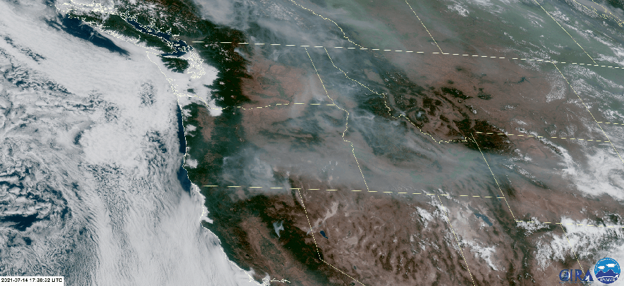
The satellite captures the everyday fluidity that is going on down through the layers of Earth. It produces beautiful images of the terrain, clouds, storms and even, wildfires and smoke. Below is a loop of the visible satellite for Wednesday morning into mid-day.
You can see how the clouds are operating out near the Oregon coast and then you have the plumes of smoke coming up from wildfires across Washington, Oregon, and California. Wildfire smoke is tracking through the Pacific Northwest (PNW) and spreading through states like Idaho and Wyoming. This is all noticeable from space! The Bootleg Fire is so large that you can even see the stress of that wildfire as it flares up. We will be able to pick up this smoke on satellite for likely the remainder of summer.
READ MORE ABOUT THE TOOLS USED FOR SPOTTING WILDFIRES HERE
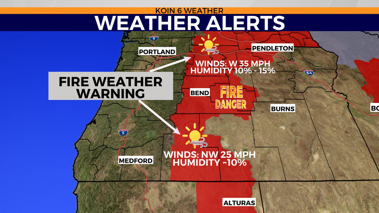
As far as the forecast goes this afternoon, we have breezy conditions for those counties east of the Cascades. A fire weather warning or red flag warning is in place until Thursday night. The graphic below helps pinpoint that large area of dry and breezy conditions. The wind will crank to the 35 mph range up near The Dalles, where humidity is expected in the 10 to 15 percent range. Further south, where the Bootleg Fire is located, the wind will not be as strong, but still a nuisance. The humidity level should drop to the lower teens. These are not ideal conditions for fighting wildfires nor preventing the spread or start of a new one.
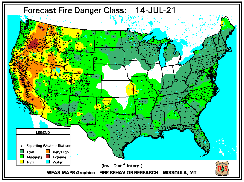
Although temperatures are dropping later in the week, we do not have a major pattern shift in the works at this time. There is a heat advisory in place too. Pendleton hasn’t had a high temperature below 90 degrees all month. With the current elements in place, you can imagine that the forecast for fire danger is high around the red flag warning area and extending even into the areas that are surrounding the strongest wind. This is going to be a tough 24 hours for wildland firefighters. Even through all the tough work they are still doing an amazing job and working to contain these massive fires.
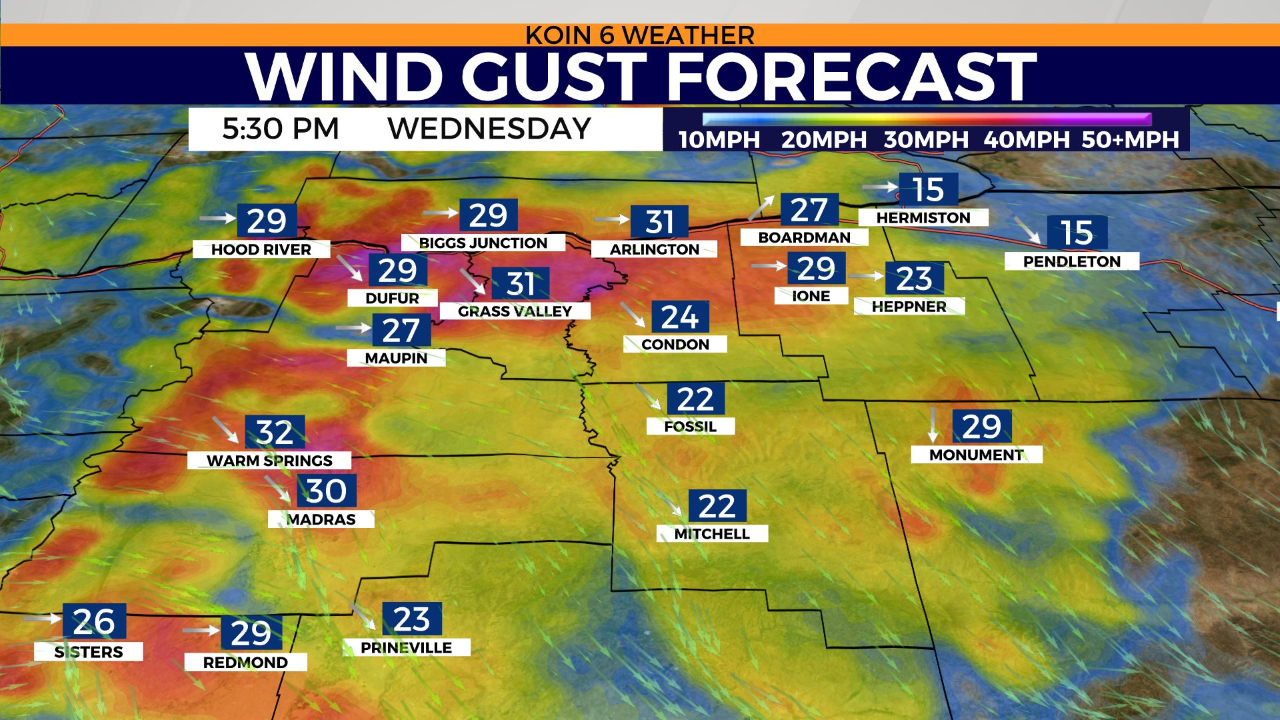
The wind gust forecast as of 5:30 p.m. has the strongest wind around Wasco and Sherman counties. Even out near the Grandview fire, the wind is going to be running around 20 to 30 mph. The wind starts to trail off out near Pendleton, but the conditions will still be warm and dry. As the cooler air settles in for Portland in the next 24 hours, the wind will increase around central Oregon and through the eastern Gorge. This contrast in temperature and pressure leads to a stronger wind east of the Cascades.
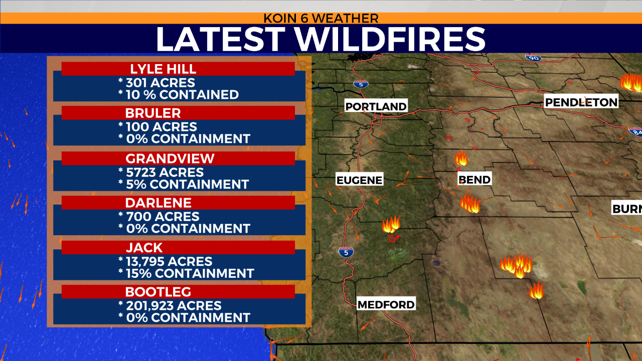
Right now we have a larger list of wildfires than what we were monitoring last week at this time. With the addition of the Lyle Hill, Bruler, Darlene, and Game Hog Creek wildfires, we are now monitoring around 8 wildfires in the near vicinity. There are wildfires up in Washington too, which are also of importance (Lyle Hill being one). The largest continues to be the Bootleg Fire, which is over 200,000 acres. We can circle back to the satellite image, which shows how massive and active that Bootleg Fire is. You can watch it spew wildfire smoke up into the atmosphere all day.