
Cool, 30-degree temperatures in the Columbia River Gorge have brought Thursday morning snowfall to I-84 east of Multnomah Falls. According to the Oregon Department of Transportation “Trip Check” webpage, highway traffic is moving slower than usual through the gorge.
KOIN 6 Meteorologist Kelley Bayern reports that a winter storm warning has been issued for the gorge until 3 p.m., as 2 to 4 inches of snow will be possible along I-84 until the mid-afternoon. Forecasts show that the snow could also switch to a hazardous mix of sleet and freezing rain.
“Heads up: Hazards are expected in the central gorge today,” Bayern said. “Snow showers have been falling along I-84 in Hood River all morning. There’s potential for accidents today with light snowfall towards Multnomah Falls too.”
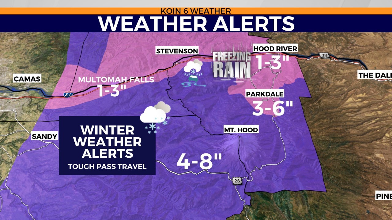
Steady rain is expected to wash over local areas of I-84 Thursday afternoon as warmer temperatures move into the gorge. Areas farther east like Hood River are forecast to see snowfall throughout the day.
More mountain snow is forecast for the Cascades with 4 to 8 inches of powder expected in Government Camp thursday. As much as 12 inches of snow could cap Mount Hood’s summit, with more snow on the way through the weekend.
Rainy weather is forecast for the Portland area through Saturday. Chances of rain will diminish on Sunday. Cold, dry, cloudy weather in the low 40s is forecast for Monday.
“We then have another storm system coming in Friday,” Bayern said. “That’ll bring rainy conditions into the Willamette Valley and that second round of mountain snowfall. We’re also watching out for damaging winds for the Southern Oregon Coast, with 70-plus mph gusts possible near Curry County. I do not see a damaging wind storm in the valley, although we could see gusts up to 30 mph at times on Friday.