PORTLAND, Ore. (KOIN) — The march of the marine clouds happened overnight and we are starting our Wednesday overcast.
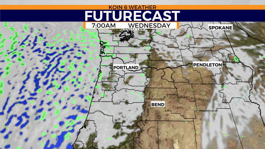
We may even pull out a few drops of rain, but most are going to be dry. The futurecast at 7 a.m. paints clouds all the way to the foothills of the Cascades. It’s going to be a nice summer day because it will start cool and it will warm nicely in the sunshine for the afternoon.
With the increase in clouds and temperatures cooler in the valley, the west wind will pick up for Central Oregon. We will discuss that in the fire danger section of the weather blog below.
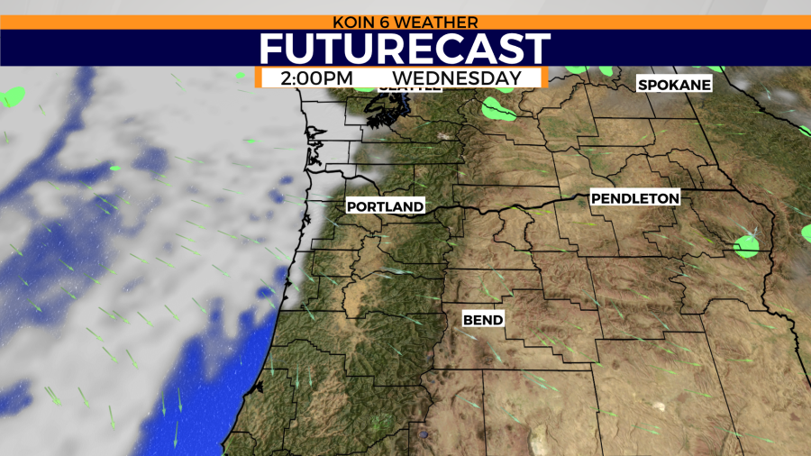
Expect a gloomy start for the Oregon Coast with drizzle or mist. This may be our only chance to pick up measurable rain for the next five to seven days. We only have a registered trace of rain this month, which likely won’t change at this point. If you cycle to the next graphic, you can see that the clouds recede by the early afternoon. Expect the clouds to stick around for Clatsop County once again.
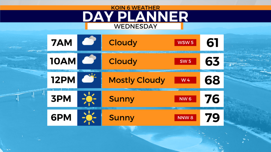
Check out the day planner below to see how the day breaks down for Portland. Temperatures starting around 60 degrees, under that blanket of clouds. Those morning clouds will keep our temperatures cool until they break in the afternoon. Once they break, the temperatures warm to about 80 degrees. It’s a nice mix for the day. You can get some garden work done in the morning and then when the sun comes out you can enjoy the yard.
The wind will run out of the west to the northwest about 5 to 10 mph. We will top off right around average which is now 80 degrees. Going out for lunch will feel a lot cooler than going out for dinner in the evening. A reminder to water those lawns in the morning before the sun and heat take over for the day. It’ll be more useful closer to the weekend when temperatures reach the 90s.
We have to discuss the fire weather warning (red flag warning) for the communities in the red in the weather alert graphic. The continued dry weather and the increase in wind tomorrow will support rapid fire spread. You want to be cautious because flames can take off very quickly, becoming unruly. Fuels will be dry and there will be moments where the relative humidity is low. The fire weather warning will expire at 8 p.m. tonight as the wind settles down.
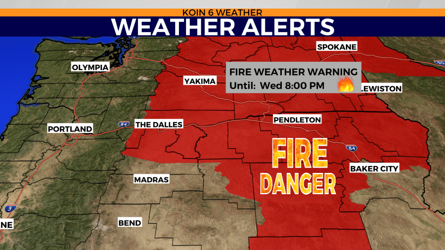
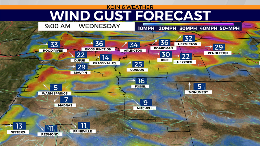
I do want to stress that the wind is already going to be strong by the morning for Hood River County all the way to Umatilla County. The wind gust forecast for 9 a.m. has many locations topping off around 35 mph along the I-84 corridor. Not as strong for Jefferson County and those south at this point of the day, but it will increase for you by the afternoon and evening hours.
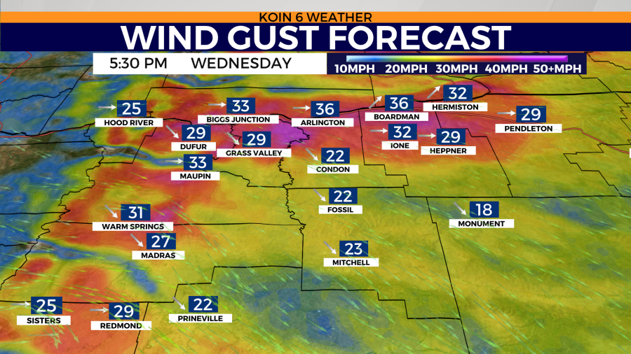
Cycle to the second graphic and you can see that the wind is still cranking for the eastern Gorge, but it is also gusty for Central Oregon communities too. Madras and the Warm Spring region will see wind gusting to the 30 mph range. This will all settle down Wednesday night, turning much slower and becoming tame by Thursday.