Editor’s Note: KOIN 6 weather specialist Steve Pierce originally wrote this story about the 1972 Vancouver tornado on the 40th anniversary. Now, on the 45th anniversary, we share Steve’s story again:
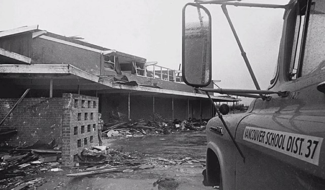
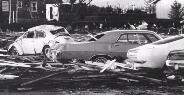
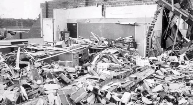
The Vancouver tornado of 1972 stands alone in the record books. It is the Holy Grail of Pacific Northwest tornadoes. Even now, 40 years later, the April 5, 1972 Vancouver tornado is the single-deadliest tornado to ever strike west of the Rocky Mountains, killing six people and injuring more than 300.
Those who lived through that hellish day witnessed the fury of Mother Nature to a degree that is not likely to be matched again in any of our lifetimes. The 1972 tornado was similar in atmospheric structure to that of the Hazel Dell tornado of January 2008. However, the 1972 tornado was much stronger.
The 2008 Hazel Dell tornado was an EF1 on the newer Enhanced Fujita scale that became operational in 2007. Winds were likely between 90-110 mph in the 2008 Hazel Dell tornado.
The Vancouver tornado of 1972 was rated an F3 under the original Fujita scale which came online in 1971. Winds on the older Fujita scale were estimated between 158–206 mph if rated as an F3. This was the case in the Vancouver tornado of 1972.
NWS list of Portland-area tornadoesNational database of US tornadoes
Unlike tornadoes east of the Rockies, tornadoes in the Pacific Northwest are referred to by many as “cold core” due to their lack of humid and buoyant air.
The Pacific Ocean keeps our atmosphere relatively mild year round. This is not conducive for the formation of supercell thunderstorms needed to generate the really large and damaging tornadoes you might see in the Midwest.
What makes the 1972 tornado so rare is the fact that it was able to spin up to F3 status and stay on the ground for nearly 8 miles.
Meteorologists I have spoken with over the years have hypothesized that both the Columbia River and Vancouver Lake could aid in the development of tornadoes across Clark County. Although the larger mechanism at play for these tornadoes lies in the atmosphere above us, there is something to be said for these two large bodies of water sitting just upwind from where these two tornadoes formed and tracked.
I have my own theory. I believe that Vancouver sits in a rare atmospheric location, on the downslope side of Portland’s West Hills. As a line of strong springtime showers moves west-to-east over the West Hills, it often collides with upper air flowing south-to-north up the Willamette Valley. When these two air masses collide, it creates some degree of rotation in the atmosphere, especially over Clark County which is relatively flat from the Columbia River north to about Battle Ground.
This unique geographical location may just put Clark County under the tornado bullseye. Even with the proper atmospheric conditions present, the odds of seeing another “perfect storm” akin to April 5, 1972 is extremely small, no matter which method of calculation you use.