PORTLAND, Ore. (KOIN) – A wave of heat is coming our direction, but it is not to be mixed up with a heat wave that would dress up our forecast to the triple-digits — we will leave that back in June.
It’s still going to be very hot around here, enough to slow things down. You could potentially call this a heat wave since we will have abnormally warm temperatures for a stretch of time this week. However, the weather story this week, isn’t just about the heat, we are also battling wildfire concerns too.
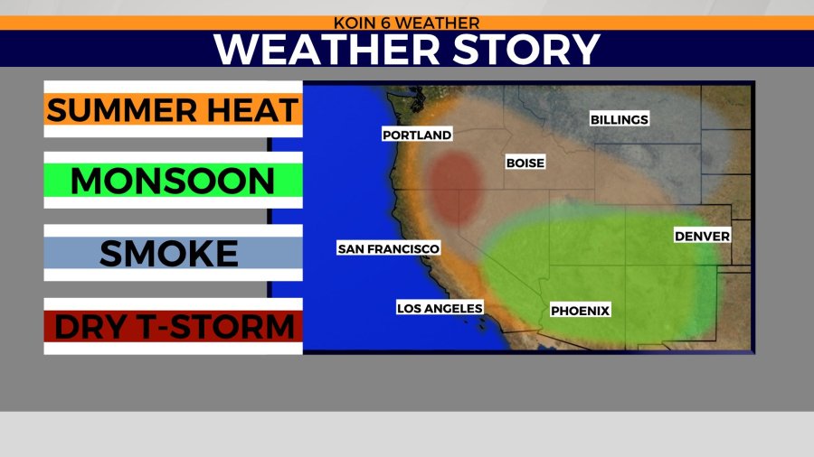
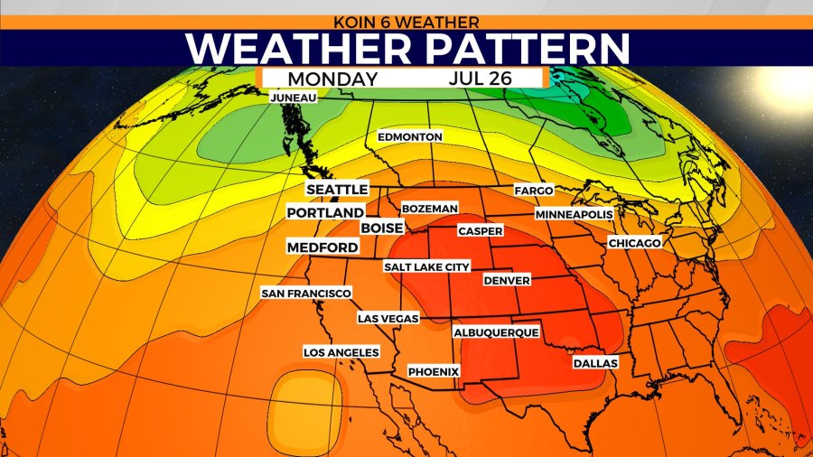
The bigger picture looks like the graphic below. We have a crossover of multiple elements, that will impact different portions of the state of Oregon.
All the topics this week have a string to either the building ridge of high pressure or the monsoonal flow occurring to the south that is generating showers and dishing moisture out. You should watch the video forecast if you haven’t yet, because we discuss the traveling of that moisture during the mid-day forecast today.
You can visually pick it out with the type of clouds that are starting to form around our region. That is the beauty of the visible satellite, it connects you with the clouds, which tell you the type of weather that may be developing and moving in to a specific region.
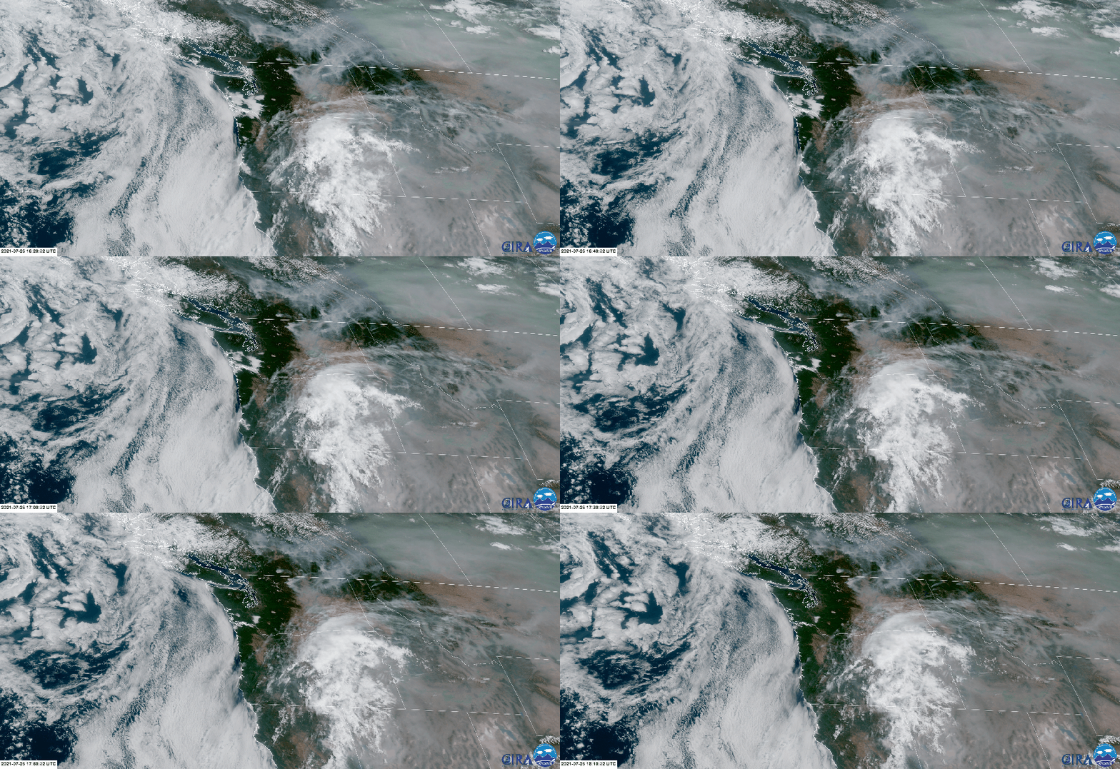
The satellite loop below is also painting plenty of wildfire smoke across the Pacific Northwest (PNW) today. That thin haze is because of the wildfires in Oregon and California and surrounding states.
You can really see the wildfire smoke up in Canada, where wildfires continue to burn across the country line. I want you to focus your attention briefly on the mass that is moving across Oregon at mid-day.
You have a mixture of dry thunderstorms and also wildfire smoke. The potential for thunderstorms the next 48 hours is elevated. That is the connection to the monsoonal flow that is maneuvering moisture our way. That sounds like it would be a good thing, right? Unfortunately, it isn’t deep enough moisture, where it will lead to widespread rain or consistent rain to seriously help out wildfires. It may increase the moisture in the atmosphere, which increases the chance for lightning.
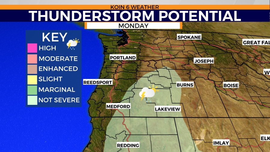
Check out the two graphics that are side by side below. The graphic on the left is showing us the area that is most likely to see thunderstorms develop this afternoon. If you’ve been following the Bootleg fire, you know the general idea of where it is in the state. That slice of thunderstorm potential does cover the area where the fire is burning.
That may increase the wind or it may even produce a scenario where the fire does receive some rain but it may bring a lightning threat for wildland firefighters. That may slow things down and it may also offer a risk for new wildfires to spark due to cloud to ground lightning.
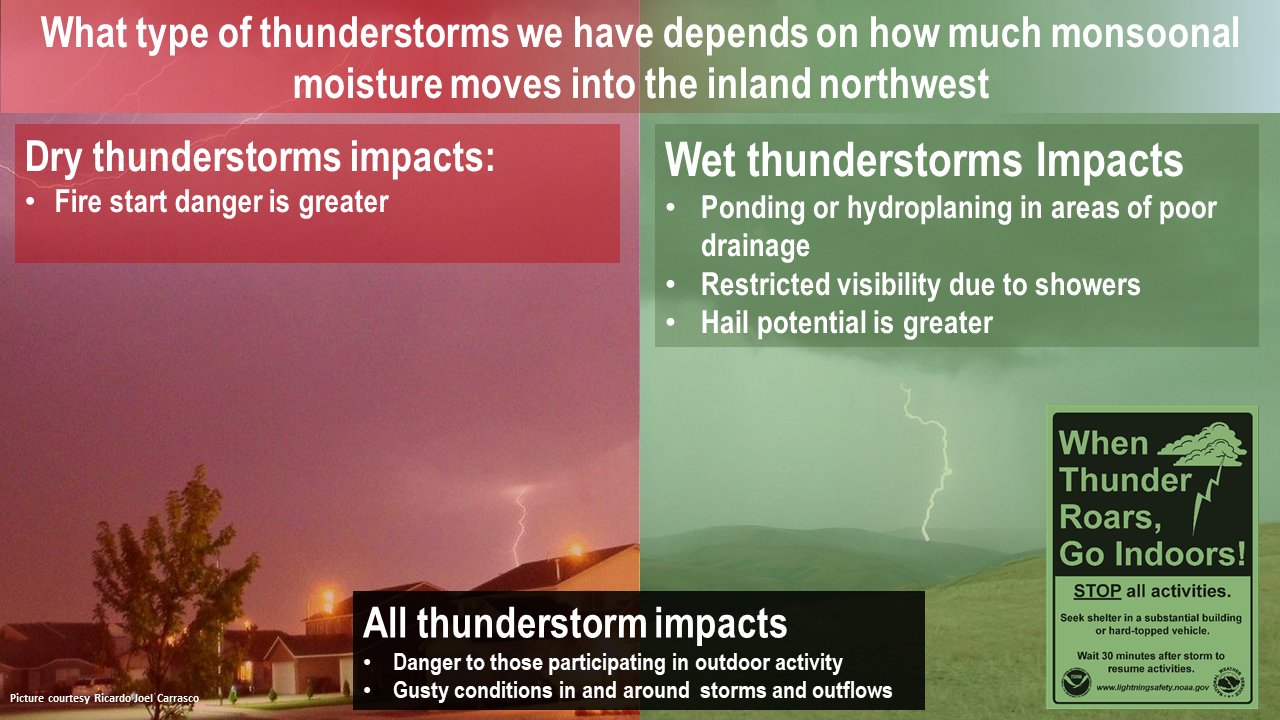
Are you familiar with dry and wet thunderstorms? How can a thunderstorm be dry? Well the graphic on the right is an informational graphic from the National Weather Service describing the different impacts between dry and wet thunderstorms.
Essentially, a dry thunderstorm doesn’t produce rain that reaches the surface. The moisture will evaporate before it reaches the ground, but the impact of the wind and lightning is still highly a concern. Yes, we want to borrow moisture from the monsoon season to the south, but it needs to be deep enough to actually create wet thunderstorms.
These are the thunderstorms that get the canopy and ground wet. Those also come with risks, which you can see in the graphic below.
NOW LET’S TALK HEAT
Temperatures are already running at a warm level, after recording two days in the lower 90s this weekend. You may be thinking, “well, that is good enough for me,” but unfortunately, temperatures aren’t going to stop there. A building ridge, one that has been stationed over the midsection of the United States for what feels like all of July, is going to shift and build to the west.
It isn’t so pronounced yet on the weather pattern graphic, but it will become more of a mountain shape later in the week. As the high pressure expands and the heat starts to flow into the PNW, our air will get real excited and it will move and dance and it will increase in temperature.
This will impact just about everyone outside of the Oregon coast (although I’m sure folks will travel to the coast to find relief). Just how intense will the heat get? Jump below and we will take a look at that extended forecast.
Go ahead and listen to our weekly podcast below! Meteorologists Kelley Bayern and Joseph Dames chat it up about our upcoming week.
Feast your eyes on the forecast trend for the full week. We kick off the week with highs right around 90, but the surge arrives Thursday, giving a jolt to the afternoon high temperatures.
Now, I want to point out, that even though we hit 90 over the weekend, it took some work. We spent most of the day in the 80s, with just a short period of time crossing over to 90.
Thursday and Friday are going to bring in a longer duration of 90 degree temperatures, creating an environment that is going to be well above average for multiple hours, if not the whole afternoon and early evening. We’ve been fortunate to have splendid evening temperatures, but they may feel a bit toasty later in the week.
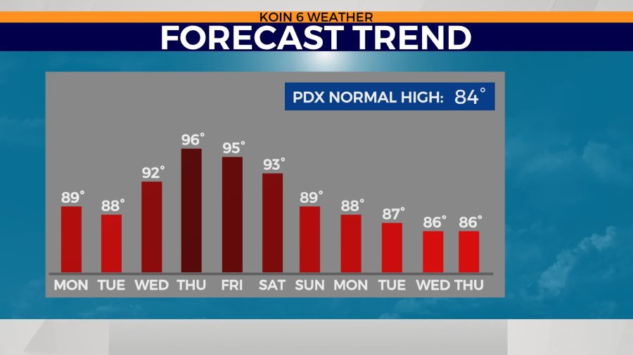
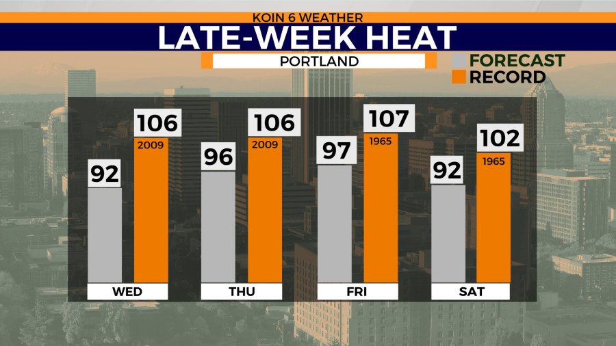
Will we be breaking any records with this wave of heat? We are going to fall short probably a good 10 degrees, as temperatures have been in the triple-digits at this time of the year in the past. The record for Thursday is 106 and for Friday it is 107. Those were the warmest temperatures that we had experienced in Portland until this last June. You know the drill, make sure you’re doing your hard work in the early hours and you take plenty of breaks in the afternoon. Temperatures in the 90s can sneak up on you real quick creating tough conditions to have to deal with. Right now, there are no weather alerts, but keep an eye open for a heat advisory later in the week.
