PORTLAND, Ore. (KOIN) – Wildfire season is starting to ramp up around Oregon, with a handful of wildfires starting and growing over the weekend.
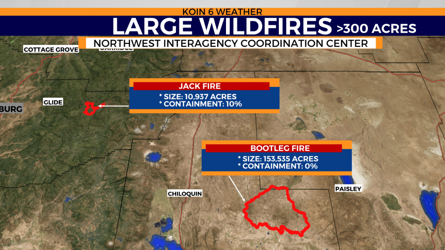
One wildfire — the Bootleg Fire in Klamath County — went from large to mega status in five days. A megafire is a wildfire that was at least 300 acres, expanding to 100,000 acres or more. Both the Jack and Bootleg fires started around the same time, but one is much larger than the other. The Jack Fire erupted on July 5 and the Bootleg Fire on July 6. We have put a lot of attention towards the Bootleg Fire because it is now at 153,000 acres with a growth rate that was doubling over the weekend. You can see the general size of these wildfires in the fire perimeter graphic below.
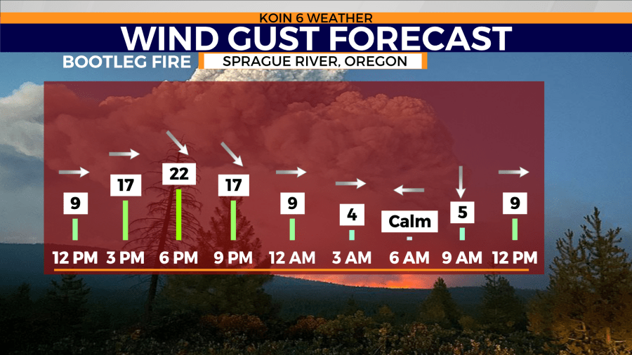
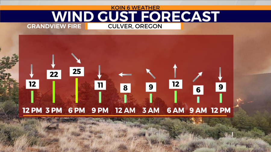
I want to focus on the forecast, because that is the information that will be helpful and it will also be the information that is going to likely impact the route of these wildfires. Below are two wind gust forecast for the nearby communities from both the Bootleg and Grandview fires in Oregon.
Peak wind gusts are going to come in the late afternoon through the evening hours. Overnight, as the sun sets, the wind will become more tame. Near the source of the wildfire, it may still be gusty. The overall conditions should settle down through the morning hours Tuesday.
The same cycle picks back up on Tuesday afternoon, as the wind will continue to gust out of the north or northwest around 25 to 30 mph. You factor that in with the dry fuels and that is the recipe for fire spread. Not much of a difference for the forecast on Wednesday too.
You can see the type of fuels that are in place for the Grandview Fire that is southwest of Culver, Oregon in the tweet below. This fire grew from 300 acres to 4,000 acres in the period of 24 hours. The main fuels in this area are going to be juniper, brush, and grasses. This is the type of wildfire that can spread quickly due to the type of fuels and how open it is to wind. There isn’t much of a barrier, allowing for the wind to rush through the full zone.
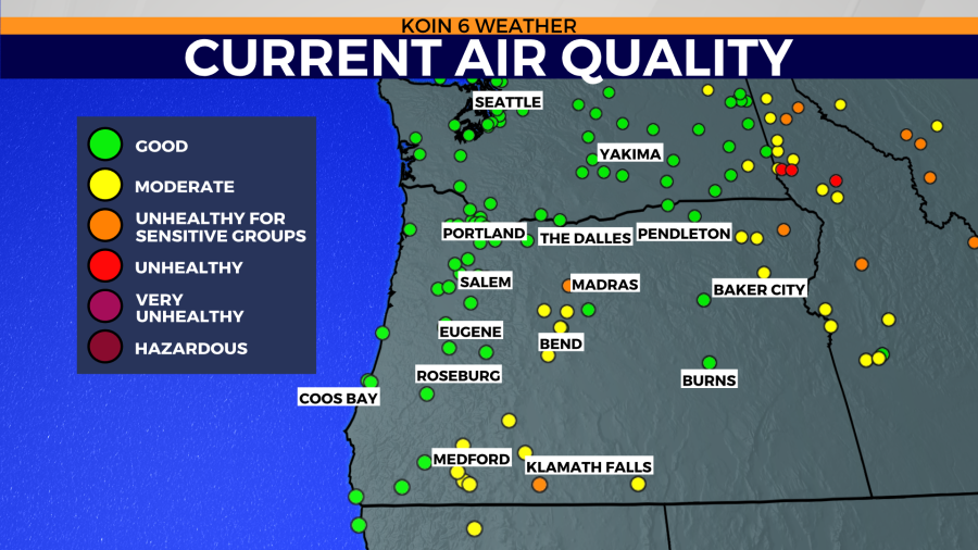
With smoke coming from our local wildfires and from nearby fires from California and Washington, air quality is going to have some issues. The Willamette Valley and Oregon coast are avoiding the wildfire smoke at this time, until a wind shift, we should steer clear of that smoke.
It would take a larger fire to the north, to bring smoke into our region right now. We are watching the Burbank fire in Yakima, which may eventually push some smoke in our direction.
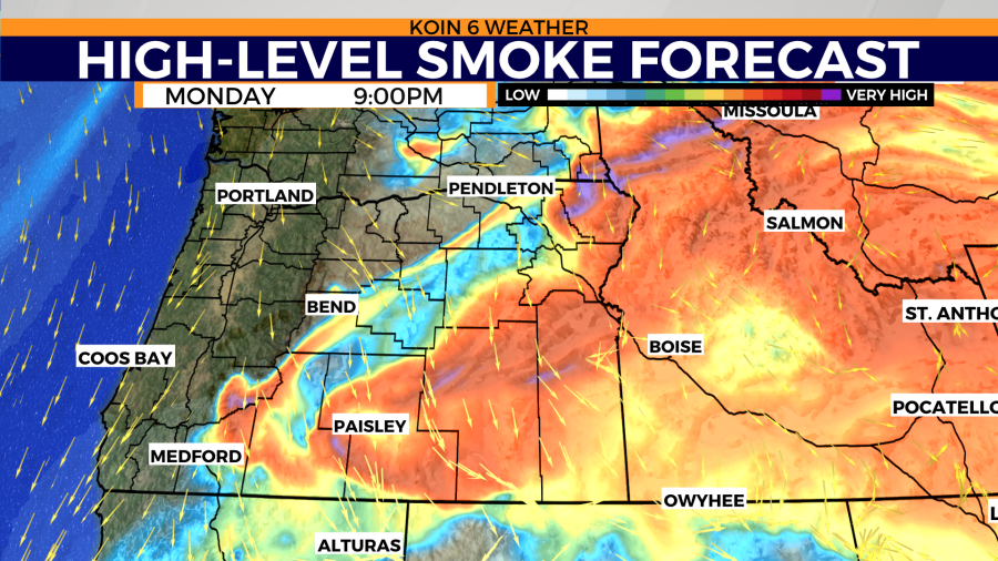
Notice the air quality is in the moderate level from Jefferson County south to Klamath. Cycle through the slideshow and you will have a good idea of the high-level smoke and the direction it is traveling. Once you get to about 10,000 feet, the wind is running from the southwest to the northeast. This is going to guide the smoke to Idaho and the surrounding states to the east. Closer to the surface, we know the wind is running more out of the northwest. Smoke should carry south and east until it reaches higher in the sky and then gets transported east. There are a few air quality warnings in place, which are in Washington and Idaho where the air quality was in the red. Smoke will be an ongoing issue for those states until a larger-scale wind shift occurs. This is not expected to happen as we sit in our stubborn summer pattern.
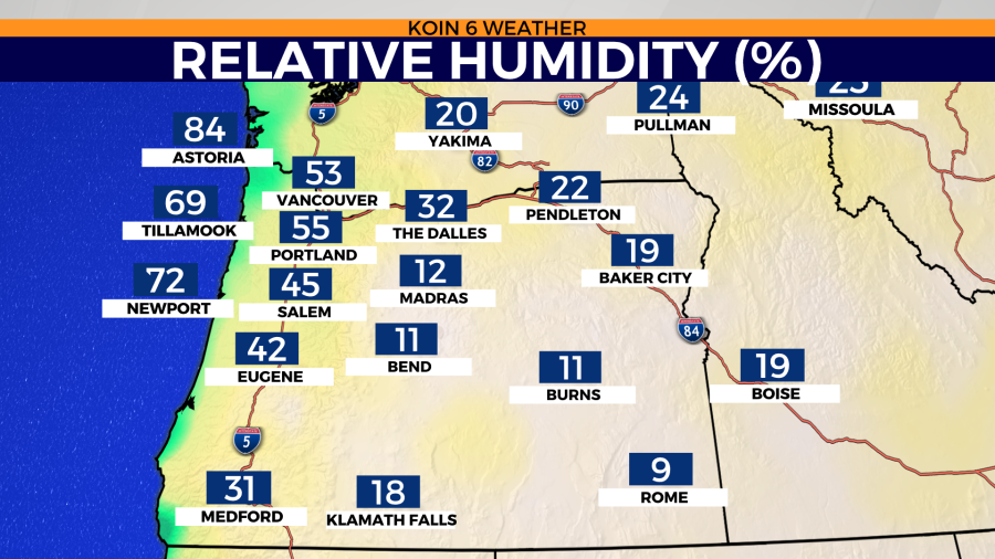
It is no doubt dry out there, with relative humidity levels in the lower teens from Jefferson County south to Klamath. This the region that is being impacted the hardest right now with our current wildfires. With more of a marine influence from the coast to the valley, we are not dealing with the dangerously dry conditions. This is a gauge to help determine how much fuels are giving and taking when it comes to moisture. We know when the relative humidity is low, the fuels are going to be dry. They have a healthy exchange with the water vapor in the air and if it is dry, that exchange isn’t happening. The forecast keeps similar levels going into Tuesday.
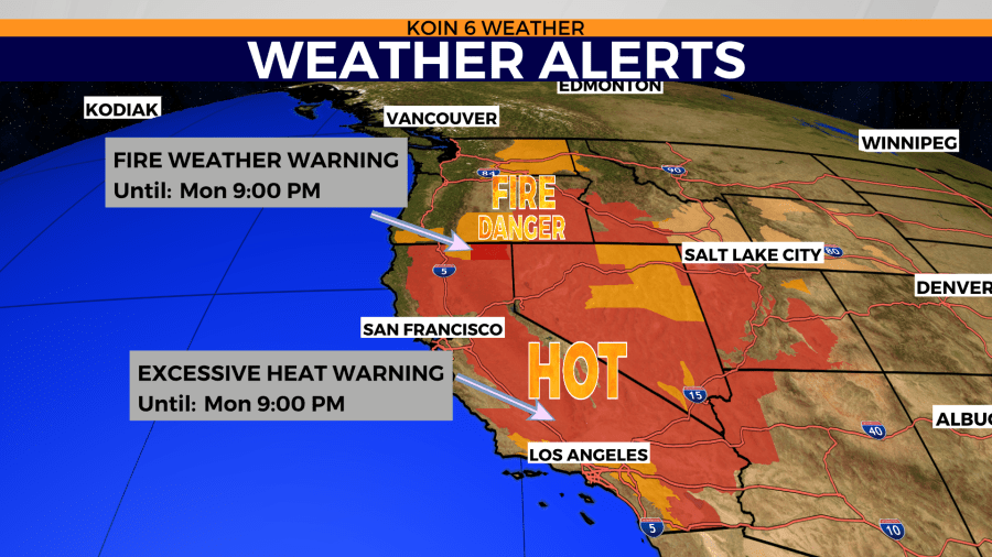
Plenty of weather alerts to be had at this hour, with a stretch of fire concerns and heat concerns from California up to Washington. This is just a sign that there is more of the same for the next few days. Although the warnings expire tonight at 9 p.m., it is likely that there are extensions or new weather alerts for Tuesday and Wednesday. We will keep an eye out on air quality warnings for Oregon.
