PORTLAND, Ore. (KOIN) — We may squeeze out a few raindrops today, but here we go again with some more dry April weather.
We had our wettest day this weekend but it wasn’t enough to bring us even close to our normal for the month. We are around two inches below our April normal right now.
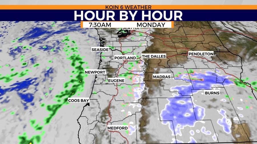
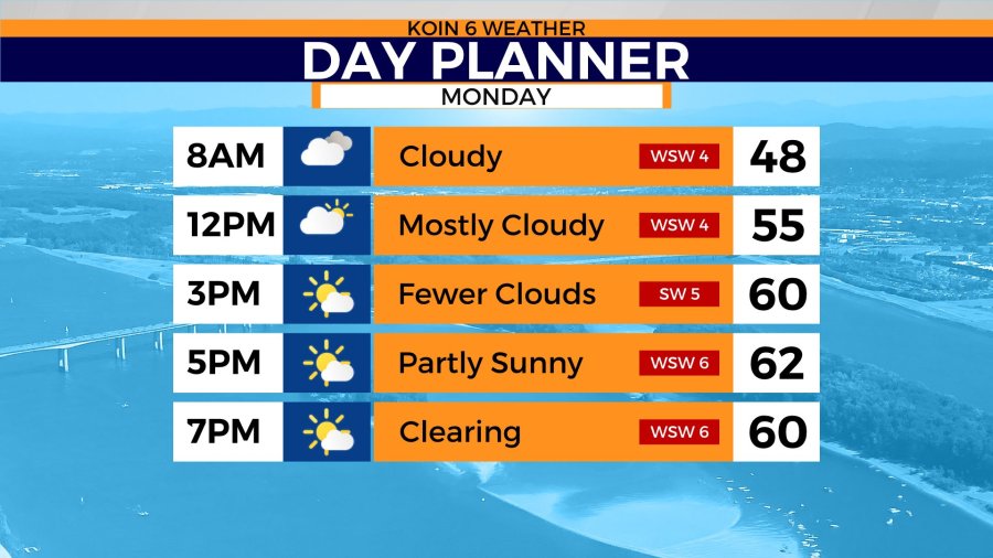
We still have a small chance for a few spotty showers today, but as the afternoon comes in, the rain chance diminishes. Heading out the door in the morning, you may actually come across a passing shower. This will hold to around late morning to mid-day before that chance clears out. The morning will start with some clouds and the afternoon should bring in sunshine with passing clouds.
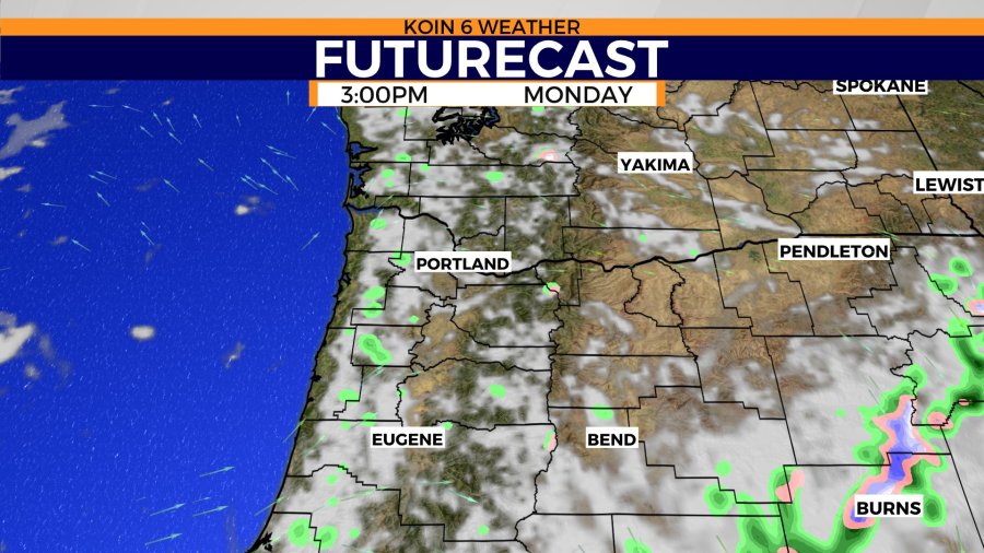
There may be a few rain clouds in the distance tomorrow afternoon, but most should be harmless. Cycle through the slideshow and you can get an idea of the drier conditions by the afternoon and the sun breaks.
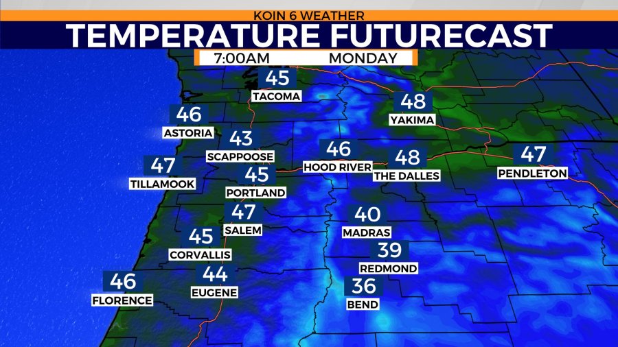
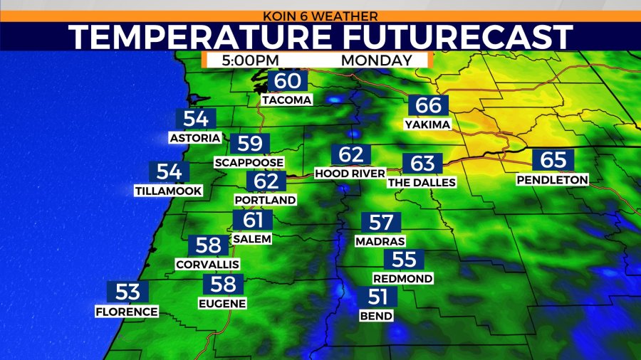
Temperatures around the upper 40s by 8 a.m. Monday morning. We will be close to our average by the afternoon with highs in the lower 60s. Our average high is 63 for tomorrow. I would count on mostly cloudy conditions until after lunch. That won’t be the case for everyone, but the valley will hold on to those morning clouds.
The wind will be running out of the southwest tomorrow afternoon around five to 10 miles per hour.
How about outside of Portland? Morning temperatures in the 40s for those of you starting your day out at the Oregon coast. A similar start to the morning, as far as temperatures go, for those of you in the Columbia River Gorge. Cooler out for Bend and some of the communities out in central Oregon.
You may need a heavier jacket if you’re out in eastern Jefferson or Deschutes counties. Those locations will have a cooler afternoon as well. Highs should hit around the mid-60s from Pendleton up into the Yakima valley.
Temperatures will actually be a bit warmer to the north in areas of Washington. The Oregon coast warms to the mid-50s, with a high in the lower 60s for Hood River Monday.
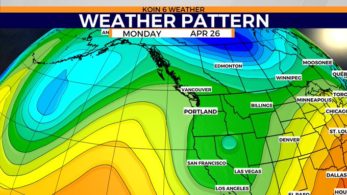
Warmer weather is coming once again, but it won’t stick around as long as our previous stretch of heat. If you examine the weather pattern graphic below, notice that we have that drop in the pressure through the Pacific Northwest. That is the trough that has been sluggishly moving east all weekend.
We are still on the outside of that disturbance, which should clear out by late Monday. There is a ridge building to the west of us, represented by the yellow and orange colors. That is going to move in through the week and it will warm us up quickly.
Another stretch of dry and warm weather is coming, but it doesn’t look to be as windy. The ridge eventually breaks down by the weekend.
What does this all mean? If you want to avoid the clouds and slightly cooler temperatures early in the week, you have warmer and drier weather by Wednesday.
We could use rain, abut it doesn’t look like it really moves in until late on Friday. That may be our last chance to kick our 2021 April out of the driest April on record.
