
PORTLAND, Ore. (KOIN) – Sure this April has been full of showers. Especially the last several days. Monday the Portland area set a record for snowfall on a single April day. Then it snowed and rained on Tuesday. And again on Wednesday.
But, don’t get your hopes up that the recent run of wet weather provided any real relief for prolonged drought in the region.
“Just because we see rain falling, or snow falling… it’s not instantly curing drought,” KOIN 6 Meteorologist Kelley Bayern said. “Our drought in Oregon is part of a mega drought extending across the west that has compounded, year after year.”
Right now, 88% of Oregon is in some form of drought. 15% of Oregon remains in the “Exceptionally Dry” category.
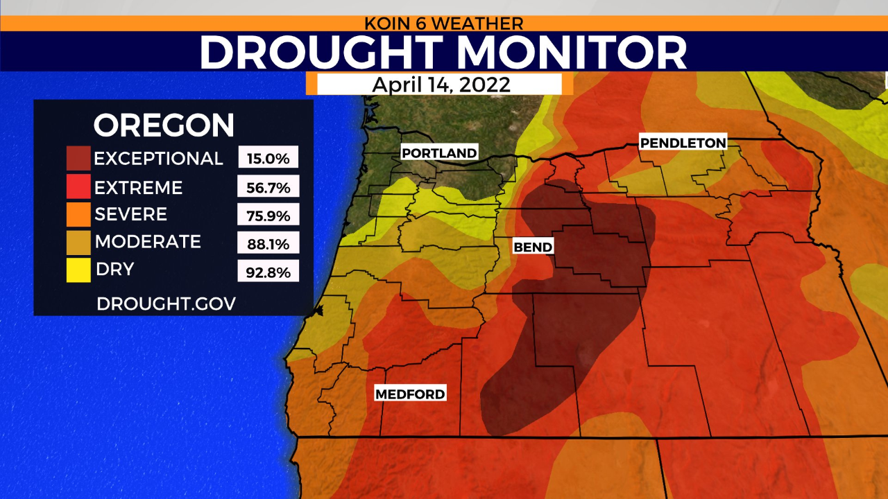
“Regions that will face the most amount of impact from drought later in the year are Central, Southern, and Eastern Oregon,” Bayern said. “But, that’s not to say the (Willamette) Valley isn’t in rough shape too.”
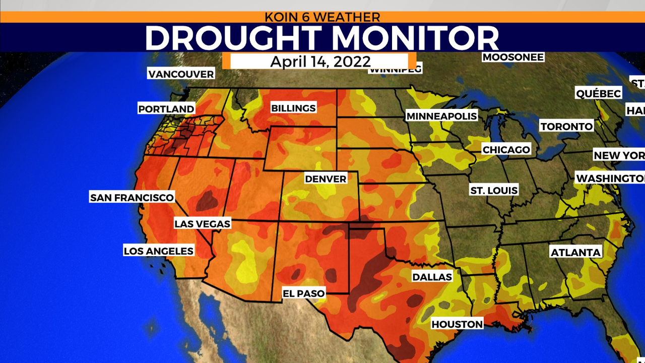
A wider look around shows drought gripping onto much of the western U.S. Water storage in the west’s two largest reservoirs – Lake Powell and Lake Mead – have dropped to unprecedented levels.
Current April and water year rain totals show a surplus in precipitation. It has been a soggy April month with over three inches of rain in the bucket. Since October 1st, the start of the new water year, we have received 31.28 inches of rain which is 2.57 inches more than we typically get at this point in the year.
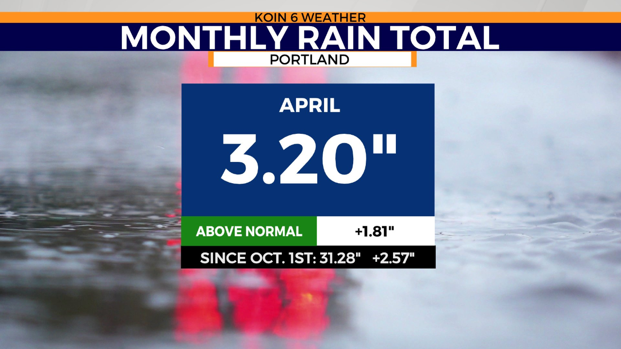
“The surplus in recent rain is fantastic to see. But Oregon doesn’t just need that this April. We need to see a surplus of rain month after month and year after year. Otherwise, we can expect water restrictions and issues in agricultural counties that need water the most, and it can set the stage for an active wildfire season this summer.”