PORTLAND, Ore. (KOIN) — An atmospheric river will continue to bring up to 2 inches of rain and warmer temperatures to the Pacific Northwest to start the week, melting a portion of the region’s abundant snowpack and raising river and streams levels in Northwest Oregon and Southwest Washington.
KOIN 6 Meteorologist Josh Cozart reports that the rising temperatures and high-elevation rain will continue to speed up the spring melt process into Thursday. With the added melt, some smaller rivers are expected to approach flood stages this week.
“All of that rainfall and snowmelt will come together in Oregon and Washington’s rivers in the coming days,” Cozart said. “Rivers and streams will continue to run higher than we’ve seen in recent weeks. No rivers are expected to run their banks in the coming days, but some, like the Tualatin River near Dilley, will near flood stage this week.”
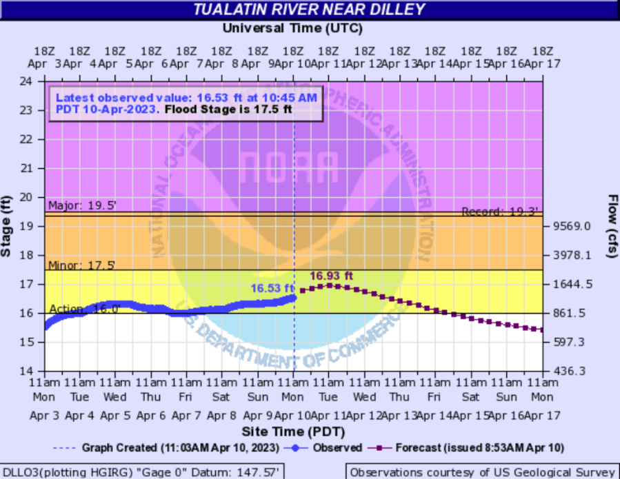
The National Weather Service states that the rivers and creeks most at risk of seeing minor flooding are located in the drainage basins of the Coast Range and the Willapa Hills, including the Grays River near Rosburg, the Wilson River near Tillamook, the Luckiamute River near Suver and the Tualatin River near Dilley.
“Overall, widespread river flooding is not expected with this event, but the chance of minor flooding is just high enough to warrant [an advisory],” the NWS stated in a hazardous weather alert Monday. “Periods of moderate to heavy rain will also pose a hazard to motorists at times Sunday through Monday, especially in low-lying areas where water can easily pool and significantly increase the risk of hydroplaning. Consider adding a little extra time to your commute in case you need to slow down.”