PORTLAND, Ore. (KOIN) – You may have had some small hail yesterday embedded into some of the rain that was moving through the Willamette Valley.
If you caught the forecast with Natasha last night or read her morning weather blog, you should be preparing for another round this afternoon. Here is some video of the small hail from a cell in NE Portland yesterday afternoon.
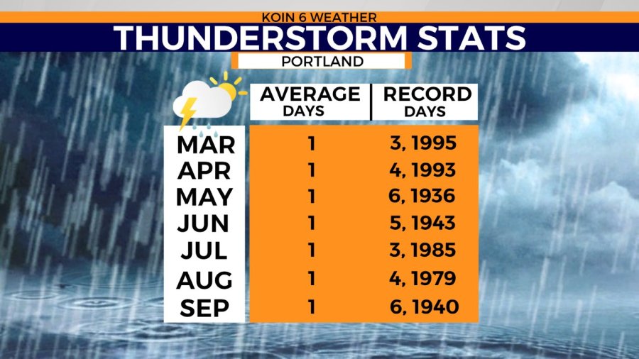
Well, it’s not uncommon for us to have back-to-back days of thunderstorm activity when we have a spring setup like this. However, on average we typically only one or two thunderstorms in March. We may fill that quota in just two days. What exactly is going on?
Let’s start with the visible satellite from our late morning hours, which had convective showers over the Pacific with clouds puffing up and casting shadows. This afternoon we will likely bring in some billowing cloud tops and more breaks in the clouds than what is occurring over the Willamette Valley near midday. With that sunshine, we will start to warm up the surface a bit and the likelihood for thunderstorms to develop in the valley will increase.

Now we will take a look at some of the things that are going on above us in the atmosphere.
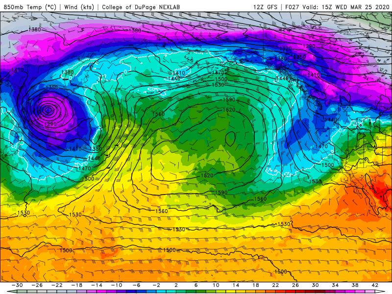
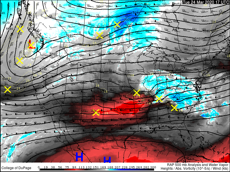
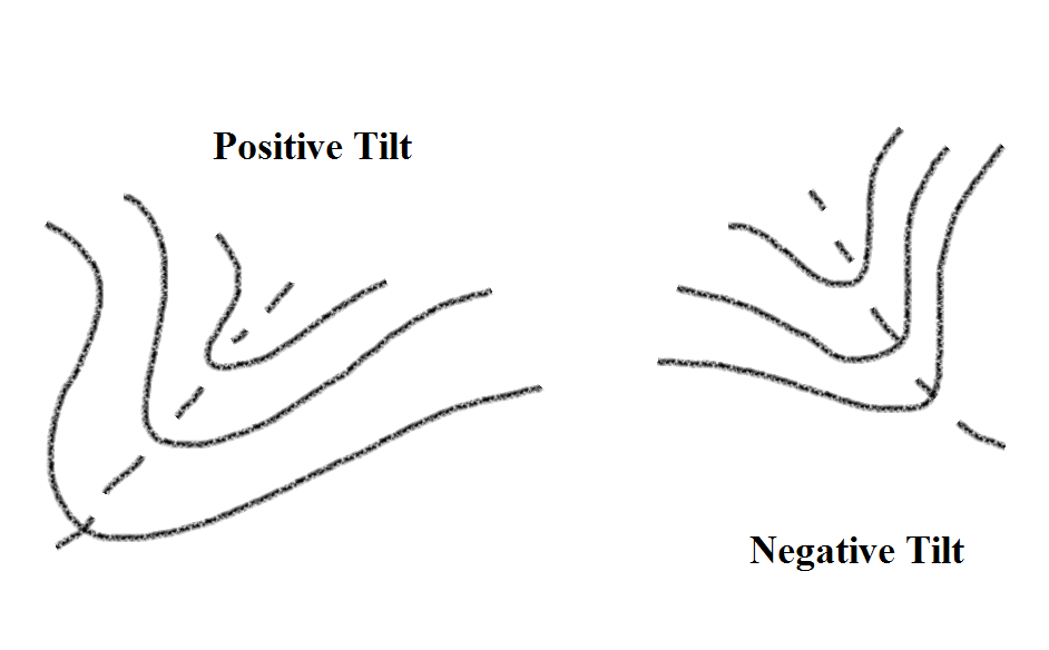
We have two graphics to help show what is going on right now over the Pacific Northwest (PNW) that would be the cause of these thunderstorms. First is we have a positive tilted trough stamped right over the top of us. With an area of low pressure associated with that elongated area of low pressure. That is also ushering in some cooler air aloft, which is going to create an atmosphere that is not exactly stable. Now a positive tilted trough is responsible for thunderstorm activity however it is typically not as potent as a negative tilted trough. With all that, it does take some time for these troughs to pass, which is why we are having back to back days of thunderstorm activity. We are still sitting in the prime location of that trough that will allow for instability to continue.