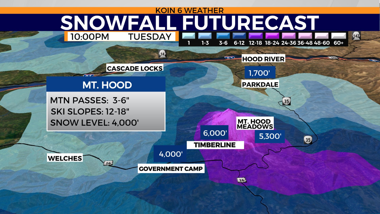
PORTLAND, Ore. (KOIN) — After receiving 18 inches of snow over the weekend, areas of Mount Hood could see another 12 to 18 inches of snow between Tuesday and Wednesday morning, KOIN 6 Meteorologist Kelley Bayern reports.
“The heaviest snowfall will be above 5,000 feet of elevation,” Bayern said. “But we’ll also see tough mountain pass travel. There are no weather alerts in place around Mount Hood yet, but that could change.”

The National Weather Service forecasts that blizzard conditions will be possible on Mount Hood and other regional Cascade passes Tuesday. Falling snow and 25- to 40-mph winds could reduce visibility down to a quarter of a mile or less along mountain passes for hours at a time.
“Those [traveling] over the Cascades on Tuesday and Tuesday night should keep an ear or eye on weather updates, as well as developing road conditions at that time, the National Weather Service warns. “Winds will pick up at the coast and interior lowlands too, with gusts 35 to 50 mph along the coast on Tuesday as the front approaches, and 25 to 35 mph for the interior lowlands.”
The region will see drier weather Wednesday and Thursday. Scattered rain showers are forecast to return Friday and persist into the weekend.