PORTLAND, Ore. (KOIN) — It’s been a long stretch of cold and snowy weather across the Portland metro area, and it isn’t quite over for some Tuesday morning.
Several areas across the Willamette Valley are seeing lingering snow flurries. Snow and mixed showers will shift north into the Portland metro area Tuesday morning.
Light accumulations are possible, mainly in the hills above 500 ft through the afternoon before drying out tonight. Some of those snow totals may be lost due to melting as temperatures start near freezing Tuesday.
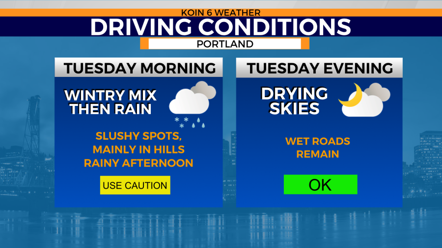
Warmer afternoon highs will send snow showers to higher elevations. A slush commute is likely for the start of the day Tuesday, but just wet roads by the afternoon and evening.
Portland and surrounding areas can expect to see warmer temperatures that climb into the 40s, but skies are expected to clear after sunset. That brings the chance for colder overnight lows Tuesday into Wednesday morning. That could refreeze wet, slushy or snowy roads that remain.
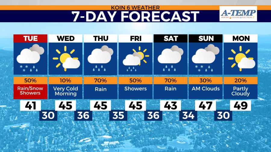
Dry weather finally returns to the Pacific Northwest by the middle of the week. That comes with slightly warmer temperatures, but highs still sitting below average for the end of February by nearly 10 degrees.