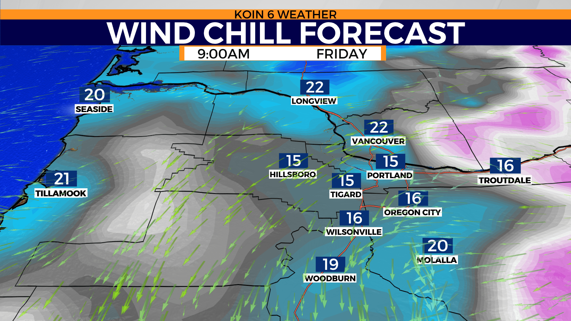
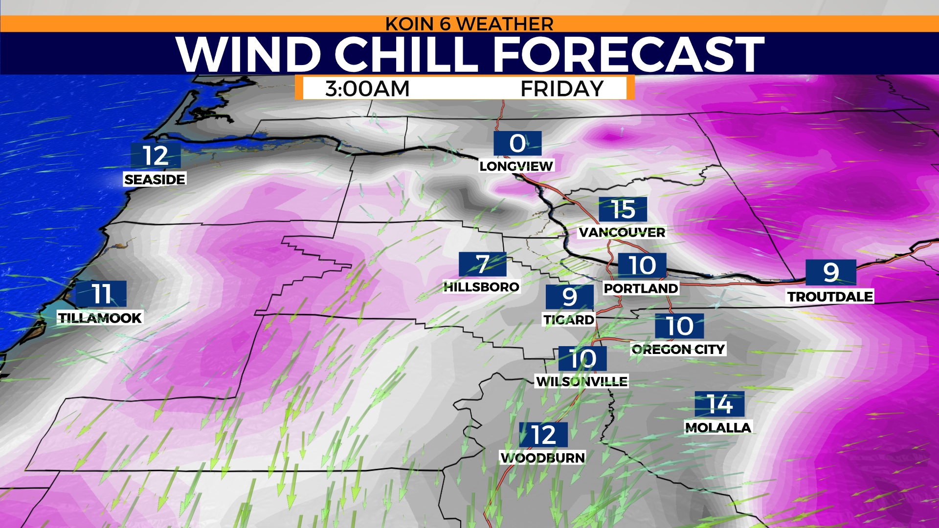
PORTLAND, Ore. (KOIN) — While Portland is on a drying trend Friday, expect dangerous wind chill and record cold as morning temperatures dip to the mid-20s and daytime highs max out in the low 30s.
There is a Wind Chill Advisory until noon Friday for wind chill temperatures in the teens and single digits.
Another concern we have is ice. Whatever snow melted on the roads will quickly freeze. Why? Overnight temperatures in the 20s. Not to mention we’ve been in the subfreezing status since Wednesday night. Temperatures in Portland never rose above freezing Thursday.
Portland was breaking records all over the place. On Thursday a record-cold daytime high was set at 31° (old record 39° 2018). Friday afternoon, although sunny, may only bring us into the mid-30s for a high temperature. The record to break Friday for the coldest low is 25° (1969) and the coldest high is 38° (1994).
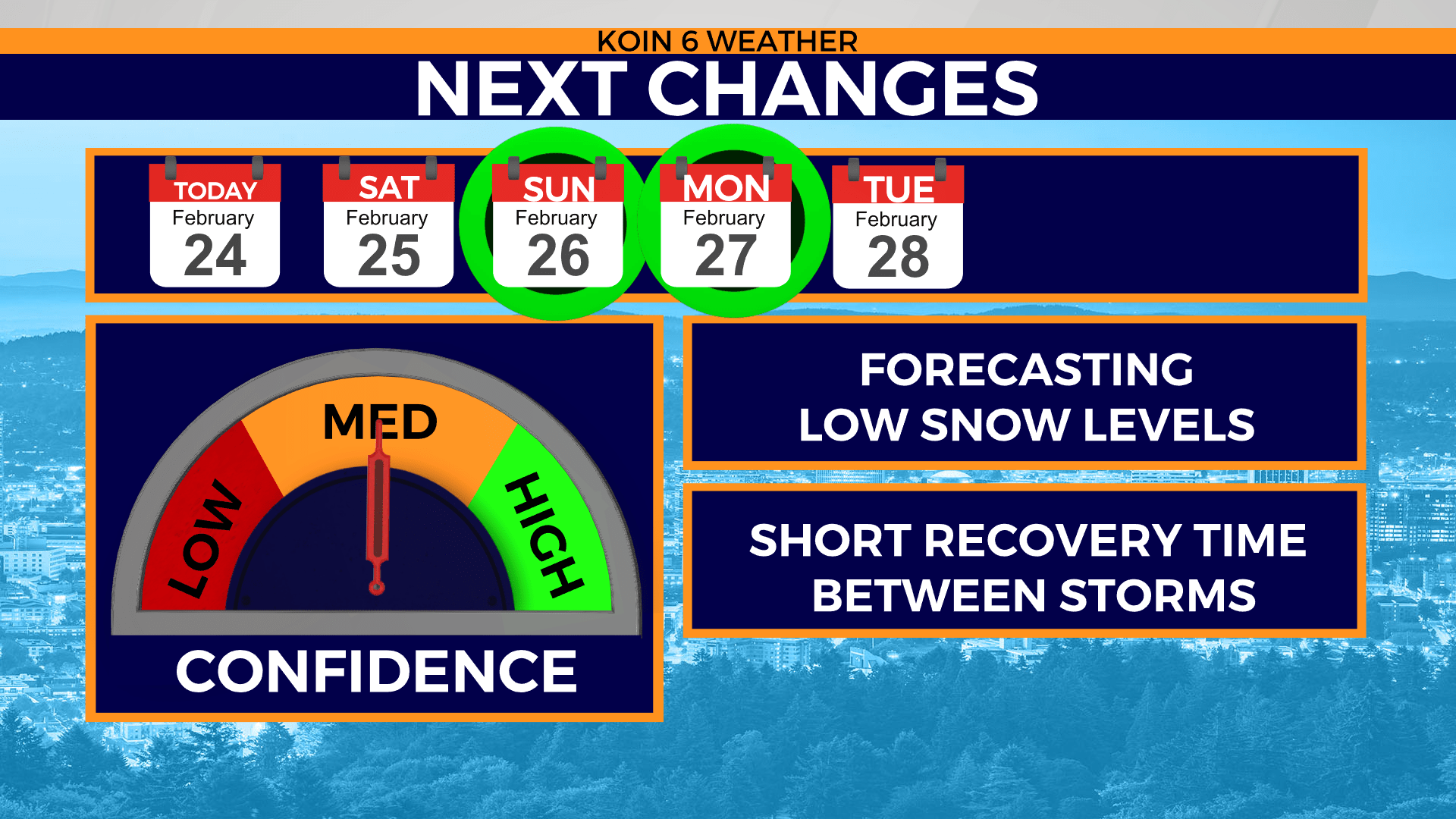
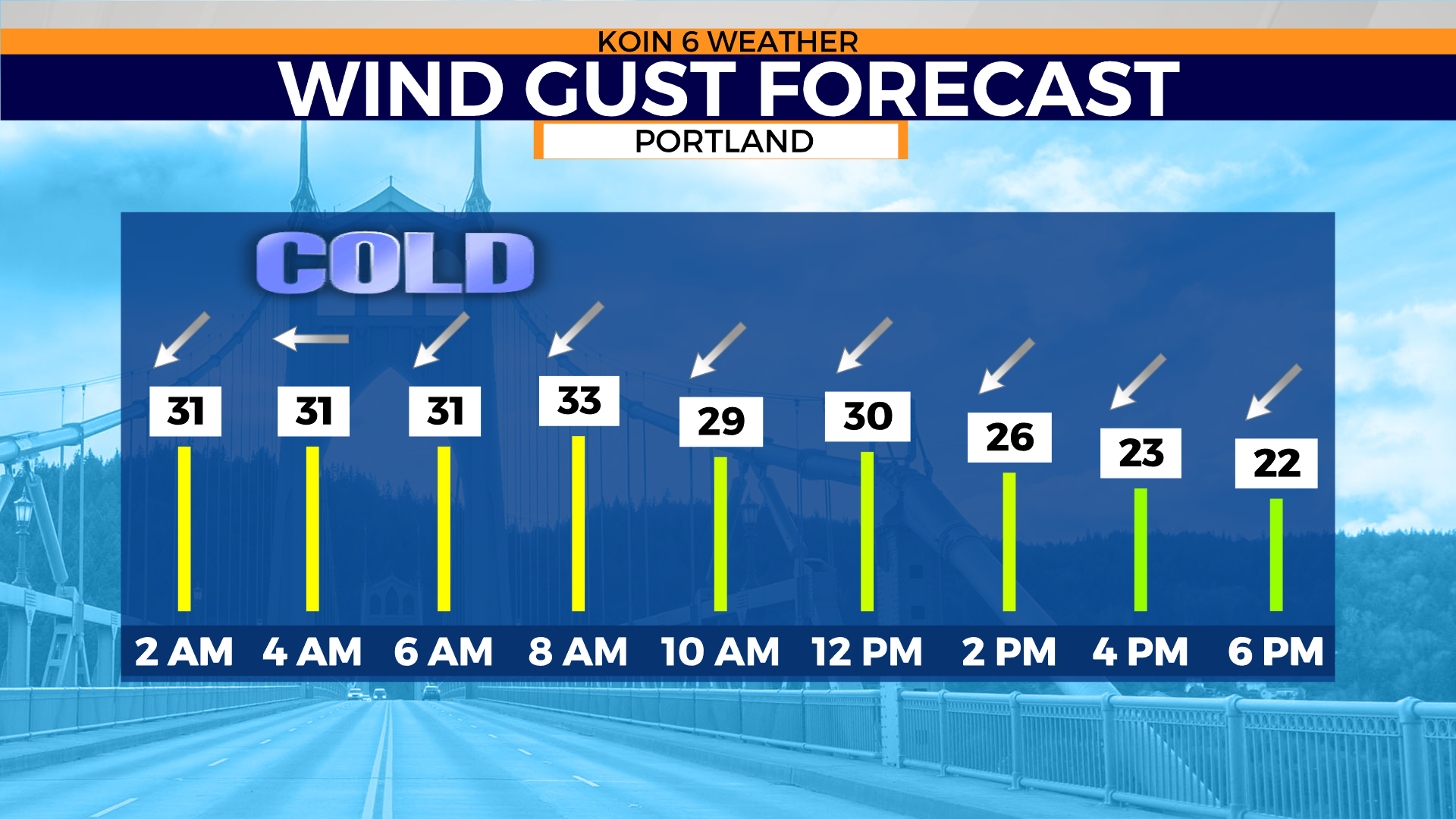
Swipe through the graphics below.

Weather alerts
The following alerts are issued by the National Weather Service Portland.
Wind chill advisory
WHAT…Very cold wind chills. Wind chills generally between 5 and 10 degrees in the Portland metro and Vancouver area, but as low as 5 degrees below zero in the western Gorge.
WHERE…In Oregon, Greater Portland Metro Area and Western Columbia River Gorge. In Washington, Greater Vancouver Area and Western Columbia River Gorge.
WHEN…Until noon PST Friday.
IMPACTS…The cold wind chills could result in hypothermia if precautions are not taken.
Winter weather advisory
WHAT…Snow expected. Total snow accumulations 1 to 2 inches, with up to 4 inches above 1500 feet.
WHERE…Highways 199, 42, Interstate 5 north of Grants Pass to Azalea, and south of Talent. Highway 227 north of Shady Cove, Highway 62 east of Trail, highway 238 near Jacksonville Hill, and eastern part of highway 140. This includes the cities of Ashland, Talent, Butte Falls, Prospect, Selma, Cave Junction, Obrien, Glendale and Azalea.
WHEN…until 7 AM PST Friday.
IMPACTS…Travel could be very difficult. The hazardous conditions could impact the morning or evening commute.
ADDITIONAL DETAILS…Most of the snow is expected to accumulate between 7 pm and 1 am pst.
PRECAUTIONARY/PREPAREDNESS ACTIONS… * Slow down and allow extra time to reach your destination. * Carry tire chains and be prepared for snow-covered roads and limited visibility. * See TripCheck for the latest road conditions. * A Winter Weather Advisory for snow means that periods of snow will cause travel difficulties.