PORTLAND, Ore. (KOIN) – After the city saw a record amount of snowfall Wednesday, frigid to freezing temperatures are expected to linger throughout the Portland area and Friday.
A wind-chill advisory has been issued for the northern Willamette Valley and the western Columbia River Gorge through noon Friday. Due to that wind chill, outside conditions may feel like single-digit temperatures at times.
The National Weather Service is warning people to dress appropriately, as the combination of wind and winter temperatures can cause frostbite, hypothermia or death.
“Frostbite is the freezing of skin and the body tissue just beneath it,” the NWS states. “It first affects exposed body tissue where blood circulation may be limited such as your fingers, toes, nose and ears. To minimize frostbite, make sure all body parts are well covered.”
The Multnomah County Medical Examiner announced Thursday that one person is suspected to have died from hypothermia, but there won’t be confirmation for several weeks at least.
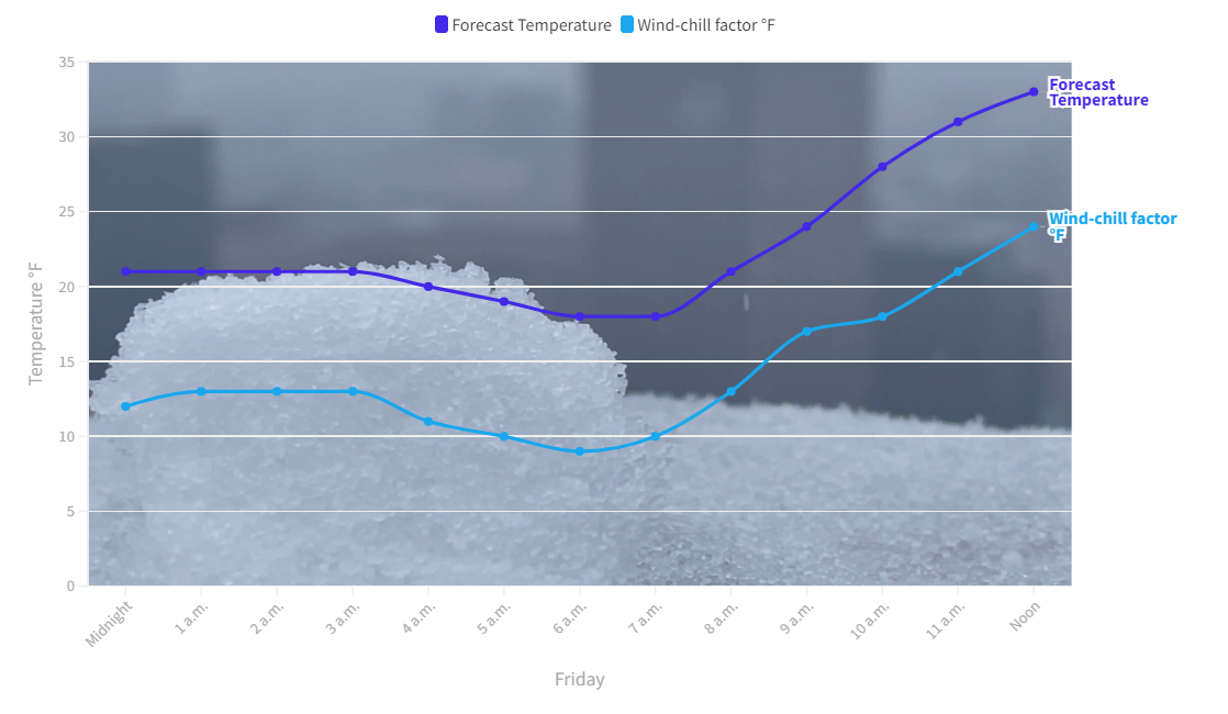
With all this in mind, KOIN 6 News has provided estimated temperatures heading into the weekend to help keep Portlanders safe during one of the most extreme snowstorms in the city’s recorded history.
Hourly forecast and wind-chill temperatures:
Chances of rain and snow will continue to be possible through the weekend. Check back for more info as KOIN 6 continues to monitor the latest storm conditions.