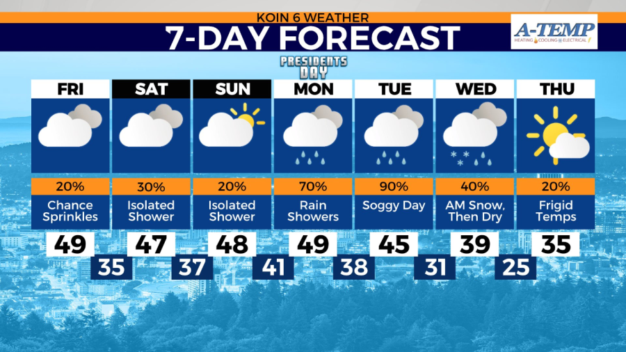
PORTLAND, Ore. (KOIN) — Temperatures Friday morning have bumped above freezing for most in Portland after a week-long stretch of frigid mornings in the 20s and 30s.
Still keep the heavy coat nearby. This afternoon stays cool with highs in the upper 40s. Expect a mainly cloudy and dry Friday.
A weak front spanning across Washington this morning will drop south into the region to bring in a few scattered sprinkles around Portland through the afternoon.

The holiday weekend stays mainly dry with a few isolated light showers possible in Portland. Whether you’re exploring neighborhoods in the city or heading to an indoor event, we’ll keep pleasant and calm conditions in place for all activities.
If you’re heading out to the coast, expect scattered showers Friday and Saturday with daytime highs in the 40s. Sunday dries out with more sun breaks, but showers return by the evening.
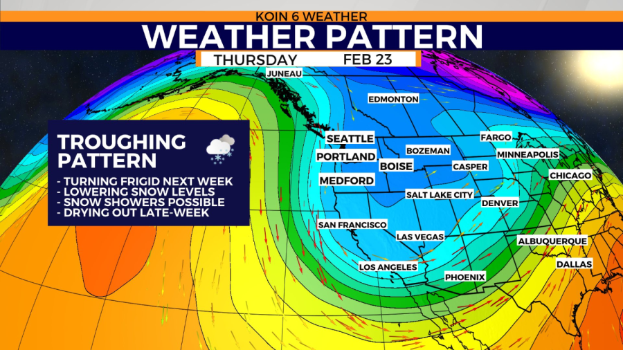
Next week turns cold in Portland. A frigid modified arctic airmass will drop down across the region to drag daytime highs back into the mid-30s with overnight lows in the teens and 20s.
Record-cold daytime high temps will be challenged next week if the current forecast holds. We’ll also see a shot at snowfall come Wednesday morning before drying out Thursday.
Keep your eyes on the forecast with us at KOIN 6 as we track the active week of weather next week.