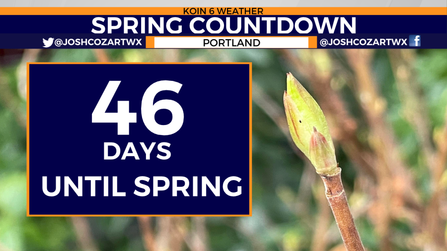
PORTLAND, Ore. (KOIN) — Winter-like conditions are still expected over the Pacific Northwest because it’s still winter! Yes, some signs of spring are starting to be found across parts of western Oregon and Washington. That’s normal as the number of days before the spring equinox drops to 46.
However, colder temperatures are expected over the Pacific Northwest over the next 90 days. The National Weather Service’s Climate Prediction Center is forecasting temperatures to sit below average for the next several months.
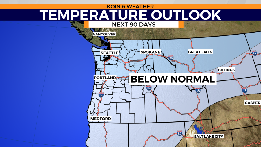
That doesn’t mean Portland won’t see some warmer than average days, but the trend will likely be cooler than normal.
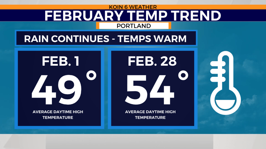
Overall, February does bring a warming trend back to the Pacific Northwest. This is typically Portland’s third coldest month of the year.
The warming trend can be seen this week and into the weekend as afternoon highs climb into the low 50s. The last round of subfreezing temperatures this week is seen this morning. Early morning lows will continue to warm through the weekend.
This warming trend comes with a better chance for rain Friday. That rain potential stays persistent through the weekend and into the start of next week.
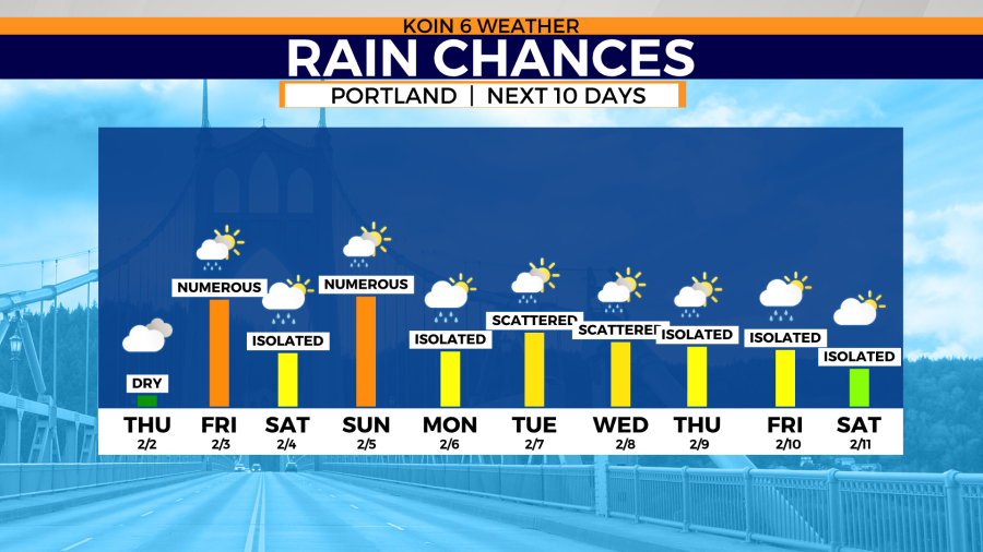
This latest stretch of wet weather will help grow the surplus of moisture Portland’s seen since the start of the water year back on October 1, 2022.