PORTLAND, Ore. (KOIN) — After a record-setting weekend of heat and strong east wind across the region, we will cool things down from the coast to the Cascades on Monday.
Morning clouds will give way to afternoon sunshine and the hot/dry east wind has abated. This is good news for firefighters battling the Nakia Creek Fire in Clark County.
The air quality advisory remains in effect and smoke will linger. Take it easy out there.
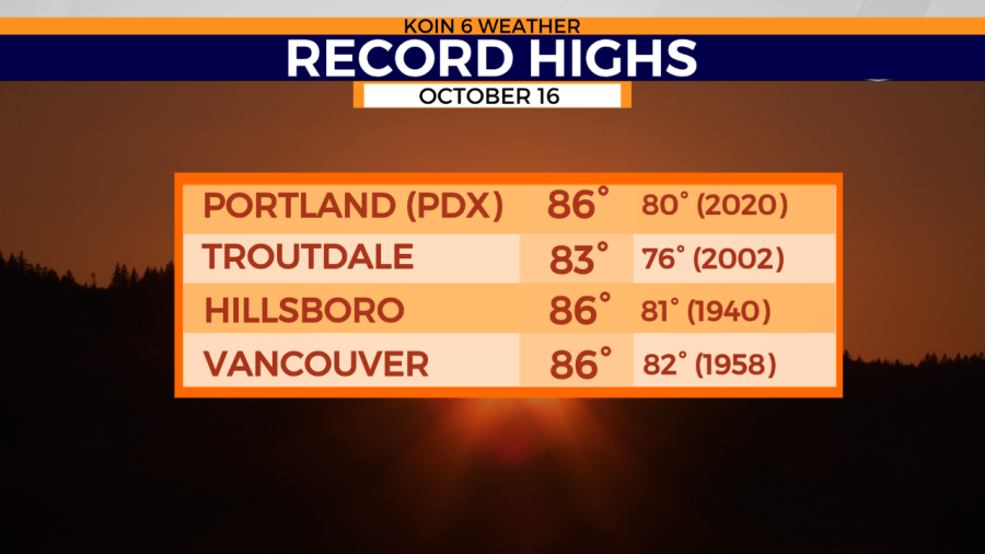
Another record high temperature was set in Portland on Sunday at 86 degrees, which officially made it the hottest weekend on record in Portland for this late in the year. Records at the Portland International Airport date back to 1940.
If you are looking for some cooler and wetter weather, then you will like the 7-day forecast. A pattern change is finally on the way later this week with showers returning for the weekend.
We may briefly touch 80 degrees mid-week, but that will likely be the last 80-degree temperature of the year. Until then, get outside Monday and get some of that end-of-season yard work done. Temperatures should range from the 60s at the coast, to lower 70s in the metro area.