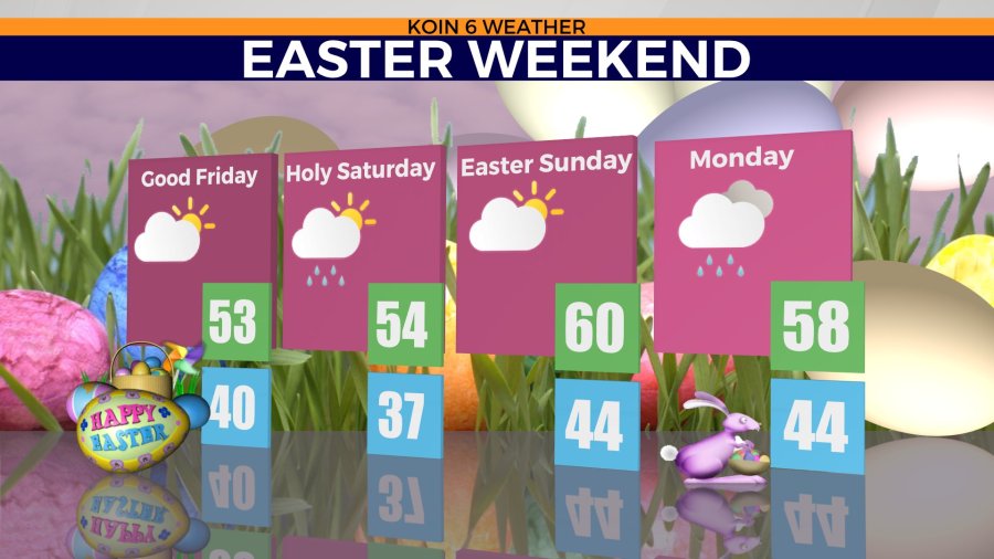
PORTLAND, Ore. (KOIN) – We have some dry time coming our way, and it is just in time for Easter.
However, before we get to that, we are going to have cool and showery moments. Conditions are going to be jumping from dry to showery and right back around for the weekend.
We will start with some dry time on Friday. That should be our first dry day coming off a very busy week of weather. Good Friday is going to be cool, with temperatures only in the lower 50s. The warm side of spring is going to stay out of the picture for some time as we are sitting on the fringe of a trough. We will discuss more on that below.
Take in your Easter weekend forecast here and we will discuss the finer details below.
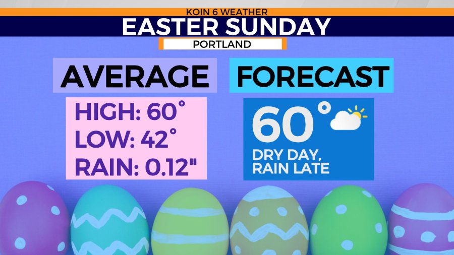
What do we usually experience on Easter Sunday?
The average high tends to be 60 degrees. Of course, Easter weekend doesn’t always happen at the same time each year, but for the most part, it usually hits around 60 — and that is exactly what the forecast is calling for this Sunday!
The holiday usually brings a passing shower or two, but this year, we are calling for a dry forecast. It will probably have filtered sunshine before it turns mostly cloudy and will be one of the few dry days we’ve had this month.
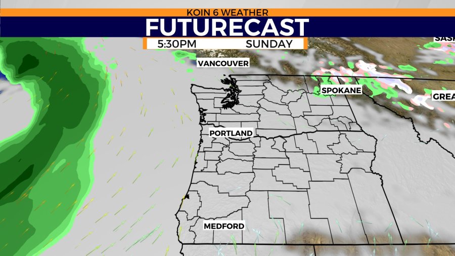
Late Sunday night may be vulnerable to rain as a system nears the coast. For now, we will call it mostly dry with clouds.
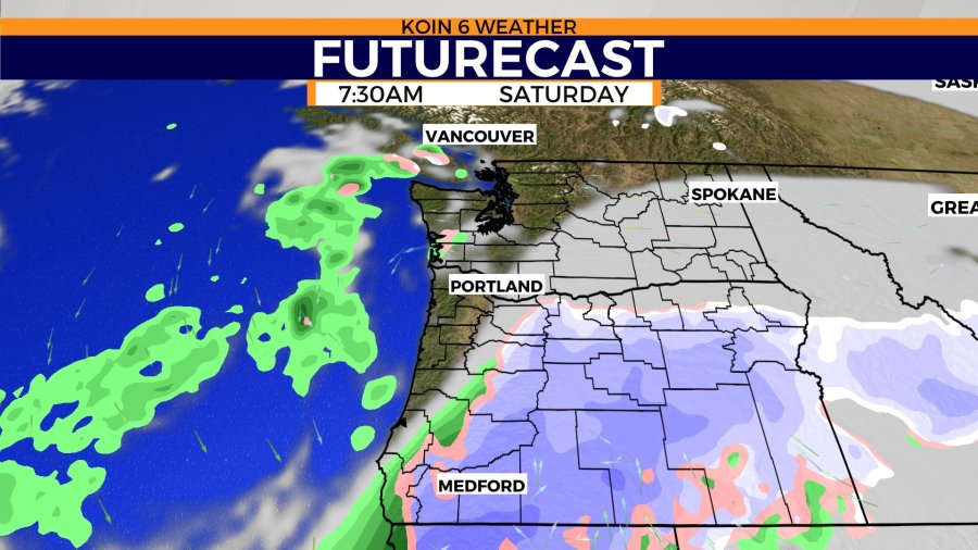
The futurecast slideshow will show the timing of potential rain in the next few days. Friday is expected to be mainly dry. Saturday is going to have some moisture moving through, which will lead to some rain and even some areas of snow for the Cascades and potentially central Oregon. Now if the event arrives earlier, it may impact Friday. We will keep you updated as weather models continue to pump out updated information.
Saturday morning may start dry but the moisture isn’t far away. The futurecast is showing a swath of moisture through central Oregon in the form of snow. Be prepared if you’re doing any sort of traveling. This may mean chains for the mountains.
Sunday has a canopy of clouds over the top of Oregon and Washington. The rain is off in the distance, but again, it may arrive late at night. Most of your Sunday should be dry and open for egg hunts and activities.
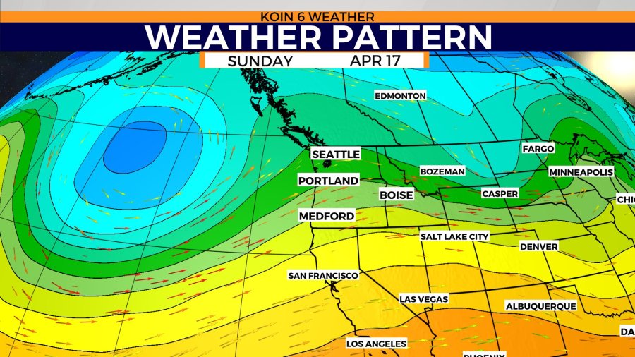
Temperatures are just going to be cool for some time. You will notice a trough moving through Saturday, which is going to be the reason for the cool and wet weather. A transient ridge is just off-shore on Saturday night, helping us dry out for Sunday.
Swipe through the graphics below to get a visual idea of the forecast. The ephemeral pattern is going to keep us on our toes for a bit.