PORTLAND, Ore. (KOIN) – It’s a winter scene across the Portland metro area and Saturday night may bring in another wave of freezing rain and snow. The northwest flow will keep us slightly busy this evening, but it will slow down slightly at midnight. We are watching another system that will move in Sunday, bringing in rain and slightly warmer air to the valley. This won’t be enough to thaw us out but it may be the first step. That said, expect freezing rain tomorrow before temperatures warm up.
Interstate 84 will remain closed Saturday night in the Columbia River Gorge due to the blowing snow and icy roads, Oregon Department of Transportation officials announced in a statement Saturday.
“ODOT is deploying numerous vehicles from around the region to the Gorge. These include plows, graders and high-capacity snow blowers that will be working through the night to clear the snow,” officials said.
Tonight
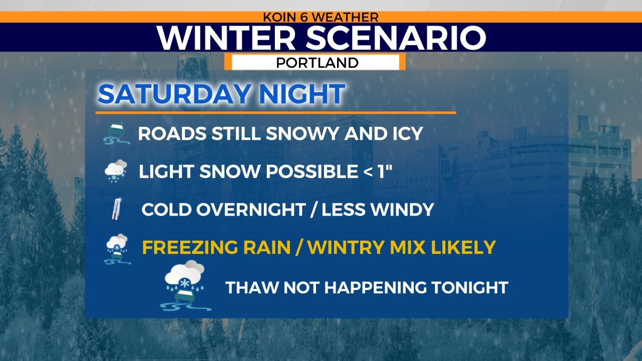
Roads will remain snow-covered and icy. Some will be better than others, but if you have to do any light travel, you should anticipate icy conditions.
Freezing rain is possible tonight. We may also find some light snow accumulations around the Portland area. It won’t be significant, but we may have a coating up to 1 inch (likely less).
We will stay cold overnight with temperatures around 30 degrees.
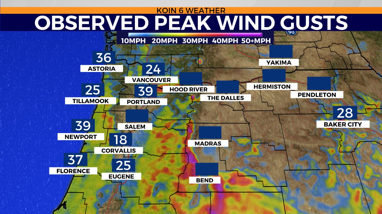
The wind gusts from the last few days will slow down.
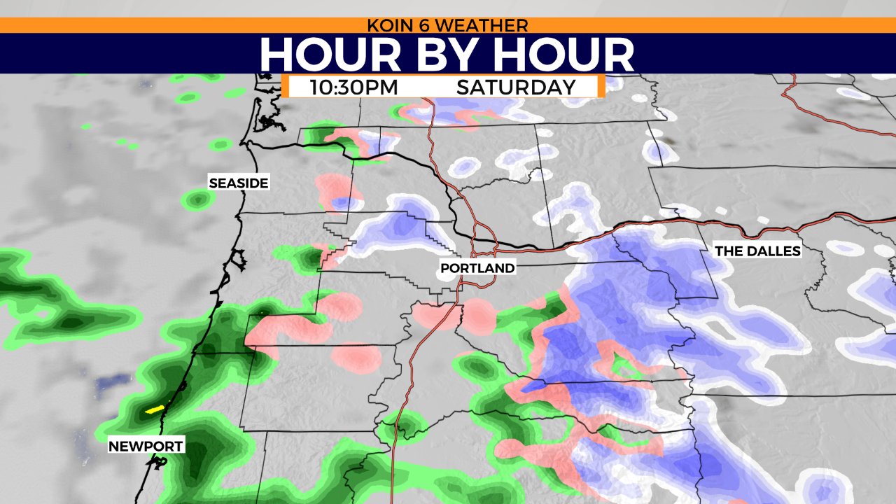
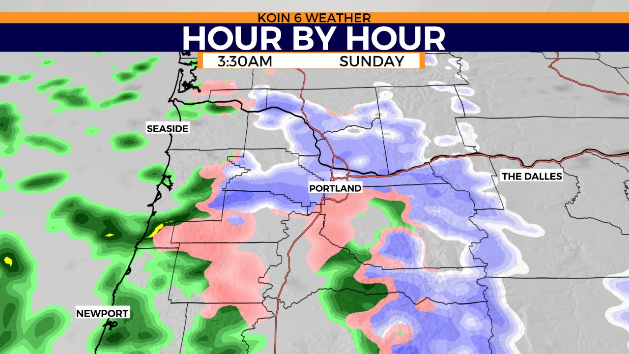
Two images of the hour by hour forecast for your Saturday night and early Sunday morning. Very scattered through late tonight, but more moisture slides in by the morning. There is a better chance for light snow late tonight, changing to the threat for freezing rain and a wintry mix tomorrow morning and through the day.
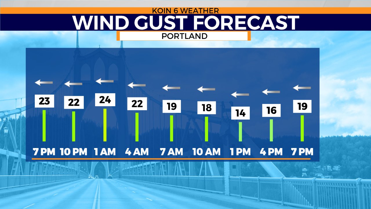
We had some very breezy moments through the overnights into Saturday morning. Most of our peak wind gusts happened before sunrise. It is still breezy, but it will not be anything like Friday night and Saturday morning. We did have a peak wind gust of nearly 40 mph here in Portland today with weaker wind in the southern valley.
Here is the wind gust forecast for the rest of tonight and the start of your Sunday. We still manage to hold on to an east wind out of the Columbia River Gorge for tomorrow. Although way more relaxed, it will keep us cooler near the surface. This is why it will be tough to warm up on Sunday. Let’s call it the 20 mph range for the wind gusts tonight and into Sunday morning.
