PORTLAND, Ore. (KOIN) — Warmer air is headed our way. And, while it may sound nice, in the winter it can lead to very dangerous conditions.
Changing precipitation types combined with the warm air can create freezing rain and ice and that can mean terrible road conditions and toppled power lines.
So, what do we think is going to happen tonight and into Thursday morning? Let’s break it down.
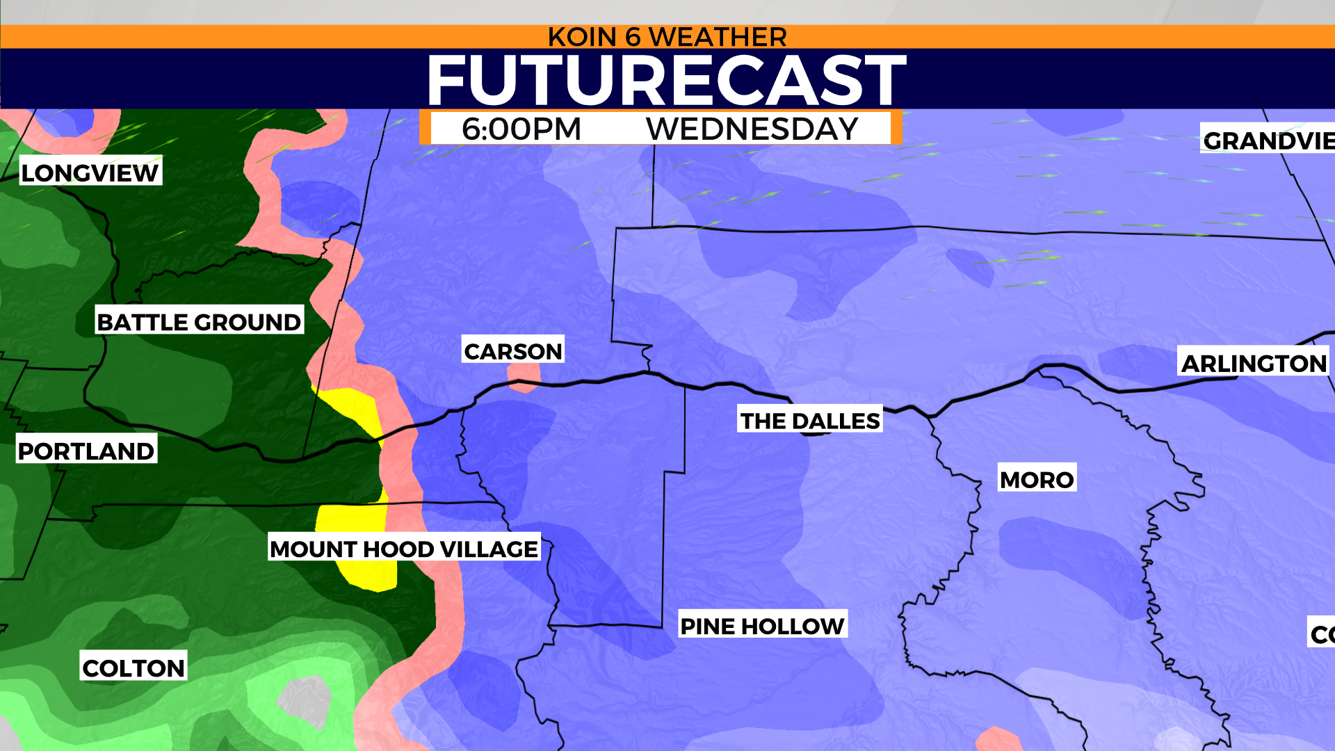
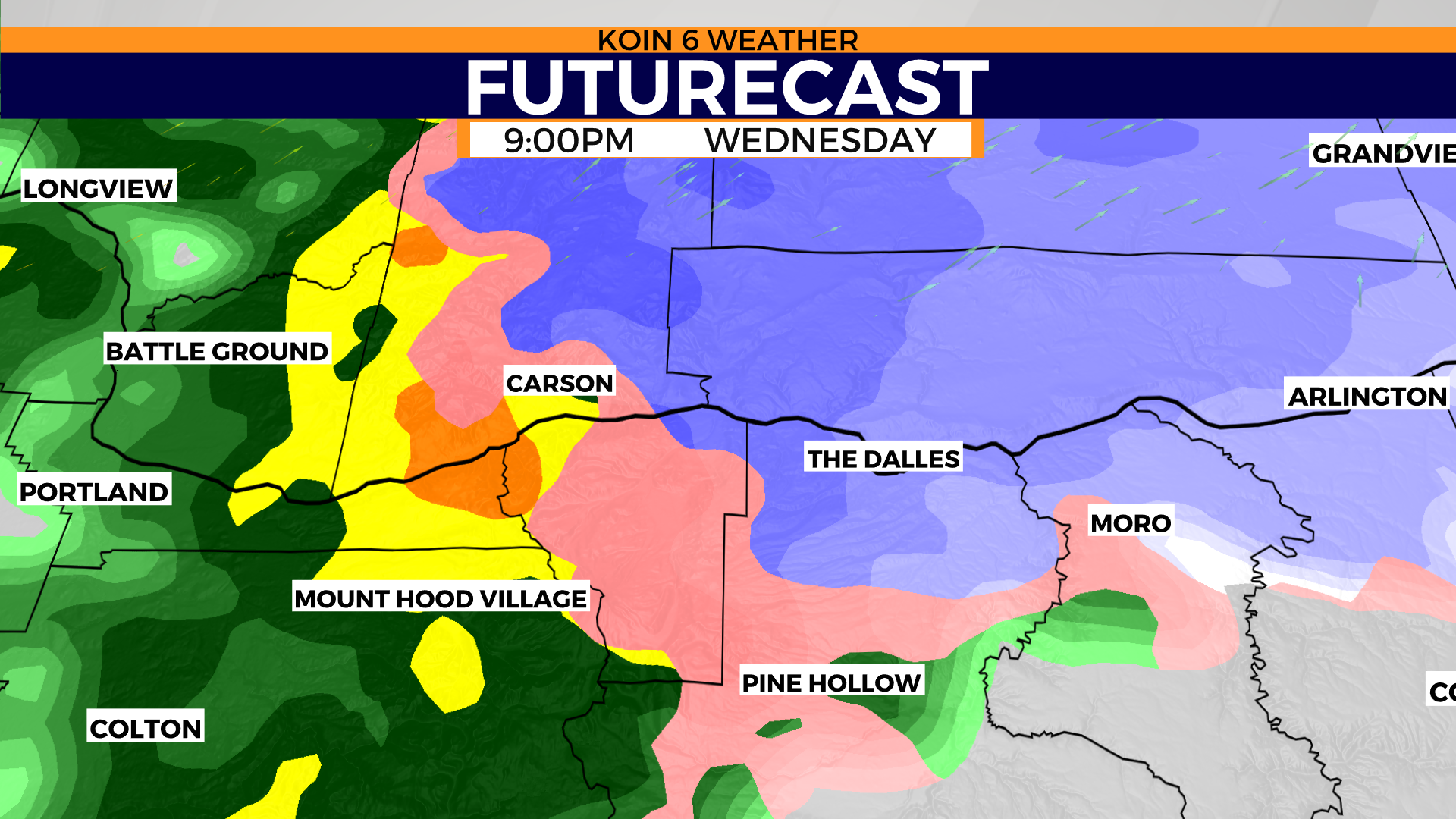
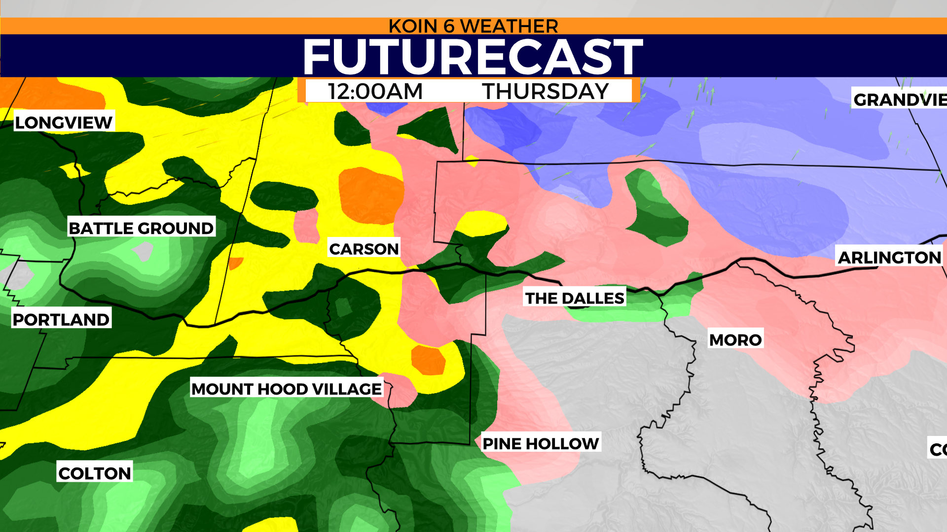
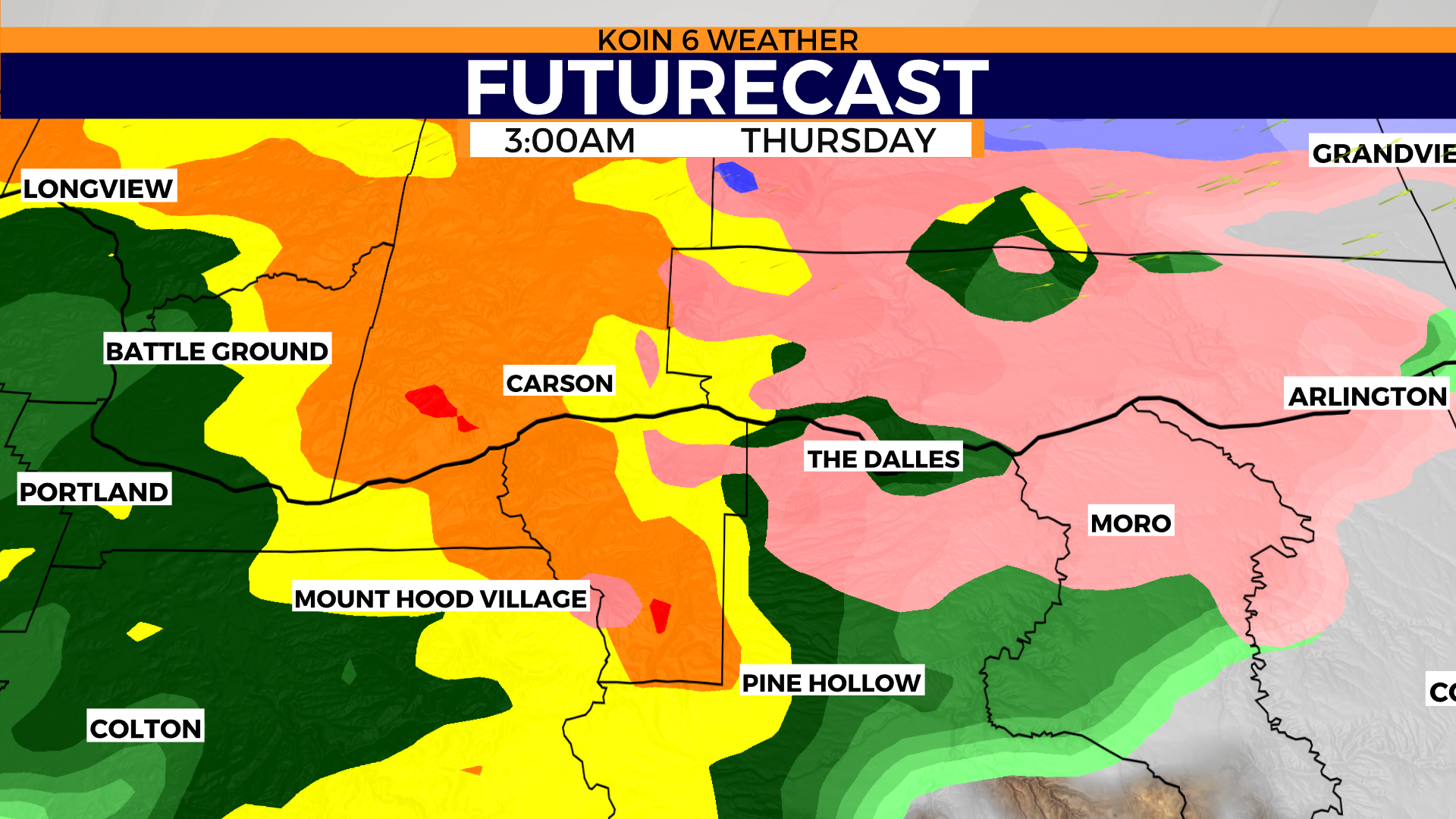
Swipe through each slideshow to get the full visual representation of the forecast.
THE MOISTURE
Warmer air doesn’t mean that much if we aren’t pairing it with moisture. We have plenty of that tonight as the front edge of an atmospheric river (AR) starts to transport to the Pacific Northwest (PNW). When we have these moisture-laden AR events, they typically warm the region up because they’re carrying a lot of moisture. Warm air can carry more moisture than cold. We are expected to see the moisture increase this evening, leading to rain around Portland and what we are projecting is a moment of snow for the Columbia River Gorge. The line for snow seems to be around eastern Multnomah county and Hood River County east. As more moisture is pumping in, the temperatures aloft start to change.
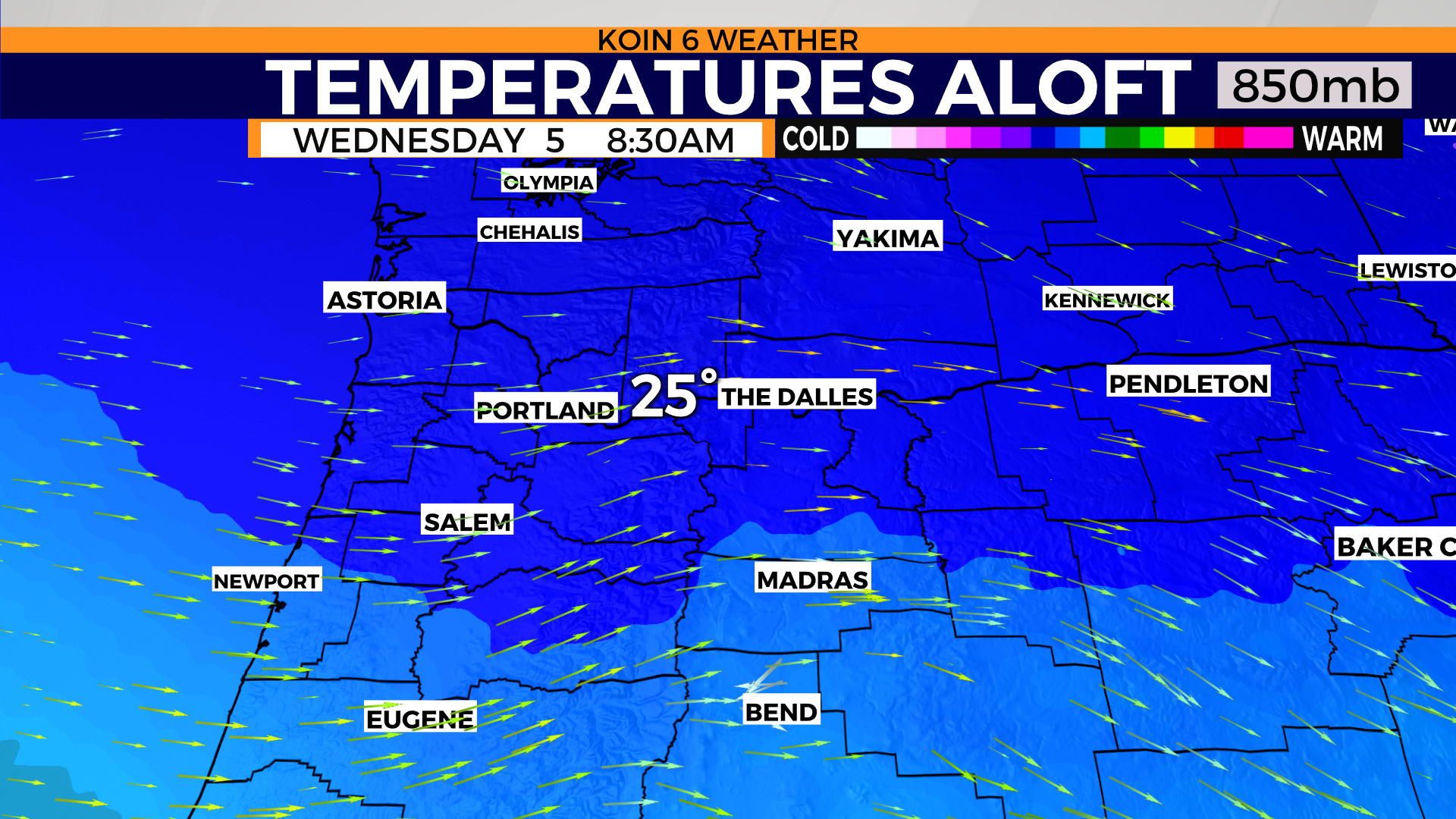
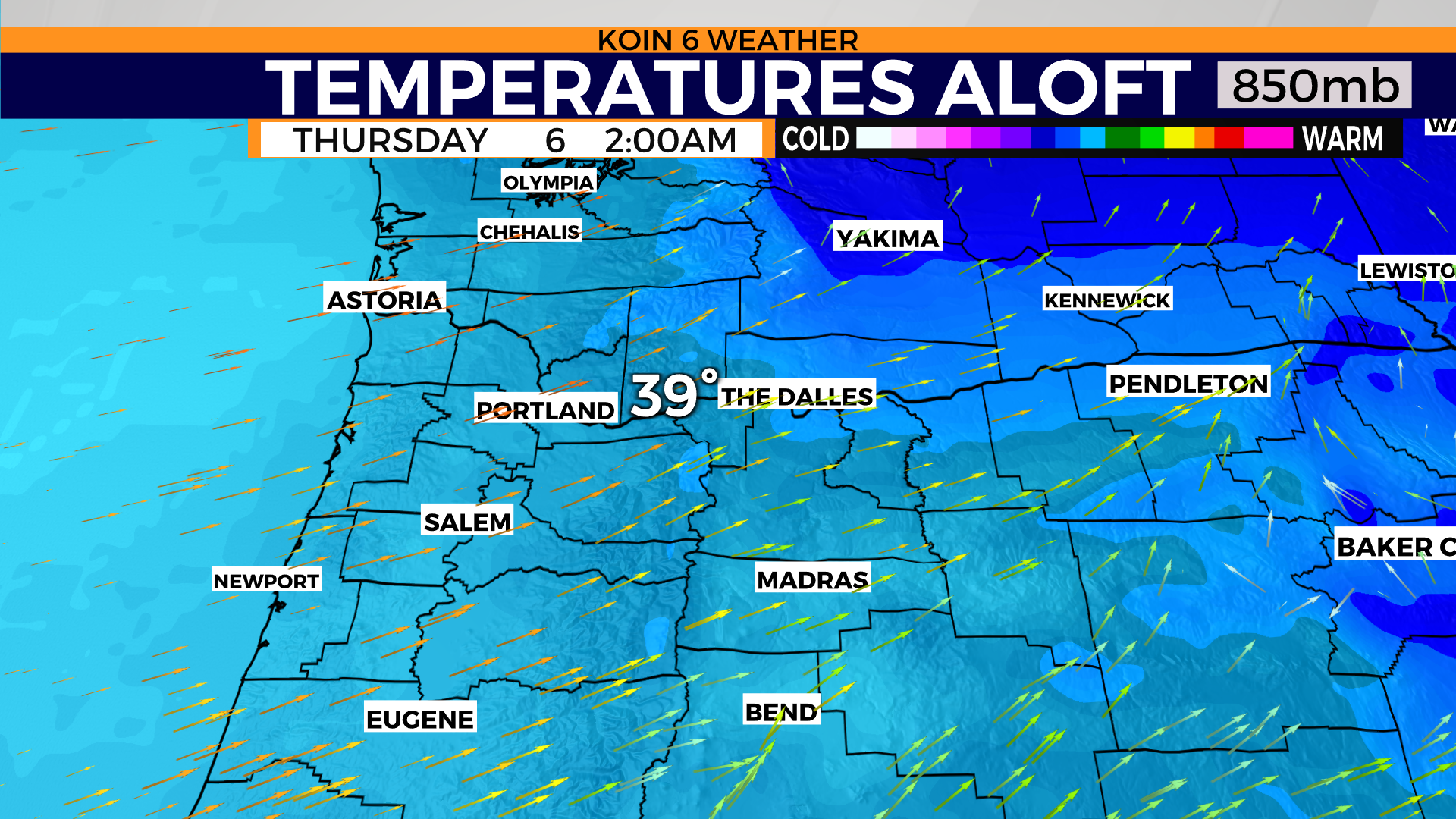
AIR MASS EXCHANGE
A way to watch for warm air or cold air advection, is to track the air mass at the 850mb level. This is around 4,000 to 5,000 feet (think the elevation of Government Camp). We know that Wednesday morning started cold aloft, with temperatures above Hood River coming in around the mid 20s. By the time we get to the evening hours, the warmer air is starting to creep in from the southwest and the layer above Hood River around 5,000 feet is somewhere around 30 degrees. Still below freezing for most of the temperature profile at this point of time. That means, the surface is below freezing and the air above it is too, which would produce snow . Fast-forward to 2 a.m Thursday., the temperature jumps to near 40 degrees above Hood River county and this is when the warmer air has fully arrived. What does that mean?

PRECIPITATION TYPES
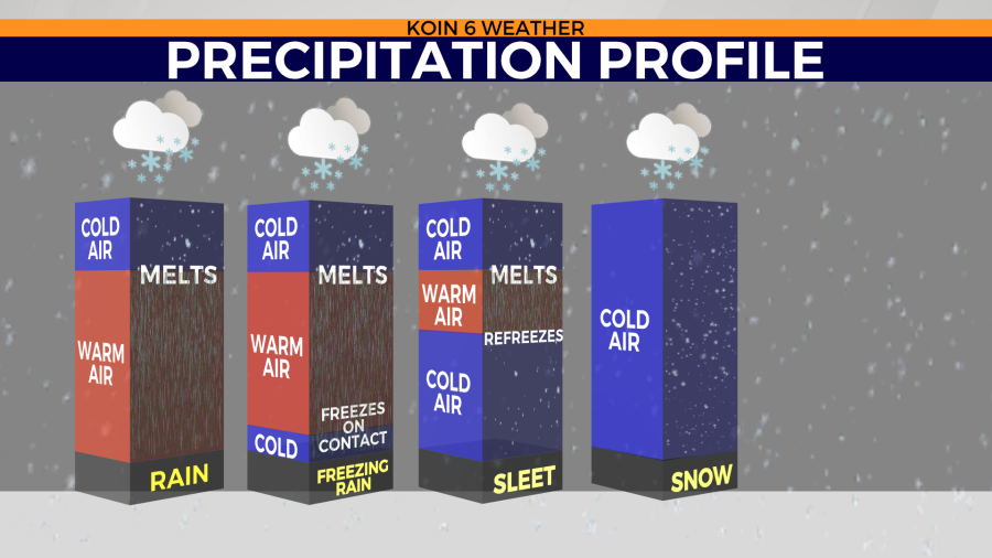
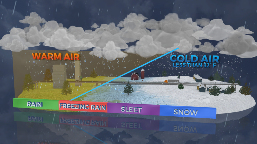
This means the precipitation type that we forecast is going to modify as the event unfolds tonight. Let’s talk about the different precipitation types before we work into the timing of what may be freezing rain below. The two graphics below should help explain what is going on from our feet to way above our heads when the air is clashing between cold and warm. Rain is the easiest to forecast because we know the air is going to be warm and the outcome is going to just be rainy. We have that coming for the Willamette Valley with this event. We will be warm from the ground up. On the opposite end of the spectrum, when it’s winter cold from the snowy ground to the top of Mt. Hood, we know that it is going to be snow. There will be moments of that Wednesday, before the warm front engages.
Tracking the warm layer is tougher, especially understanding how thick that layer may be. It’s always changing, so a wintry mix is a good call for a moment that may include both sleet and freezing rain. You can see from the graphic below what it takes for freezing rain versus sleet. It is likely that we are going to have a profile that favors freezing rain for at least a brief window tonight for the Gorge. That is the cold air aloft, with a thick layer of warm air coming in tonight, with freezing temperatures on the ground from the snow packed areas.
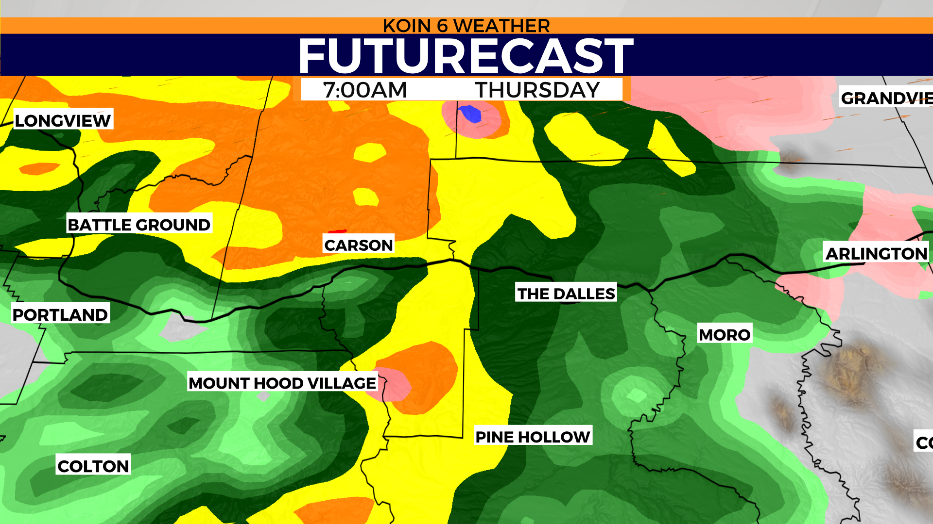
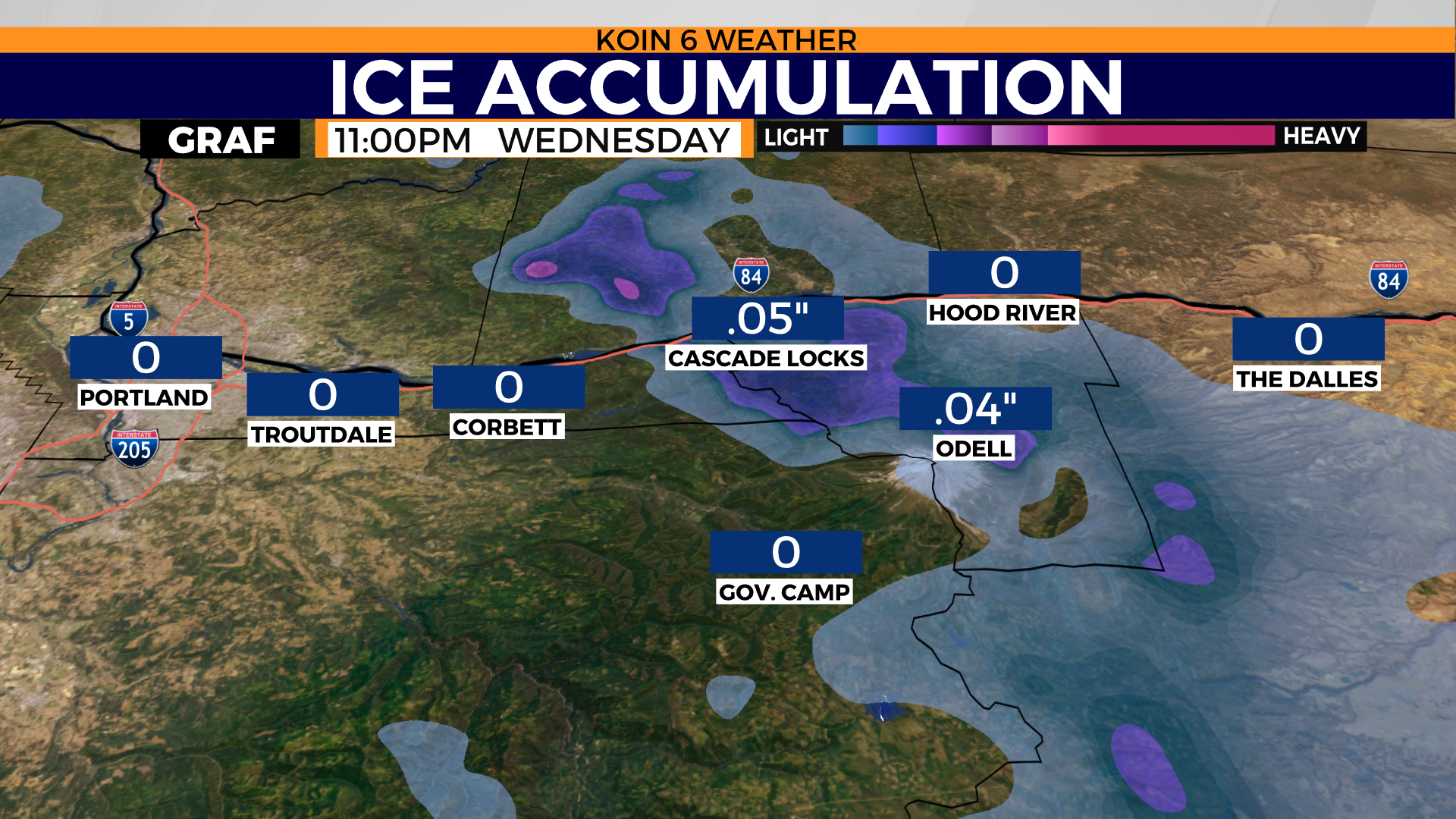
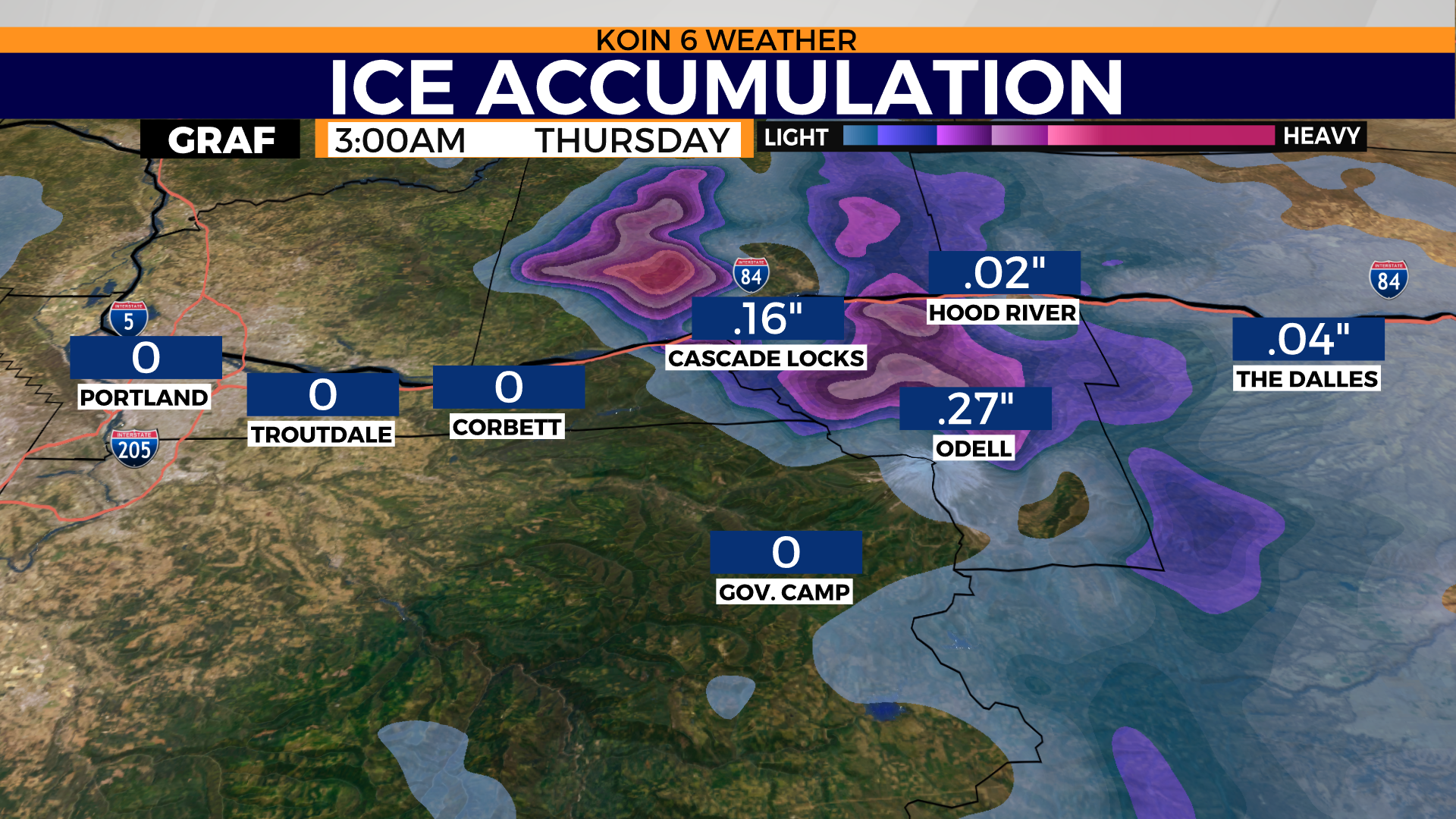
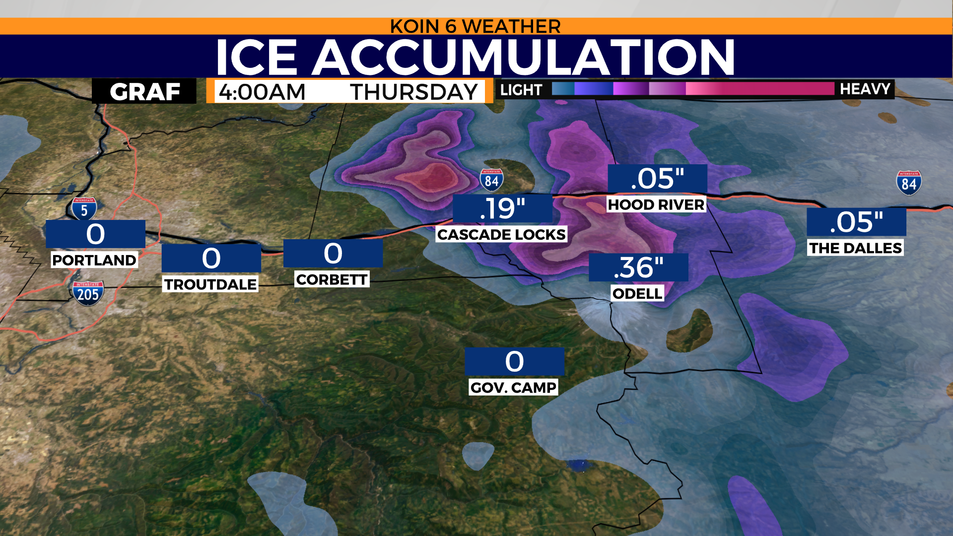
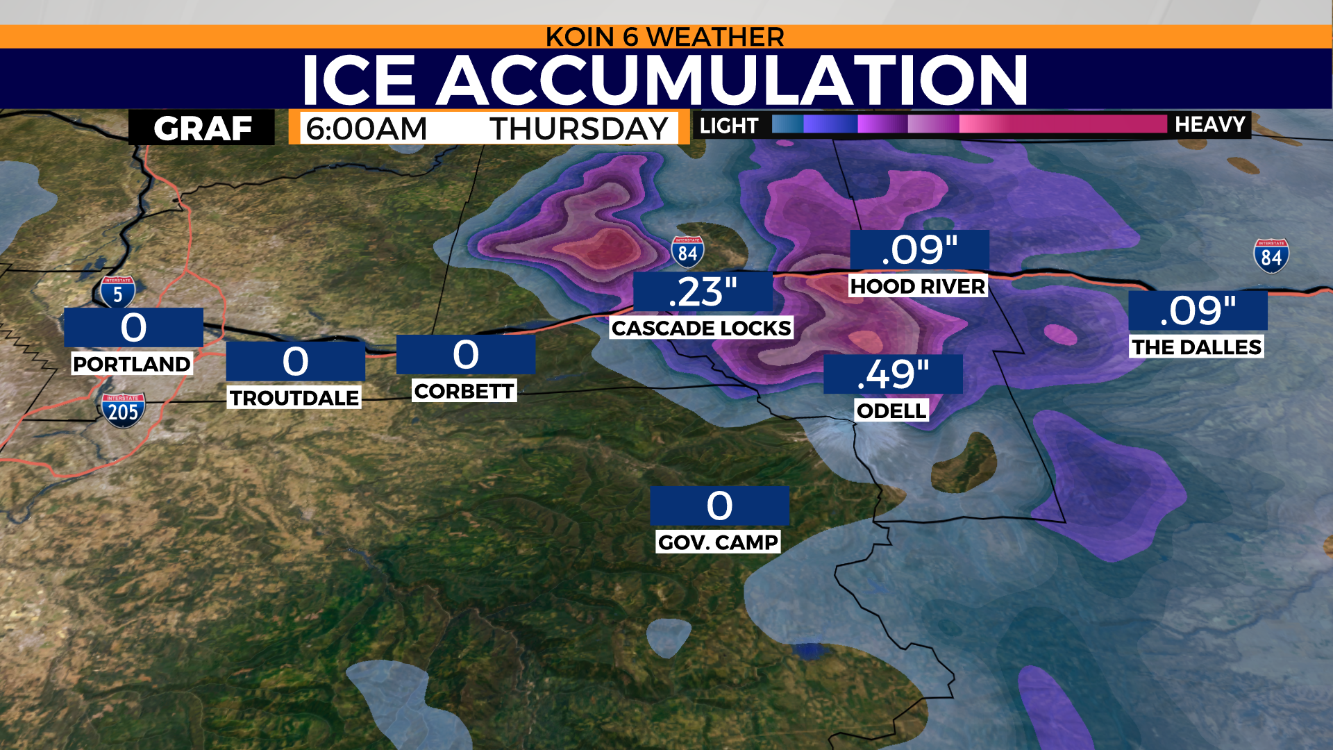
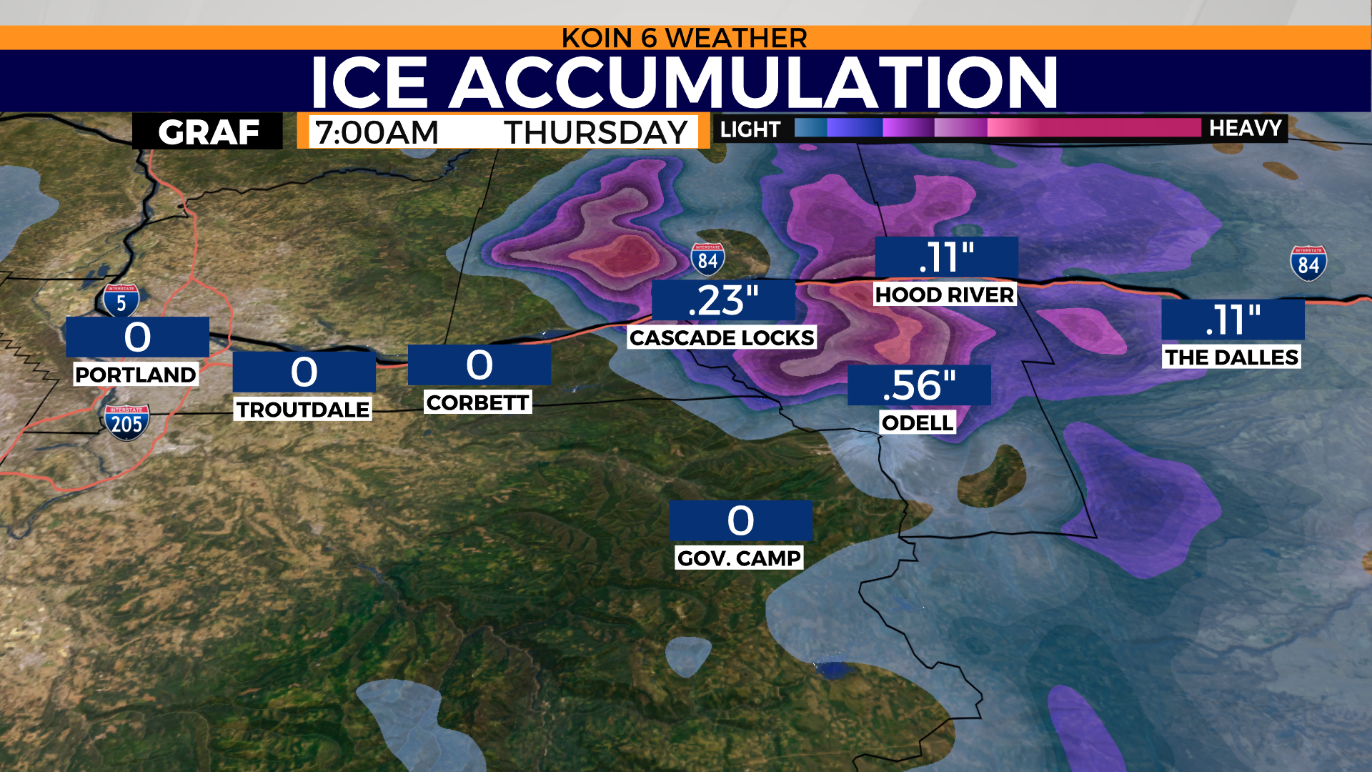
ESTIMATED TIMETABLE
Let’s get you prepared for what could ultimately be a tough transition from snow to rain. A wintry mix is likely when we have this type of transition. We have weather models that are projecting freezing rain leading to ice around the Gorge. This could lead to some serious travel trouble. Follow the timeline below and you will have a better idea of when the ice is expected.
You don’t necessarily need to worry about the ice totals, but more of the timing and expectation.
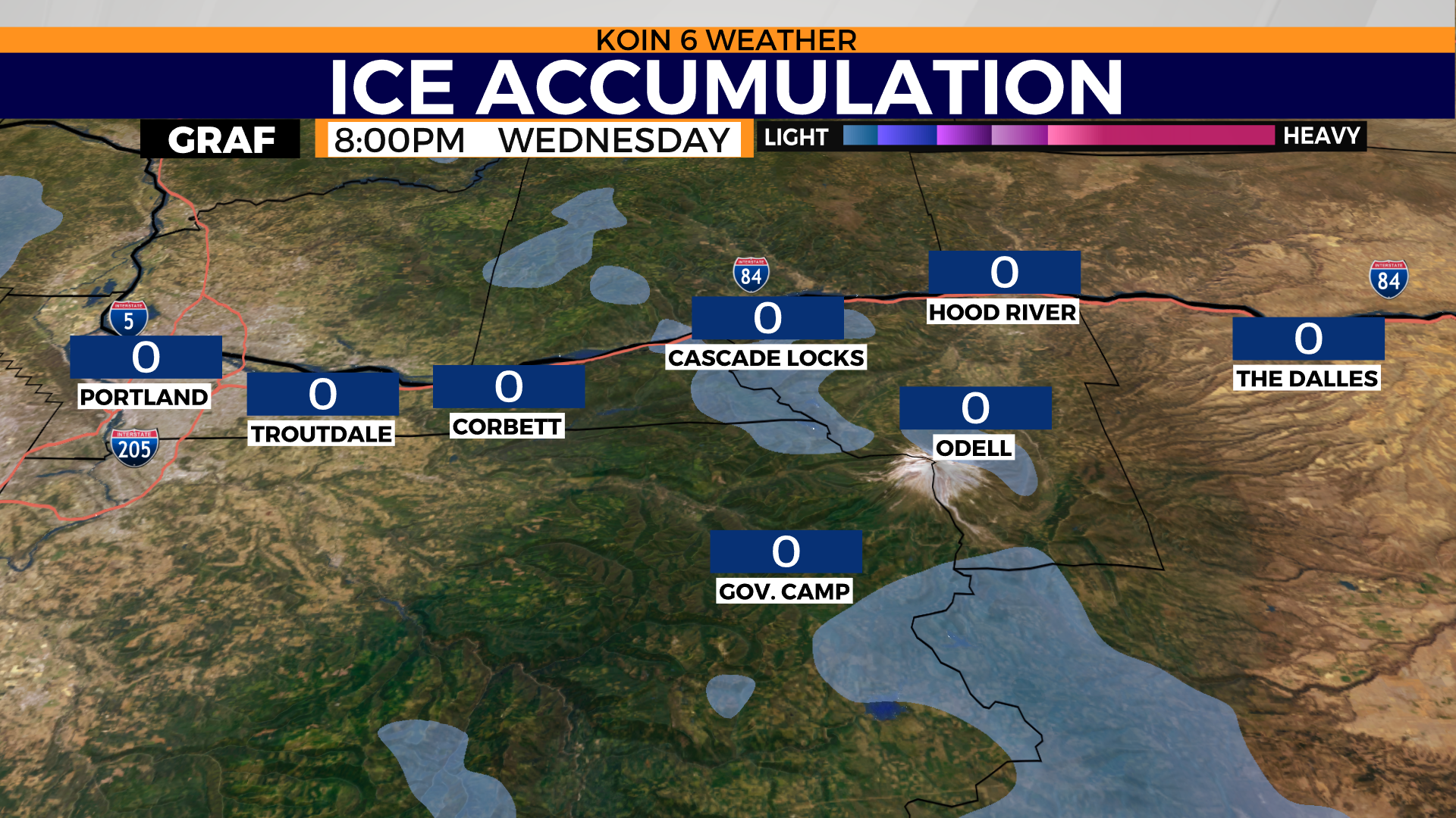
WEDNESDAY NIGHT:
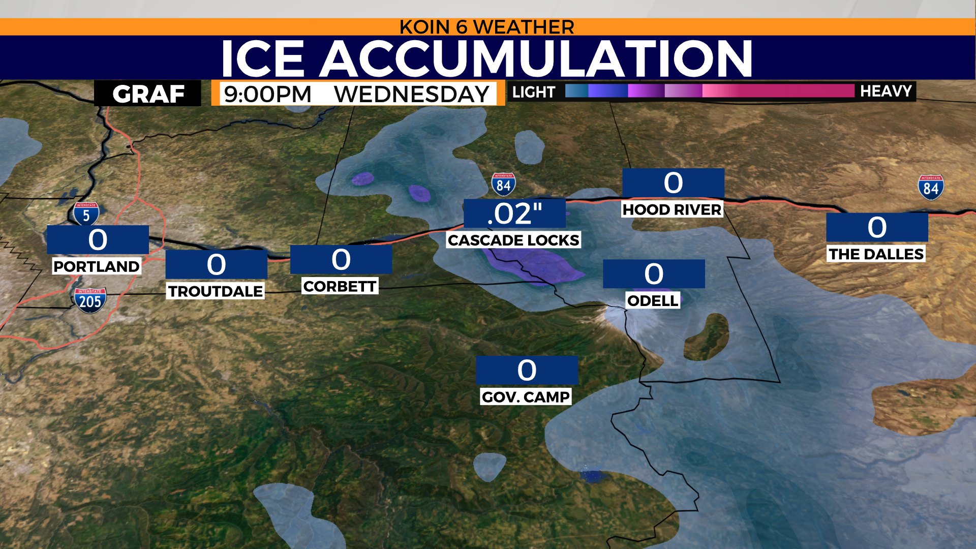
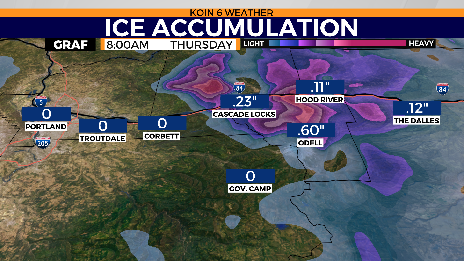
Not much of a concern for ice accumulation in the early hours of Wednesday evening. We my start seeing some signs of a wintry mix as early as 8 p.m.. This seems more likely for some of the locations up in the hills of Hood River county. Cycle through each slideshow to follow the hour by hour of the projected ice accumulation. Models are projecting we will start to see accumulation of ice around 9 p.m., but it won’t necessarily be widespread. It will be closer to midnight when we start to see more of a consistent build up of ice.
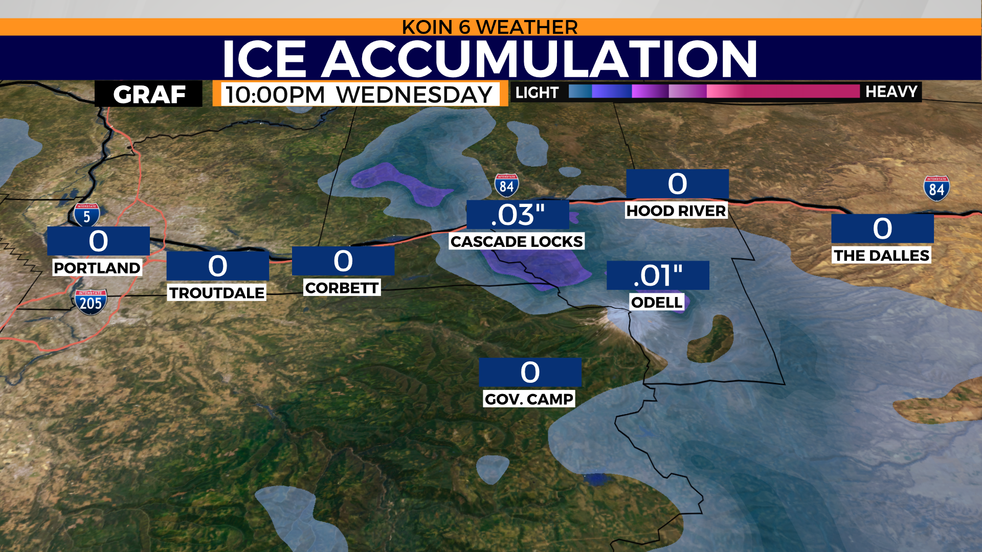
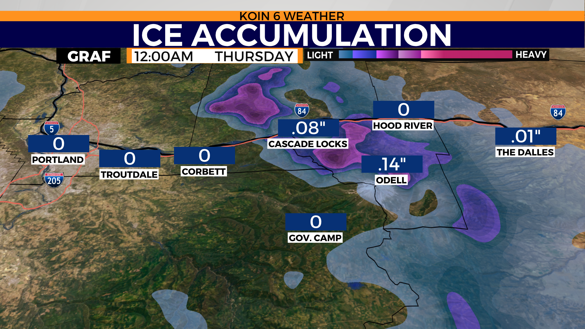
AFTER MIDNIGHT:
This is when the event is most likely to start picking up in activity. We know that warm layer of air is moving in around this point of time (from the analyzing the information above). This seems to be mostly a Hood River and Skamania county concern Wednesday night and into Thursday morning. There will be some fringe issues around Wasco county, but this seems to be more concentrated for the upper Hood River valley. It seems like there may be some locations that are starting to pick up significant ice by the time we get to early Thursday morning. Models are pushing some heavy ice accumulation by the time we get to Thursday morning. This may create really tough travel conditions by sunrise Thursday on ORE 35 and through a segment of I-84.
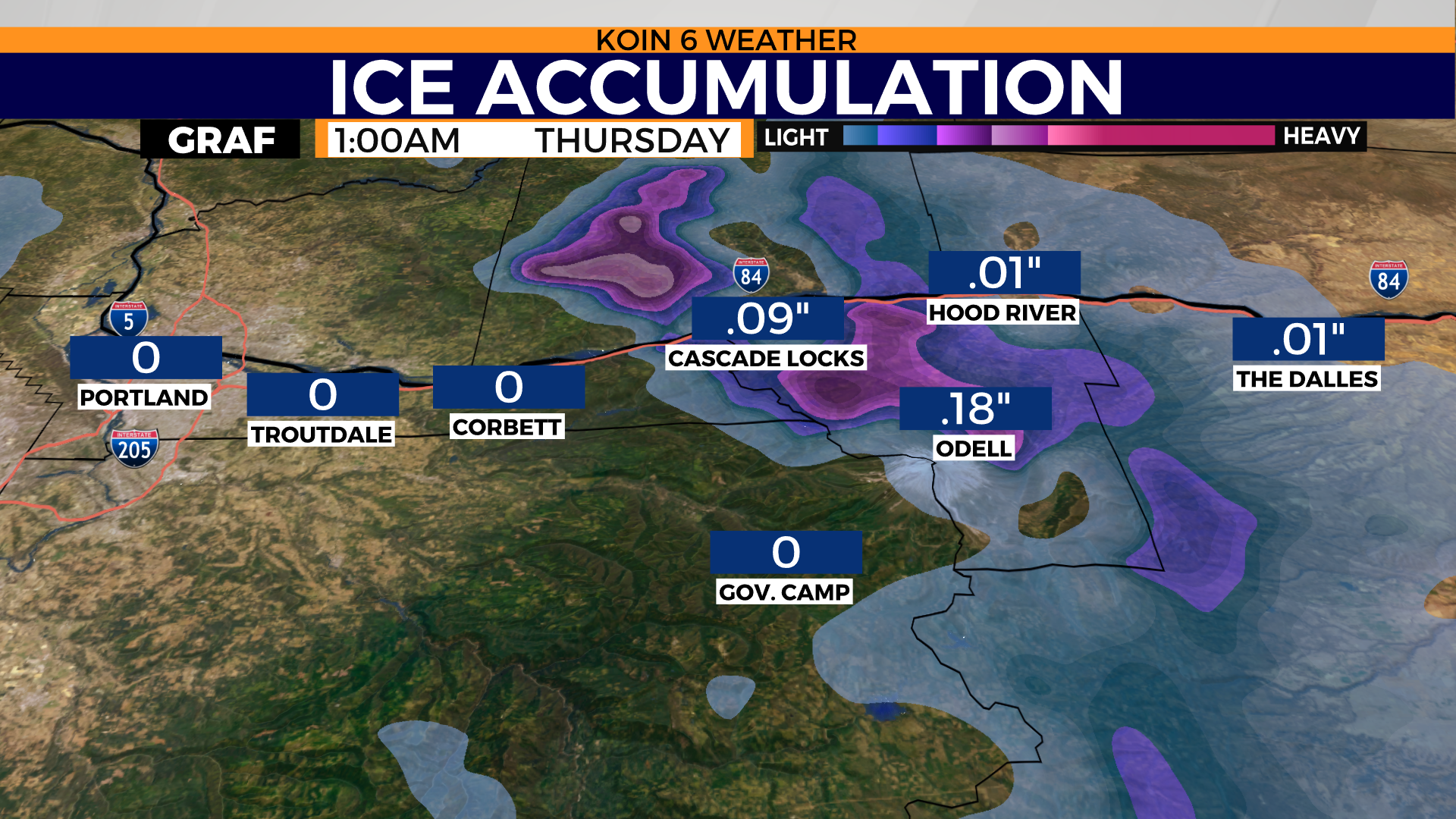
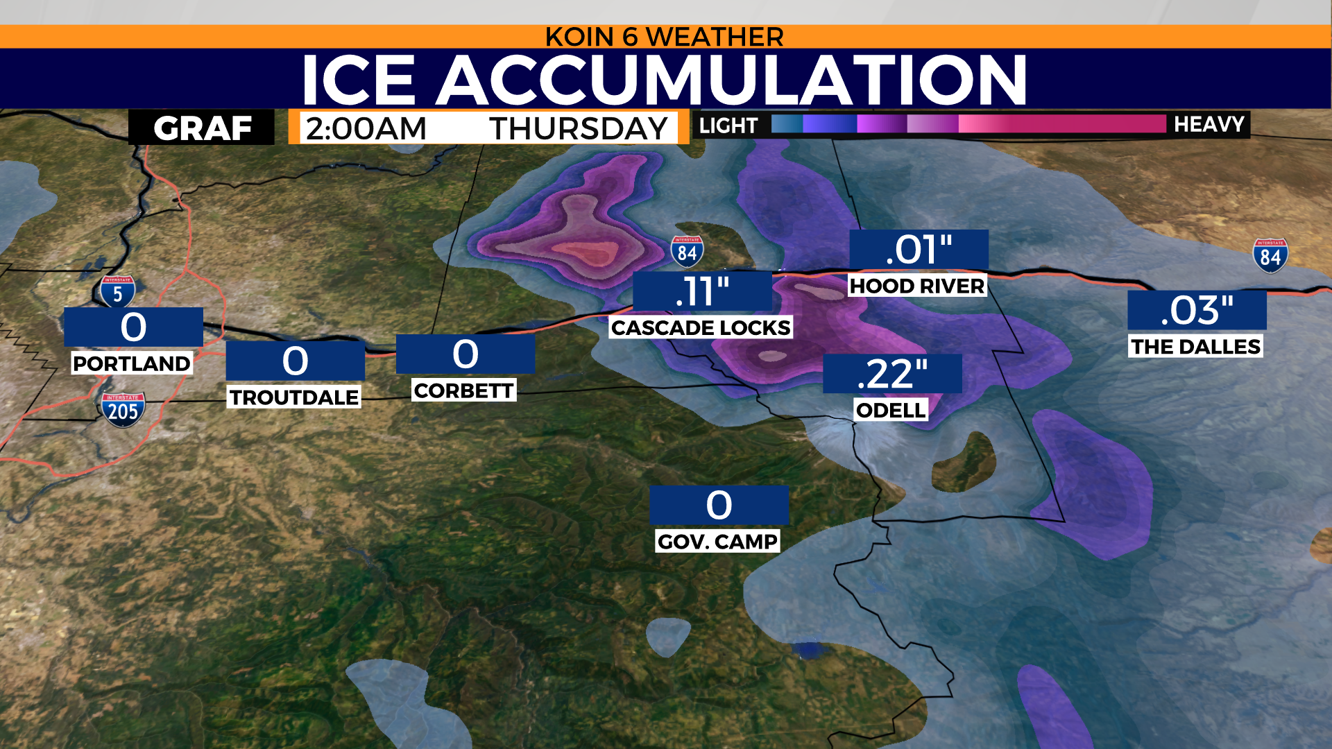
THURSDAY MORNING:
If everything plays out, we may have significant travel issues and potential power loss issues because of the impact of ice. We are expected to warm up fully aloft to support rain, it just depends on if we can scour out the cold at the surface. This will not impact areas around Portland, but it will be an event to keep our eye on from Cascade Locks east to Hood River and up. Models are likely overplaying this scenario, but we want to make sure you are prepared.

Check in with KOIN for your weather updates.