PORTLAND, Ore. (KOIN) — Following a night of heavy rain Saturday, the National Weather Service in Portland issued a flood advisory Sunday from the Portland-Vancouver metro area to the Corvallis area.
The advisory lasts until 8:30 p.m. Sunday.
Saturday night’s heavy rains also led to another combined sewer overflow for about four hours overnight, according to the Portland Bureau of Environmental Services. Officials urged the public to avoid contact with the Willamette River downstream of the Ross Island Bridge for 48 hours.
NWS also issued a flood watch for Lincoln County until 10 a.m. Monday.
A downed tree knocked out power for some households in Forest Grove Sunday, officials shared in a Tweet. A Street was closed between 21st and 26th Avenues while crews attempt to repair the lines.
23rd Avenue was also closed between B and Main Streets.
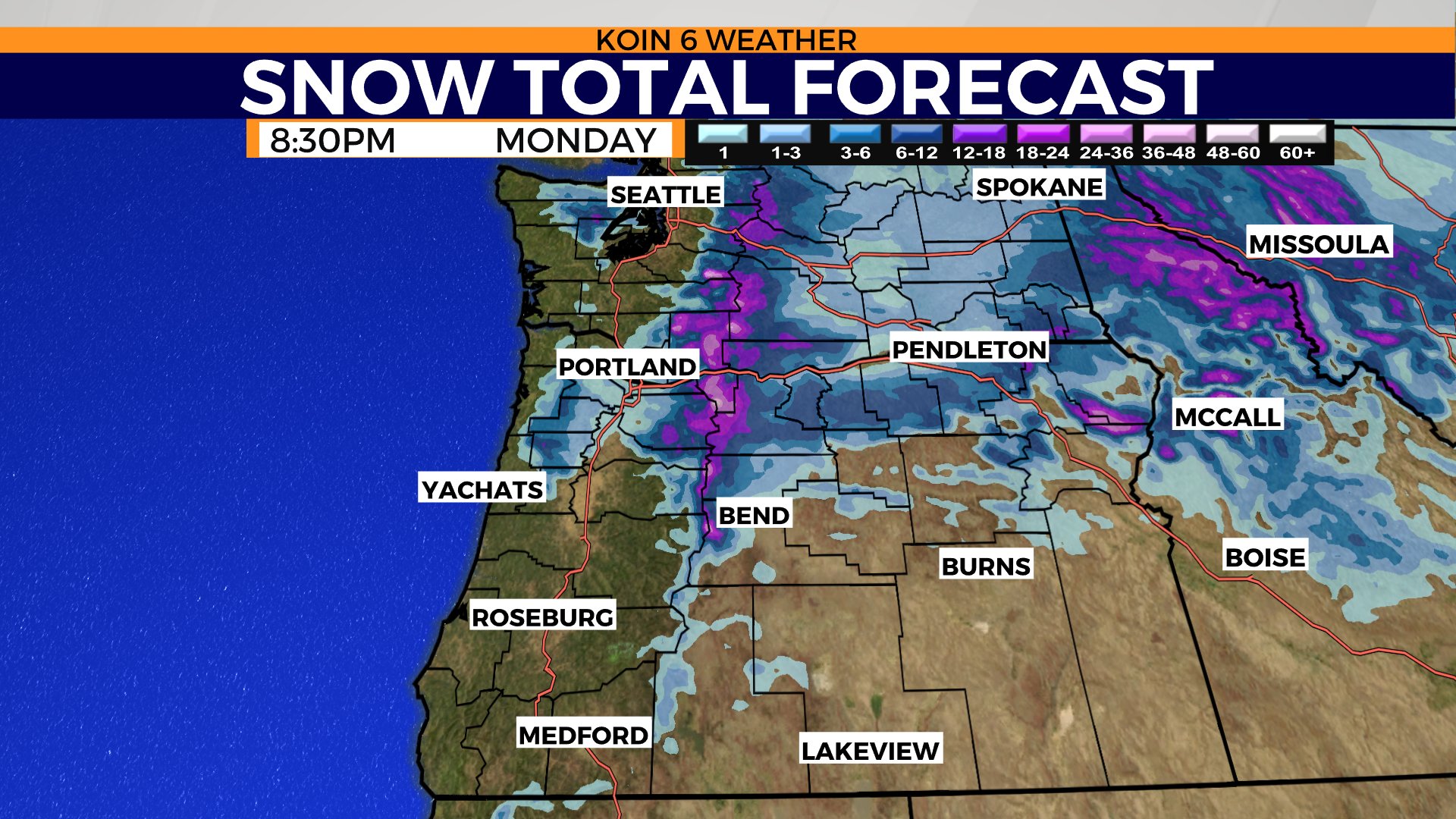
NWS in Portland said periods of heavy snow are expected Sunday night and Monday for the Hood River Valley and the Central Columbia River Gorge. Officials urged drivers to use caution when traveling along I-84 to the east of Cascade Locks.
Original KOIN 6 weather blog follows below.
Talk about a soggy Saturday night and start to our Sunday. We have more rain moving in as we move through the remainder of the weekend, too!
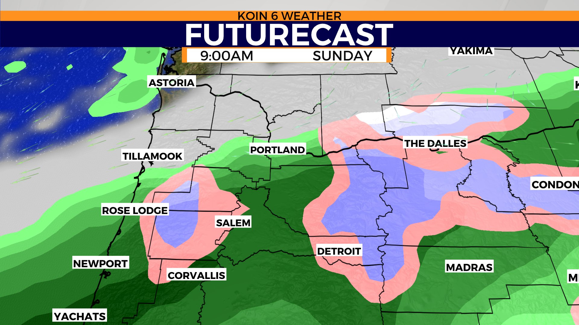
A fresh coat of snow for the mountains, hills, and even the valley floor. Flooding issues with high water on the local roads may be an ongoing problem this weekend. We may have some dry time north of Portland to start Sunday. Most locations should see rain south of Portland, extending through the valley.
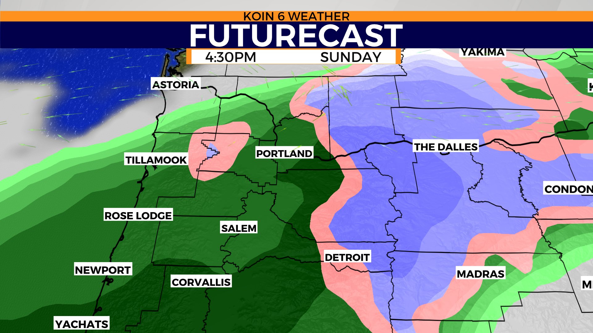
I also want to mention the snow chances for those east of the mountains on Sunday. We will have more on that information below. Now may be a good time to swipe through the graphics, too. Steady rain returns for the second part of the day, which will also be a good time for consistent steady snowfall for the mountains. This may be a moment for snow in the Columbia River Gorge, too, for locations around Hood River.
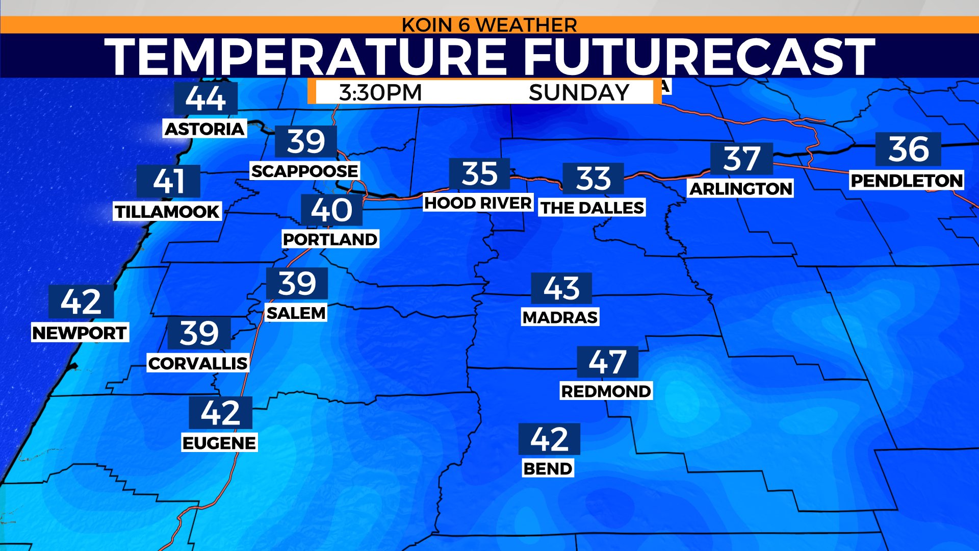
Temperatures are going to be above freezing Sunday morning, so we aren’t expecting a freeze. However, snow up in the hills and through the coast range can definitely create a hassle or two.
Those of you that want to hit the mountain up, you will want to take your time getting up to the slopes. It will be snowing for your trip up there and at times it may be heavy. Make sure you have your snow gear ready for travel.
Temperatures do seem to stay above freezing for most sections of the coverage area. Temperatures will not warm much for the afternoon, with daytime highs pushing the upper 30s to 40 degrees. It will be a rainy and cool day. Not that great for last minute holiday shopping.
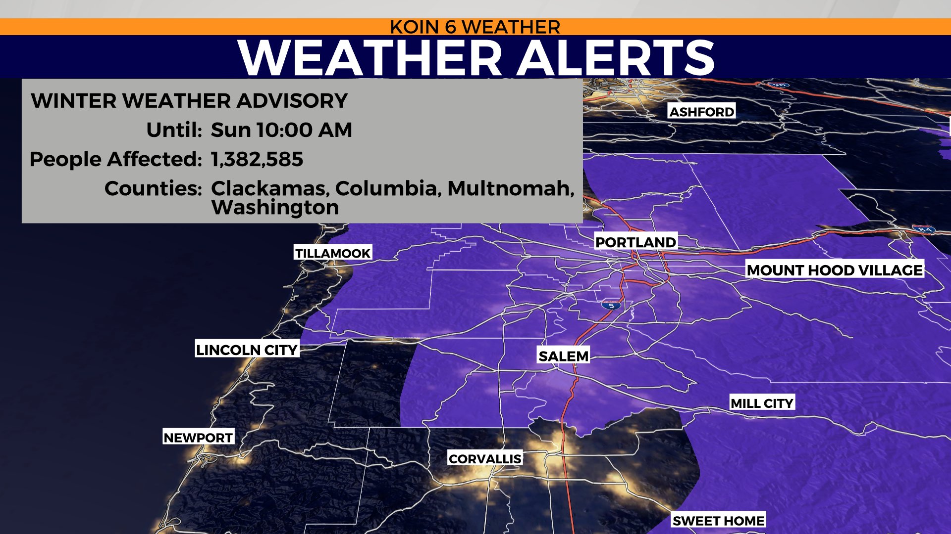
I want to point out that there may be some moments of heavy snow across the north central counties of Oregon. A Winter Weather Advisory is in place until Monday for those locations. You can see the map in the slideshow below. We may also have some snowy conditions around I-84 in the Gorge for Hood River and points east to The Dalles. This is going to be an issue Sunday night and Monday.