PORTLAND, Ore. (KOIN) – Have you heard of El Niño or La Niña? How about ENSO? Joseph…what are you talking about?
Well I’m sure you’ve wondered what the winter forecast may be? Maybe you’ve wondered how much snow may or may not be coming to the Willamette Valley, or your favorite ski resort.
Interestingly, those thoughts are sometimes associated with those words at the start of this lesson. El Niño and La Niña are simply the names for warm and cold phases that occur in the east-central Equatorial Pacific waters. El Niño is associated with warming and La Niña is associated with cooling. You may know that the word in El Niño means “the little boy” and the word La Niña means “the little girl” in Spanish. If not, you have just learned two new words.
WHAT IS ENSO?
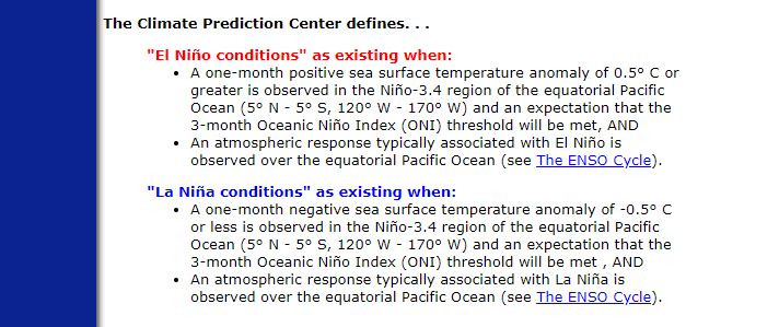
El Niño-Southern Oscillation, or ENSO, is the cycle that describes the fluctuations in temperature between the ocean and atmosphere in the east-central Equatorial Pacific (approximately between the International Date Line and 120 degrees West). Those fluctuations are known as El Niño and La Niña, which is defined below.
STUDY THE GRAPHIC BELOW NOW
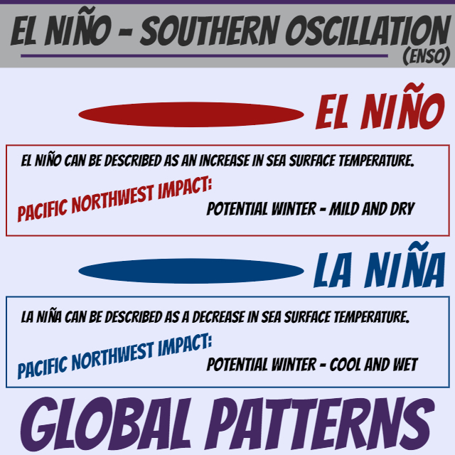
As you’ve learned, El Niño and La Niña are opposite phases, and can each impact large-scale ocean processes and global weather and climate. That is why this lesson is about global patterns:
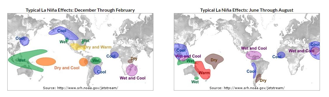
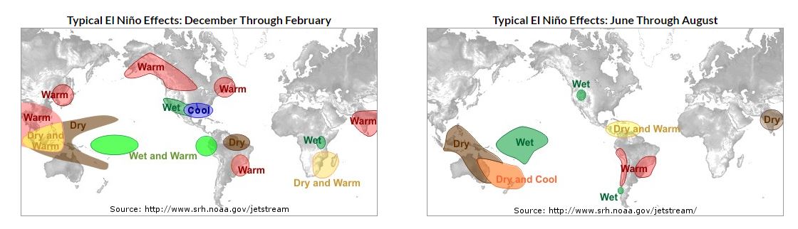
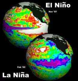
It may take an image to help determine where exactly this is all occurring. To the side is an illustration of both an El Niño and La Niña outcome. One from November of 1997 and one from February of 1999. You can see the difference between the warm and cold phases, with the sea surface temperatures (SST) either red or purple west of Central and South America. Now that is just the difference between two or so years. The changes in the sea surface temperatures may be irregular, but tend to be around 3 to 7 years.
The surface waters across a large swath of the tropical Pacific Ocean warm or cool by anywhere from 1°C to 3°C, compared to normal.
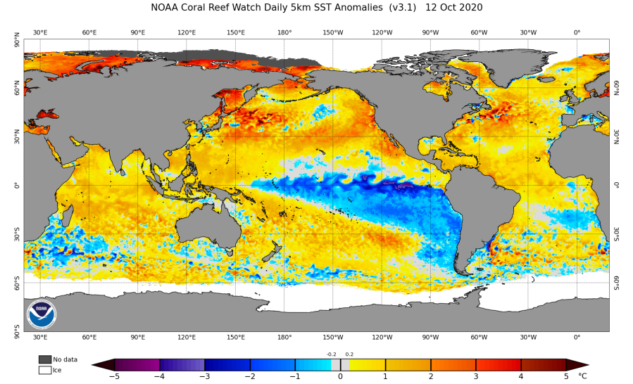
Below is an example of a SST Anomalies chart, which will help depict El Niño or La Niño conditions. What is a SST anomaly? First, sea surface temperature is the temperature of the top millimeter of the ocean’s surface. When we look at anomalies, we tend to use long-term information, such as 30 years. However, to determine sea surface temperature anomalies for ENSO cycles, they come at irregular intervals (roughly every 3-6 years).
Now, when you hear us talk about these terms on the broadcast, you have an idea of what we are discussing. We are looking at the ocean temperatures and how it may influence our pattern in the coming season. This is very popular when determining winter weather, although is must be stressed, both El Niño and La Niño events are not set in stone. We have had very snowy El Niño events or the opposite for La Niña.
Until next time…
ADDITIONAL MODERATE LEVEL INFORMATION