PORTLAND, Ore. (KOIN) – You are currently living through the hottest days that we’ve experienced here in Portland.
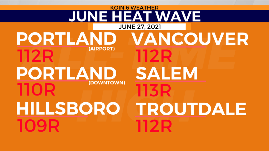
Not only are you battling the heat out this afternoon, but you’ve been doing it for now three days. Portland hit 108 on Saturday, then followed up with 112 on Saturday, and at 2:30 p.m., the National Weather Service announced Portland International Airport had officially hit 113. The thermometer then rose to 115.
But the record was set shortly after 5 p.m. when the official temperature at PDX hit 116 degrees.
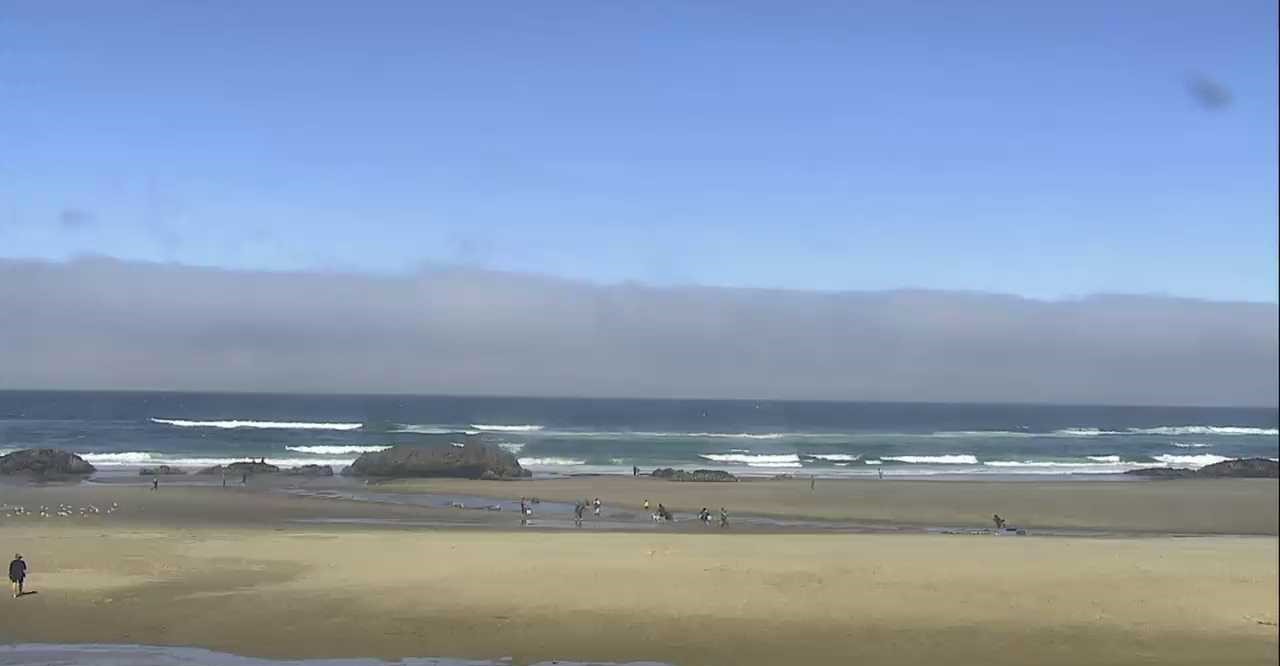
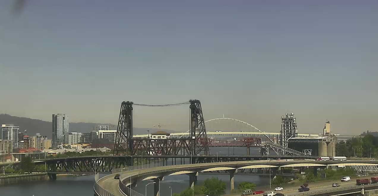
Here is the good news: we know that the weather isn’t permanent. We will escape this heat before we have to deal with it for a fourth day. Let me show you what is going on and what will happen over the next 18 hours. We will start with a view of Lincoln City, Oregon, as of midday. We are spotting a cloud deck off in the distance that is much thicker than previous days and that is going to be the influence of cooler marine air. If you cycle over to Portland, you will instantly notice that it is just a hot and clear afternoon. What you can’t see, is the wind! The wind is going to trouble and help us out today.
COAST CHANGES
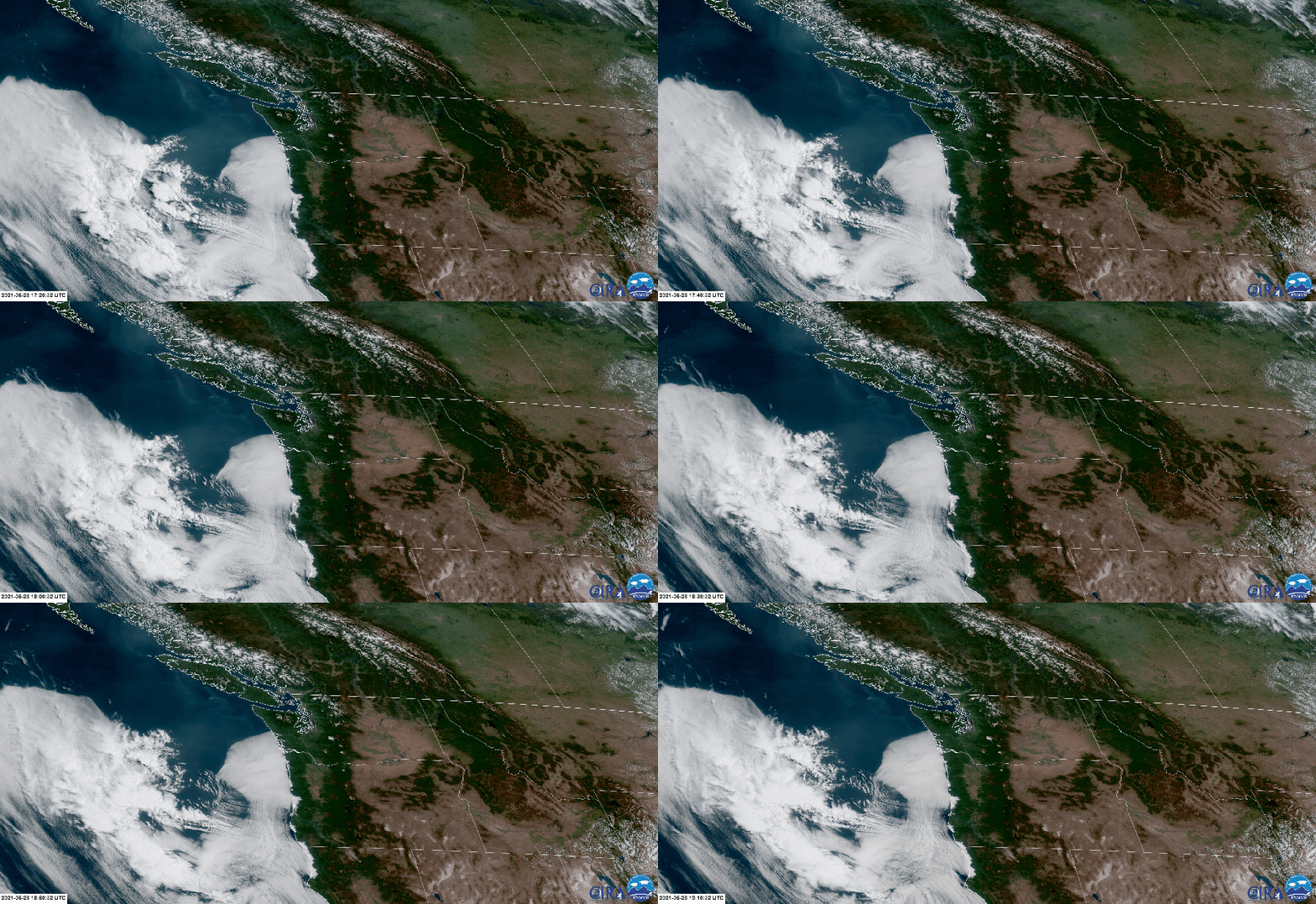
Before we get to discussing the mechanics of the atmosphere this afternoon, why don’t we look at the Oregon and Washington coasts first. After seeing temperatures in the triple-digits in Tillamook and Clatsop counties Sunday, the cooler air has now arrived for you. That goes for the southwest Washington coast this afternoon. The loop shows that cloud deck that we noticed in the image above of Lincoln City moving north. That cloud coverage is a clear sign that we have a change in the wind and noticeable changes coming today. Clouds higher in the atmosphere are streaming westward over the top as a surface low navigates the coast.
COOLER AIR COMING – TIMING
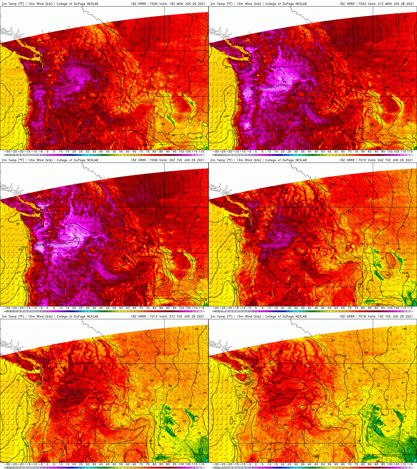
I want to state that we have about six to eight more hours of extreme temperatures, before we finally find relief here in Portland. It will be less for you folks in the southern Willamette Valley and near the coast range channels.
The loop below will paint the picture of what will happen outside this afternoon. You can watch the shade of pink shrink and give away to the cooler air through the evening hours. That heat recedes from the south to the north, reaching Portland around 8 to 10 p.m. tonight.
What is happening? The east wind that is causing our temperatures to warm up in a swift nature today, will be cut off and the wind will shift to the southwest. That shift in the wind is going to be ushering in the cooler marine air that we can spot in the section above. This should take our triple-digit temperatures to the 80s shortly after sunset in Portland, eventually allowing for the temperatures to hit the lower 70s tonight to potentially the upper 60s around Portland. It’s a blazing process this afternoon and evening, but it will also take a full day for our temperatures to cool down even more. Expect conditions to be cooler by Wednesday morning.
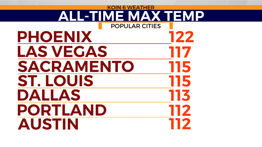
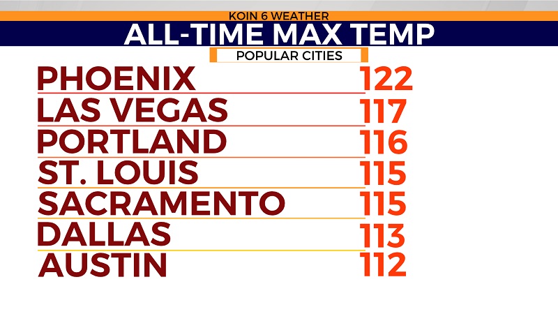
CURRENT ALL-TIME RECORDS
For now, Portland has an all-time record of 112 degrees. If you go through the list below, you can see some of the larger cities around the United States that have similar all-time max temperatures or slightly warmer. The type of heat we are experiencing, is more of the desert south west or the great plains region. It takes a series of mechanisms for the Pacific Northwest (PNW) to break 100, but we are watching them at an extreme level. We have an absolute boss area of high pressure that has extended into areas of Canada. You factor in that dome of heat with the compressional warming from the mountains and you find yourself in record territory. The combination has boosted our temperatures and dried us out significantly.
If you want to feel something really neat, you will want to stand outside around sunset, to feel the cooler air rushing in to the Portland metro area. In the meantime, hang in there, we are almost out of this heat wave.
