PORTLAND, Ore. (KOIN) – Just when you may think the summer heat was going to make a truce with early fall, they decided to break the deal. We are going to keep the toasty summer weather going for another week.
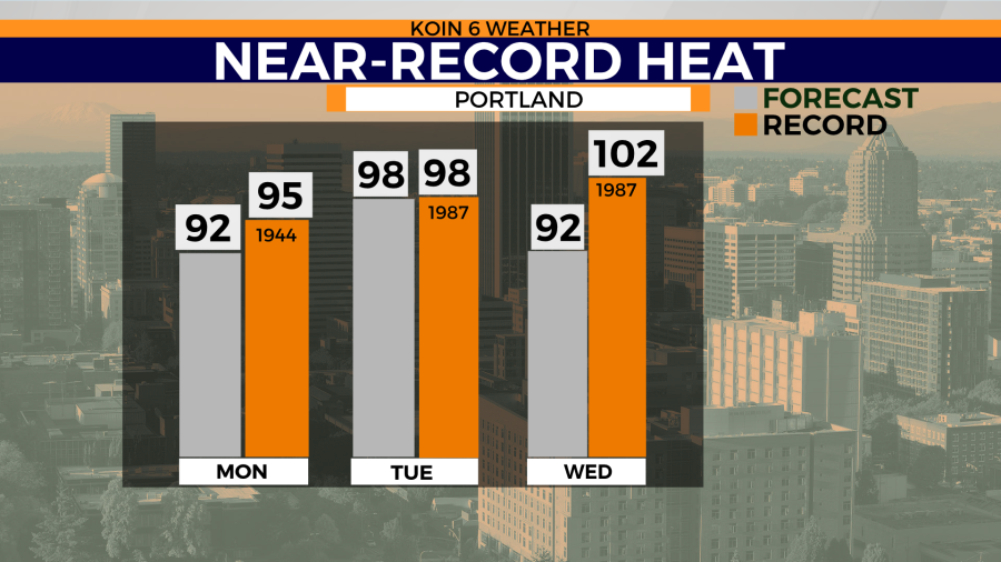
This will be our fifth heat wave of the summer. Like most heat waves, they usually come with near record heat, with near-record temps both Monday and Tuesday. Temperatures are expected to reach the 90s for the next four days. This is just in time for the start of the school year in Portland and many communities around the metro area.
The record high on Tuesday is 98 degrees — and that is exactly what the forecast is, too. There will be no need for flannels just yet, we can ride out the summer gear for the start of the school year.
This does mean the afternoon sports will still be very warm. For those of you that have children playing football, they’re going to feel the heat for a bit longer. Those cool fall football nights are still to come.
FIRST DAY FORECAST
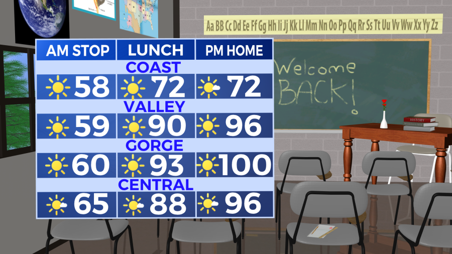
Expect a morning that is bright and much warmer than what we had the last few mornings. Temperatures will start in the mid 60s with a light breeze on Tuesday with sunrise at 6:30 a.m. Temperatures are expected to be in the lower 90s by the time we get to the lunch hour.
It would be helpful to carry that sunblock for any outdoor activities for the day. Temperatures make that jump to the upper 90s on the way out of school. Expect a temperature running above average all week (we may get lucky with a cooler day, Friday).
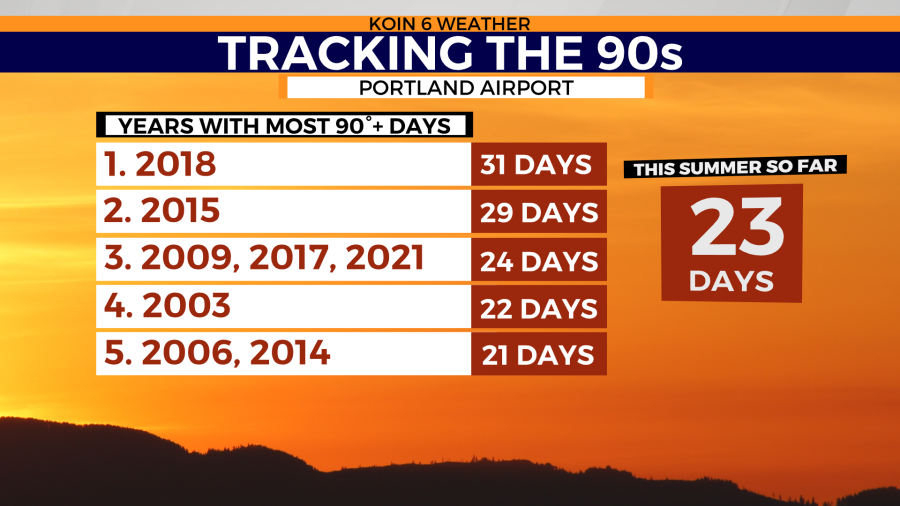
These warm days will add to our already impressive list of 90-degree temperatures this summer. We are now sitting at 23 days, with the ability to collect three to four more by the end of the week. We may be encroaching on the record of 31 by the time we get through early September. I think we may fall short, ending up closer to the 2015 90-degree total.
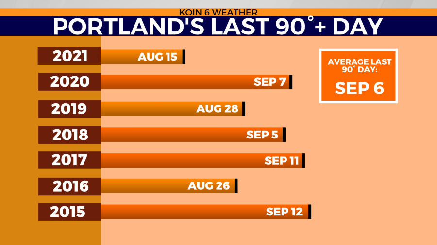
If you use the slideshow below, you can swipe over and see when our average last 90-degree day is. Last year, we had our final 90-degree day on August 15. However, going back to 2015, it has either been the very end of August or the first two weeks of September. Keeping the heat into the last few weeks of summer isn’t unheard of. In fact, we have even had a 90-degree day in early October. The last time that happened was 1988.
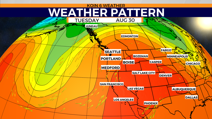
What is the cause of this weather pattern? There are a handful of strings attached to this, but the most obvious attachment is from the massive ridge that is developing to the southeast. This is going to continue to build up to the PNW and it will take some time to flatten out. Tuesday will also generate an offshore wind, which will warm us up a few more degrees, which is why we are going to be in the upper 90s by the afternoon. We are looking for some relief out west or to the north, but there doesn’t seem like much available.
