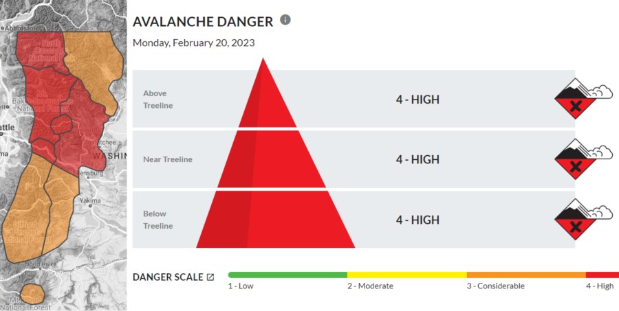
PORTLAND, Ore. (KOIN) — A “high” avalanche warning remains in effect for Washington’s Central Cascades Monday, including Stevens and Snoqualmie passes and the avalanche terrain along Mountain Loop Highway.
The Northwest Avalanche Center in Seattle issued the heightened warning on Feb. 19. The advisory remains in effect until Feb. 20 at 6 p.m.
“Heavy precipitation, strong winds and warming temperatures will create very dangerous avalanche conditions Monday at the pass,” the Northwest Avalanche Center stated. “There’s the potential for several rounds of natural slides throughout the day. Avoid any area where avalanches can start, run or stop.”

Strong winds and heavy snow at higher mountain elevations and rain at lower elevations are expected to increase the chance of avalanches in the danger zone. Avalanches could also occur outside the boundaries of the warning area.
The NWAC warns that there is a “considerable” risk of avalanche on Mount Hood Monday. A developing storm is forecast to bring heavier snow to Mount Hood between Monday night and Wednesday. Low-elevation snow will also be possible in the Portland metro area. However, Portland’s chances for snow don’t increase until Wednesday.
“Dangerous conditions will develop as the day progresses,” the NWAC stated Monday. “You can trigger an avalanche in areas where the wind has drifted new snow in fresh slabs. So, keep your terrain simple and avoid steep slopes that appear wind loaded.”
Mountain-goers are advised to look for shooting cracks in the snow. These lines are considered to be “red flags” for an impending avalanche.
