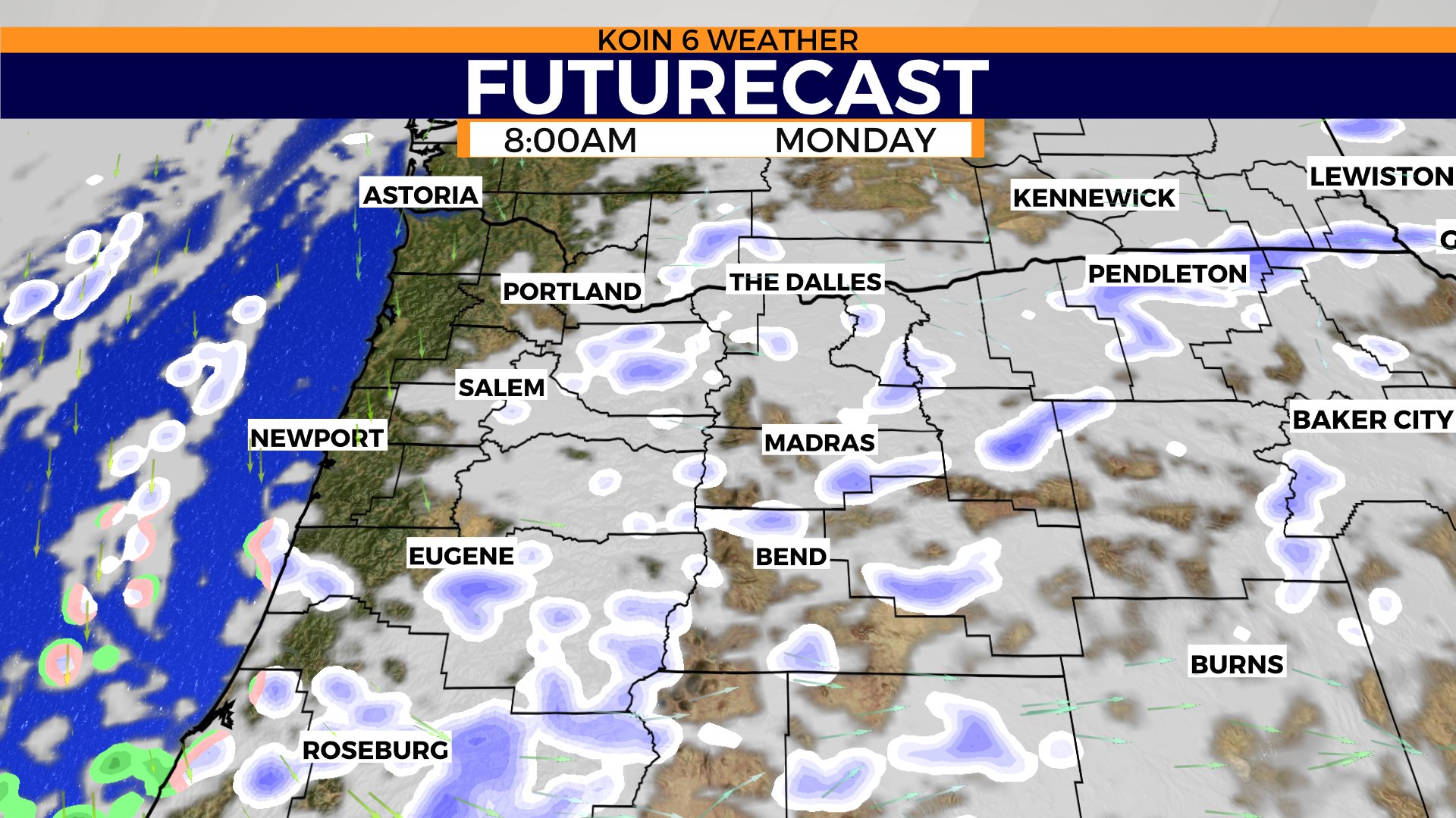
PORTLAND, Ore. (KOIN) – We have a few sporadic snow showers around Monday morning, but most of the moisture is going to be dissipating quickly. We can’t rule out some spotty snow around the foothills of the Cascades all morning, as weather models seem to hold onto that until late morning.
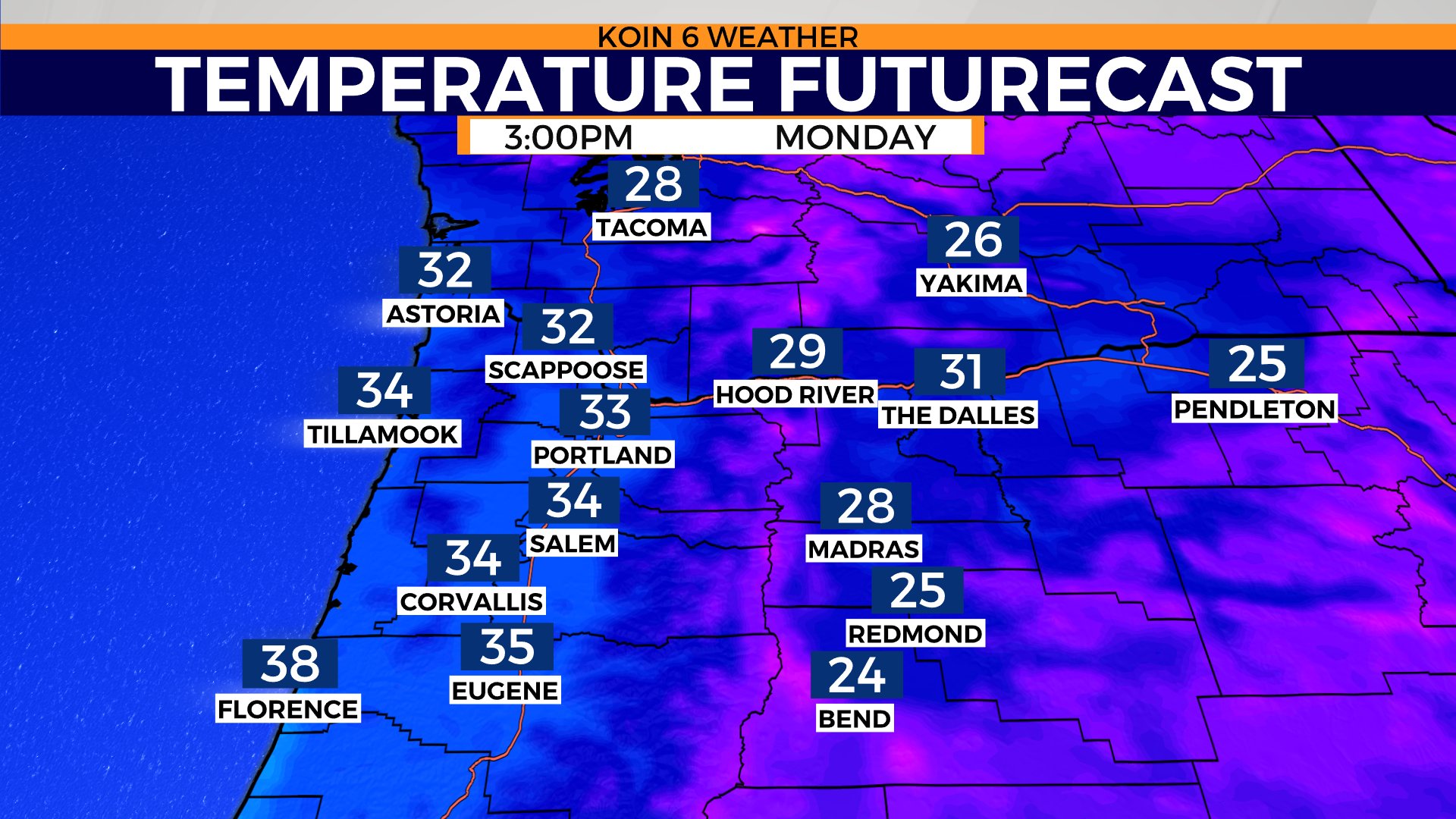
A spotty flurry is still possible with little to no accumulation expected. We’ll keep it dry and cold through the afternoon. Highs will top out at or near freezing today with the arctic air arriving and sending the region into the freezer.
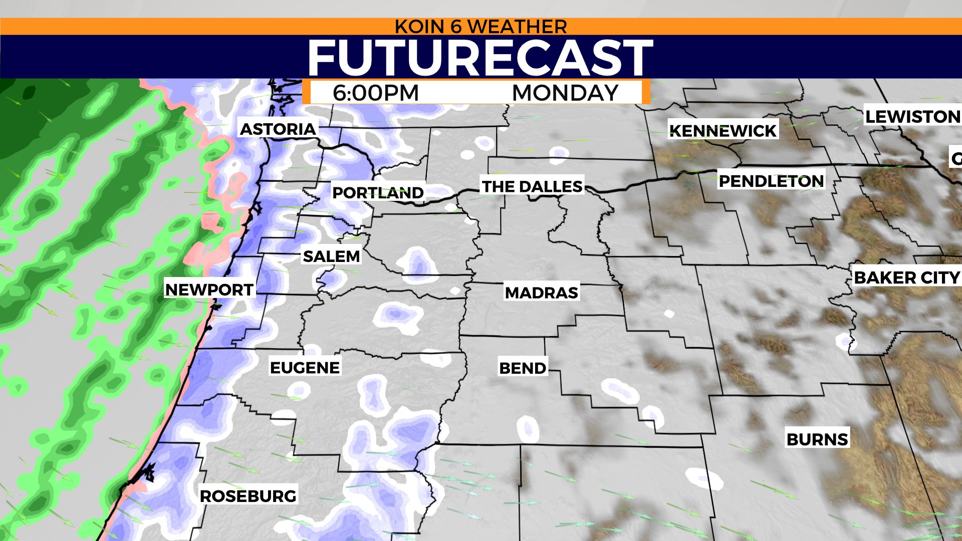
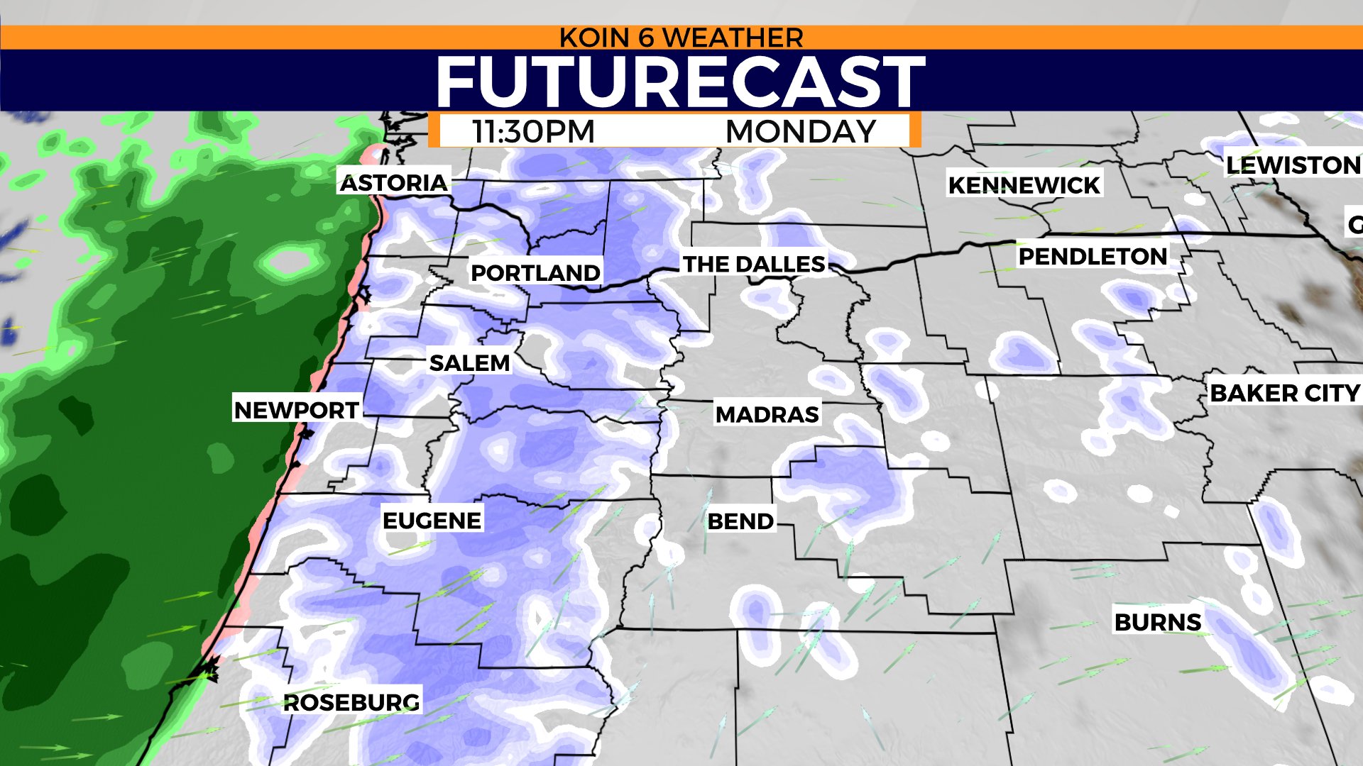
We then have a fast-paced area of low pressure that is going to drop south late Monday night bringing in another opportunity for some snow into Tuesday. This may even bring more coastal snow at night, before turning over to rain again as temperatures warm. If you cycle through the slideshow below, you can get an idea of the snow chance for Monday night on the Futurecast.
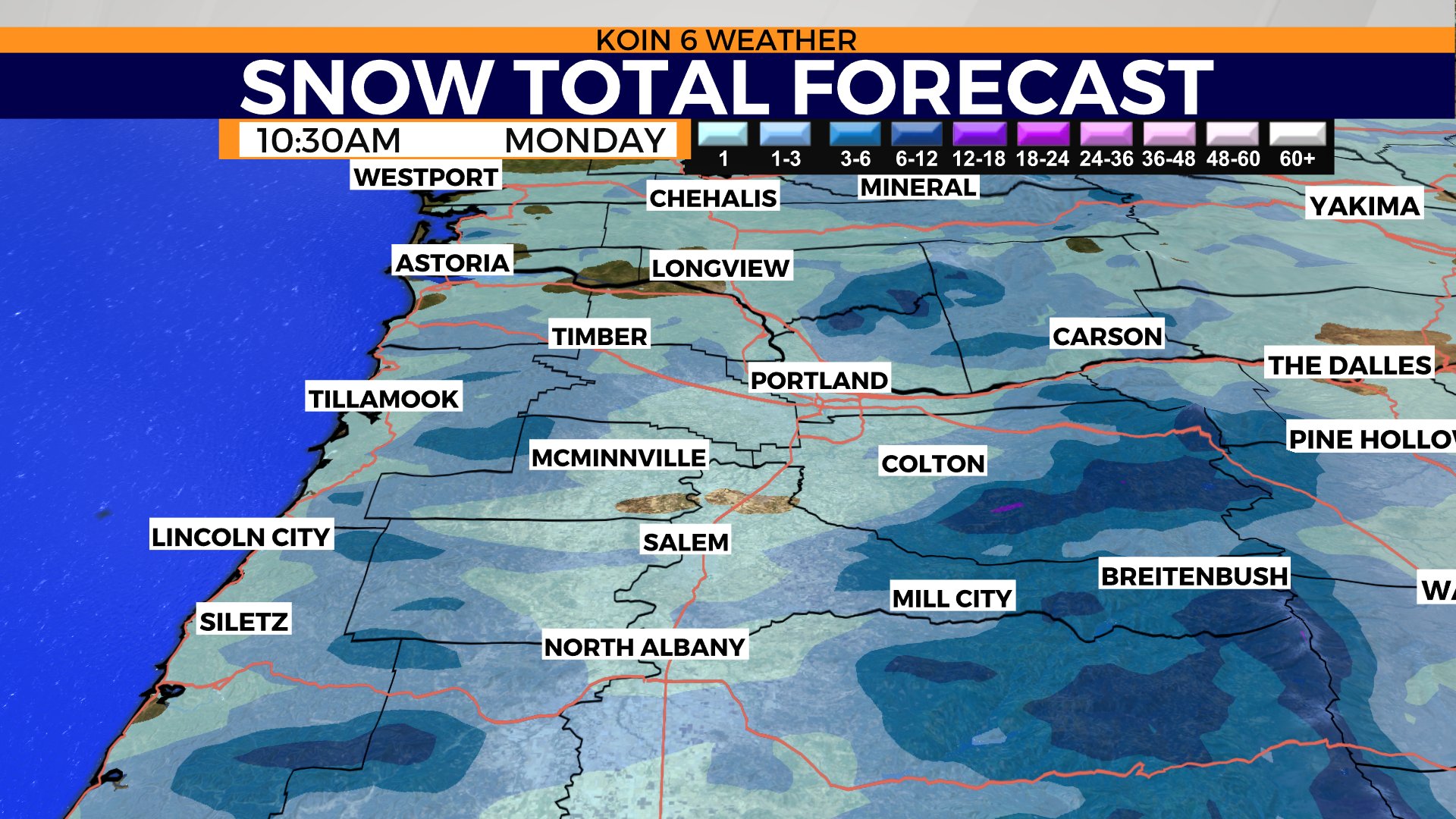
We may have up to an inch of snow around areas of the valley by Monday morning. Some spots may collect more than that. I would be most prepared for some snowy roads and icy roads by your morning travel.
The mountains are going to continue to be the hot spot for tough travel. If you don’t have the gear or experience, I would avoid mountain travel. Although we will clear out some of the clouds and moisture by mid-day, we are still expecting temperatures to be cold. We may break above freezing, but I wouldn’t count on anything warmer than that. That means the snow on the ground will hang around a little longer.
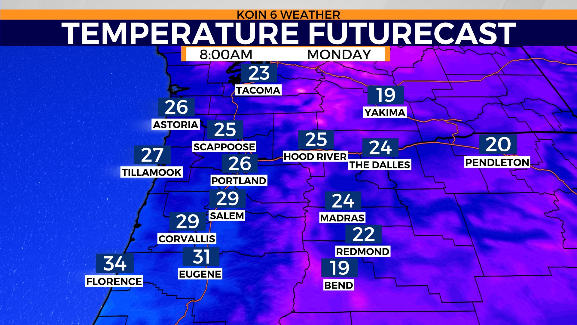
Weather models have us in the mid to upper 20’s by 8 a.m. Monday. We have some spots that will be colder than that. It will be a day that you want the winter gloves and boots to help clean off the car in the morning. I would wait until the early afternoon to do much traveling if you are going to get out and about. That should be the best window to really gauge the roads. Temperatures start to plummet late Monday night, falling to the lower 20’s by Tuesday morning.
We’re expecting another round of winter weather tonight as our next system arrives. A Winter Weather Advisory is in store tonight through Tuesday morning for 1-3″ generally around the Portland metro. This advisory includes the coast too with 1-2″ possible into Tuesday morning. Snow showers will start around the evening time, maybe 7-8 p.m. and continue into tomorrow morning before tapering off that afternoon.
