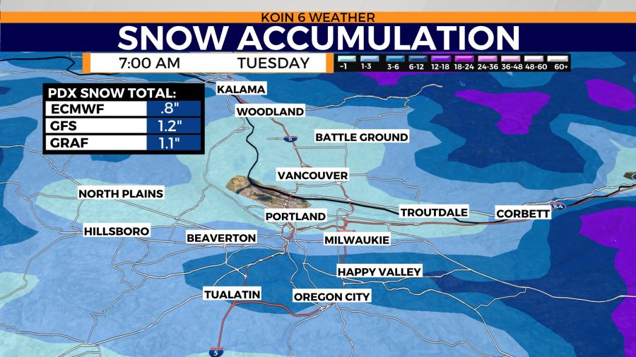
PORTLAND, Ore. (KOIN) — Snow is taking aim at western Oregon and Washington Monday night. Snow accumulation will vary depending on altitude, but even some of the lowest lying areas could see a few snow flakes by Valentine’s morning.
What’s my elevation?
Some areas around Portland could see slightly higher snowfall amounts if a heavy, more isolated band of snow moves through the area.
Portland’s latest weather forecast
Rain and wind will welcome the cooling trend Monday morning. Rain will continue to fall through Monday evening. Wind gusts in Portland could near 30 mph. Afternoon temperatures will be cooler than Sunday’s high of 51 degrees. Mid and upper 40s make a return Monday afternoon with even colder temperatures expected Tuesday.
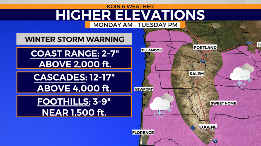
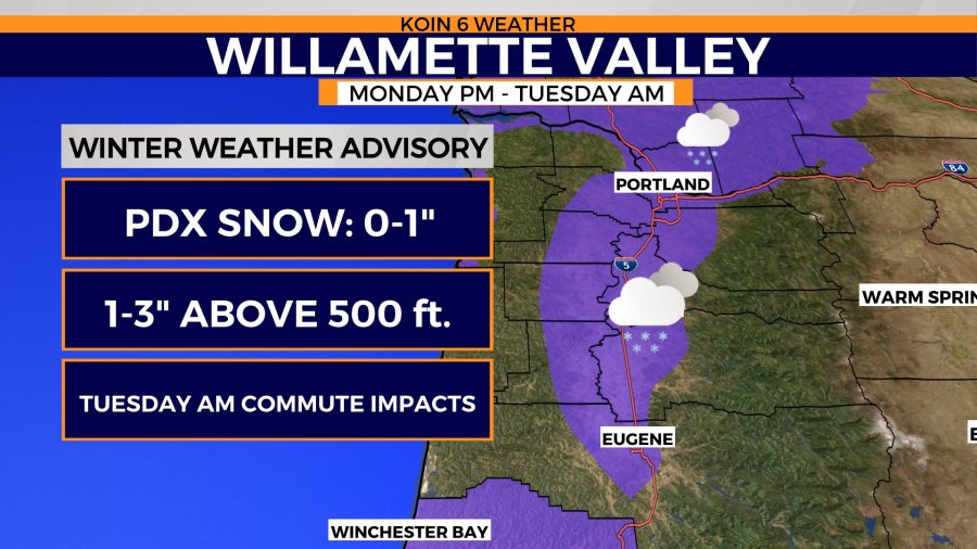
Snow chances don’t start to increase for the I-5 corridor until after midnight. Isolated show showers will move from west to east through the night and will clear by sunrise Tuesday morning. Snow will start as early as Monday afternoon for the Coast Range and the Cascades.
Interactive radar
Travel impacts will be at the most severe early Tuesday morning. Mountain passes will be snow packed. Roads along the Willamette Valley may see some minor accumulation, but most of the snow totals will be lost to melting.
Dry and sunny skies return by Tuesday afternoon as highs continue to sit in the mid 40s through the middle of the week.