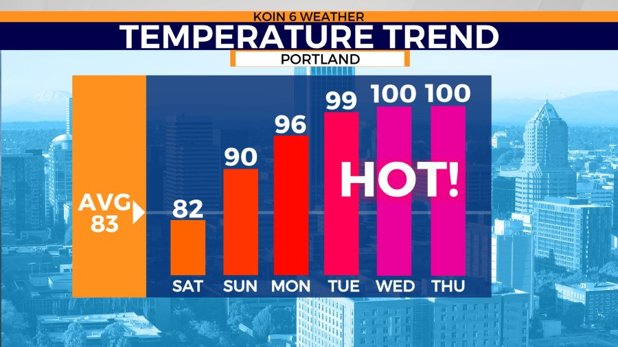
PORTLAND, Ore. (KOIN) – Yes, Saturday feels a little cooler. It’s going to get warm. Then it’s going to get hot, maybe dangerously hot around the middle of next week.
But will it be like what we saw at the end of June 2021?
Nope.
Thirteen months after high temperature records were broken in the Portland area on back-to-back-to-back days — topping out at the all-time high of 116 on June 28 — more extreme heat is headed into the region.
There is no indication, yet, that temperatures are going to get near those record numbers from last year.
“This is pretty much a really standard heat wave for us,” said KOIN 6 Morning Meteorologist Kelley Bayern “We may see this high pressure anchored in for the entire week but nothing really stands out.”
As of Saturday morning, most models show the warm up beginning Sunday with the hottest temperatures expected next Tuesday, Wednesday and Thursday. The KOIN 6 Weather Team says temperatures will likely reach the upper-90s with a good possibility of breaking into the low-100s over those three days.

“The core of the work week is going to be sweltering,” said KOIN 6 Meteorologist Joseph Dames. “Each day may get a degree or two warmer as this high pressure builds. Record temperatures that week start at 100 degrees.”
“Tuesday, Wednesday, and Thursday, all have the potential to hit the record high and we may see a new one when it’s all said and done. The all-time record high for the month of July is 107 degrees. That occurred on July 30 in 1965. We are not expecting that,” he added.
Bayern said the National Weather Service will likely issue both watches and warnings about excessive heat.
While daytime temperatures are going to be hot, temperatures likely won’t fall below the mid-60s range in most places in the valley after sunset during the thick of the heat.
“We may not get much relief overnight,” Bayern said. “Expect some tough sleeping conditions in those temps.”
The ridge of high pressure in the region will bring some of the hottest temperatures of the year, but hold off on calling this the same thing as the heat dome of 2021.
“The heat dome of June 2021 had positive temperature anomalies aloft to which are not being seen this time around,” Dames said. “That means the air aloft was much warmer than the long-term average. We will still have temperatures that are very warm above our heads and at the surface next week.”
“This is because high pressure sinks and it promotes compressional heating. The difference between the heat dome of June 2021 and this ridge, is essentially the strength, the air mass is just not as intense, and the pattern setup is different,” he added.
While this building ridge isn’t the same as last year’s heat dome, excessive heat is dangerous, especially to the elderly, those who work outside and people living in homes without air conditioning.
Be sure to stick with KOIN 6 News and KOIN.com for constantly updated heat wave forecasts and up-to-the-minute coverage of all the weather in the region.
