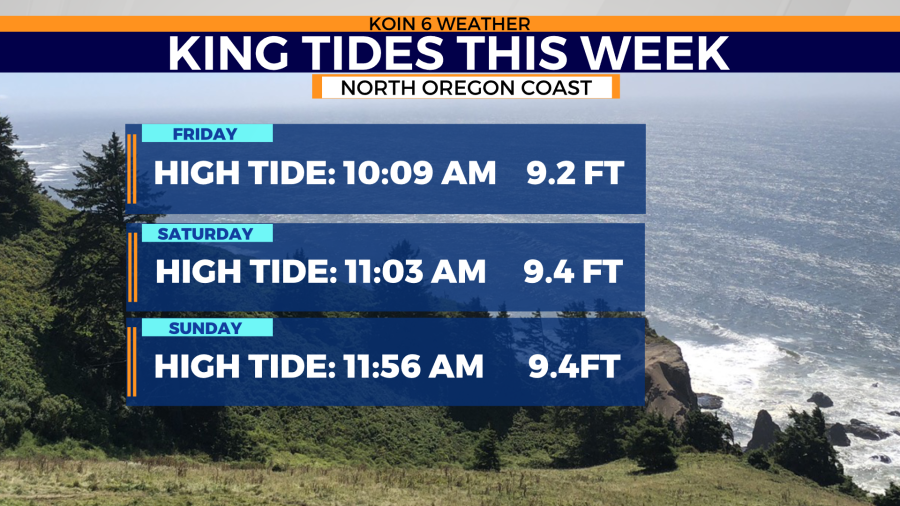
PORTLAND, Ore. (KOIN) — King tides are taking aim at the Oregon and Washington coasts later this week.
This comes as another storm builds over the Pacific Ocean, bringing rain and wind back to the region Wednesday. As this latest storm continues to build, the threat of sneaker waves also grows.
The threat of king tides and sneaker waves remains high along the shores of Oregon and Washington this week, but there is a big difference in how these events form and the threats they bring to spectators.
The National Weather Service explains king tides as, “a non-scientific term people often use to describe exceptionally high tides. Tides are long-period waves that roll around the planet as the ocean is ‘pulled’ back and forth by the gravitational pull of the moon and the sun as these bodies interact with the Earth in their monthly and yearly orbits. Higher than normal tides typically occur during a new or full moon and when the Moon is at its perigee, or during specific seasons around the country.”

Since king tides coincide with the tide pattern, that makes them very predictable. The seasons come into play by making the tides more extreme. During the winter months, the earth’s perihelion, the closest orbital distance to the sun, is less than during the summer months. That increases the gravitational pull the sun has on the oceans during the winter and increases the tide heights.
However, sneaker ways are very unpredictable. The National Weather Service defines sneaker waves as, “potentially deadly waves that suddenly surge much farther up the beach than expected, overtaking the unaware.”

Sneaker waves are typically caused by a storm developing over the Pacific Ocean or moving toward the coast.
Despite the difference between sneaker waves and king tides, these two events can happen simultaneously. So, knowing the tides and weather forecast before heading to the beach is a smart way to insure your safety. The final tip to take to the beach is to ‘never turn your back on the ocean’.