PORTLAND, Ore. (KOIN) – We have a transition day coming, moving from a dry weekend to a showery period, as we wait for the arrival of our next system Monday night.
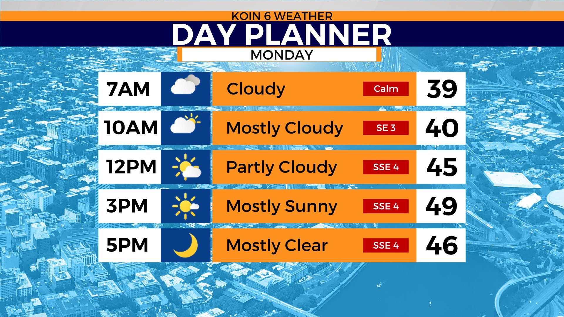
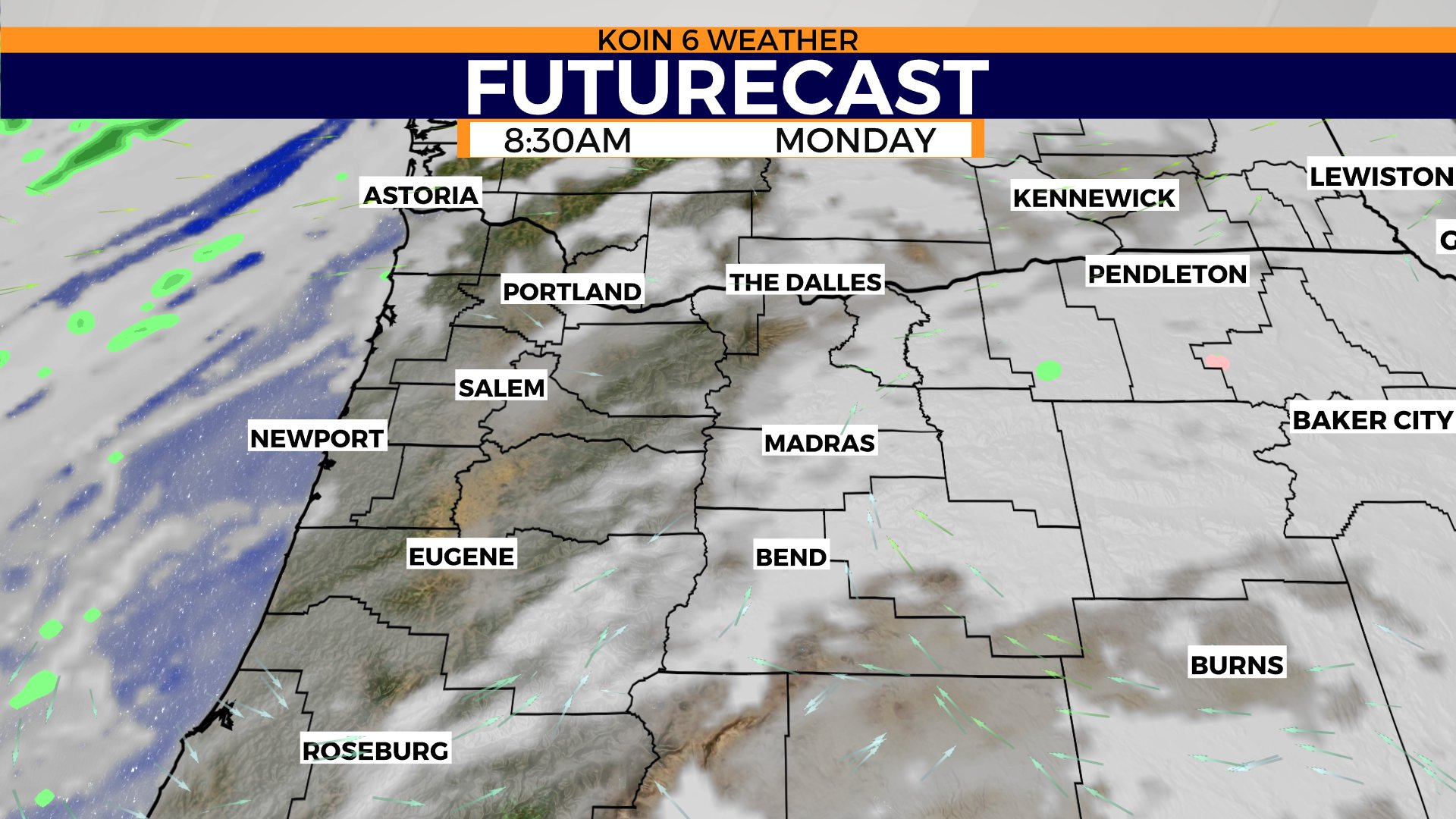
We will wake up to some areas of patchy fog. It will not be as widespread or as dense as both Saturday and Sunday mornings. Some may not even be bothered with the fog, but I would at least expect clouds around, with more sunshine by mid-day.
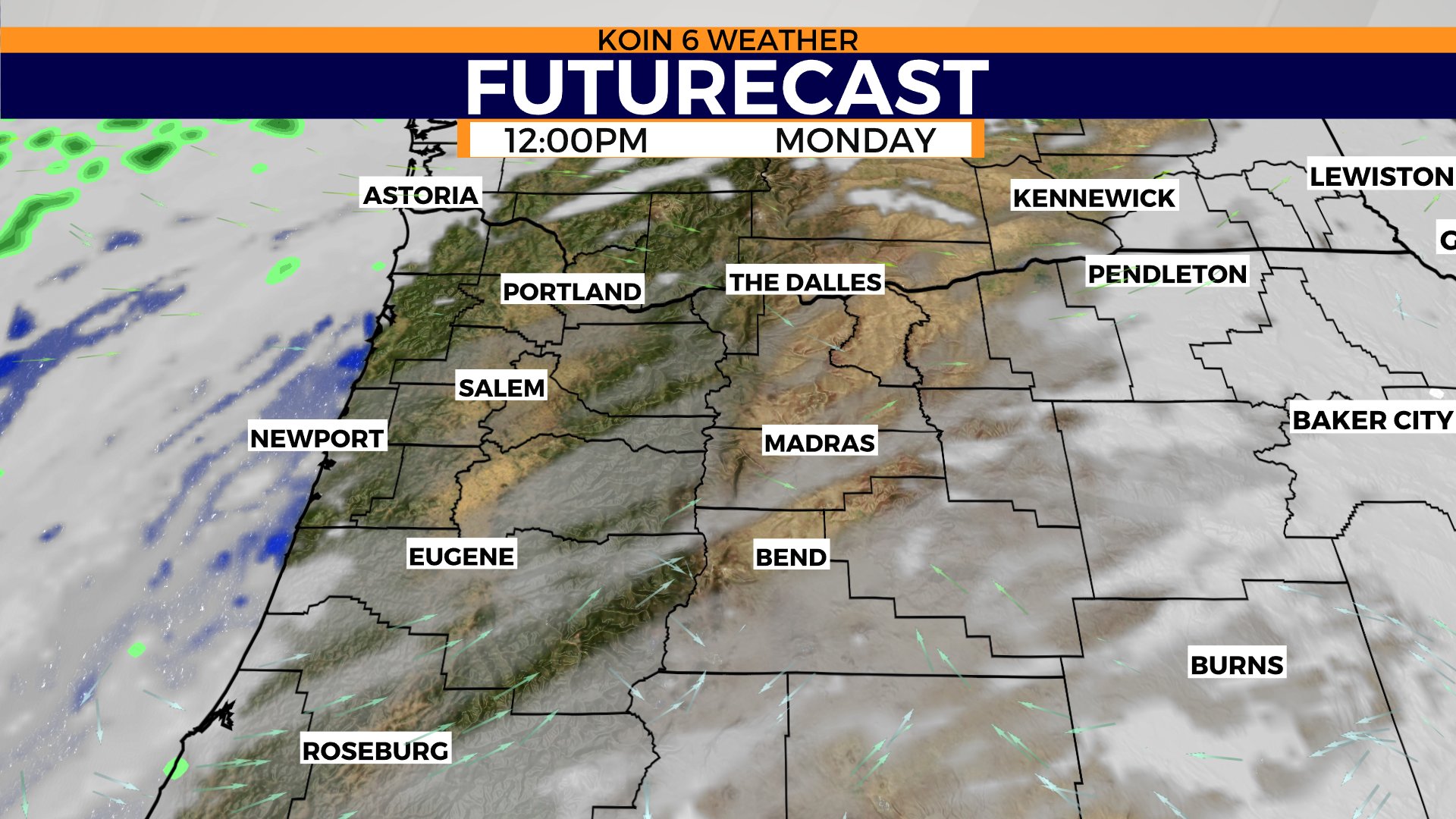
There should be an extended window of blue sky and sunshine by early Monday afternoon. Temperatures will be hovering around 50 degrees in the valley. The wind will be running more out of the southeast Monday, too. Not much of a gusty forecast coming our way — should be running fairly light between 5 to 10 mph. This system will help clear up our air stagnation, which has lowered the air quality over the weekend due to the inversion.
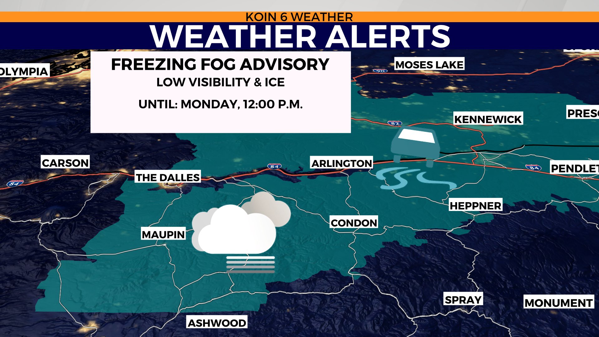
I do want to mention a freezing fog advisory for the lower Columbia Basin Monday morning with areas of fog and even some ice from Maupin to Pendleton. This will expire at noon. Be wary of bridges especially — they are usually the first to have issues during a freezing fog environment. You can find a better look at the freezing fog advisory in the slideshow below.
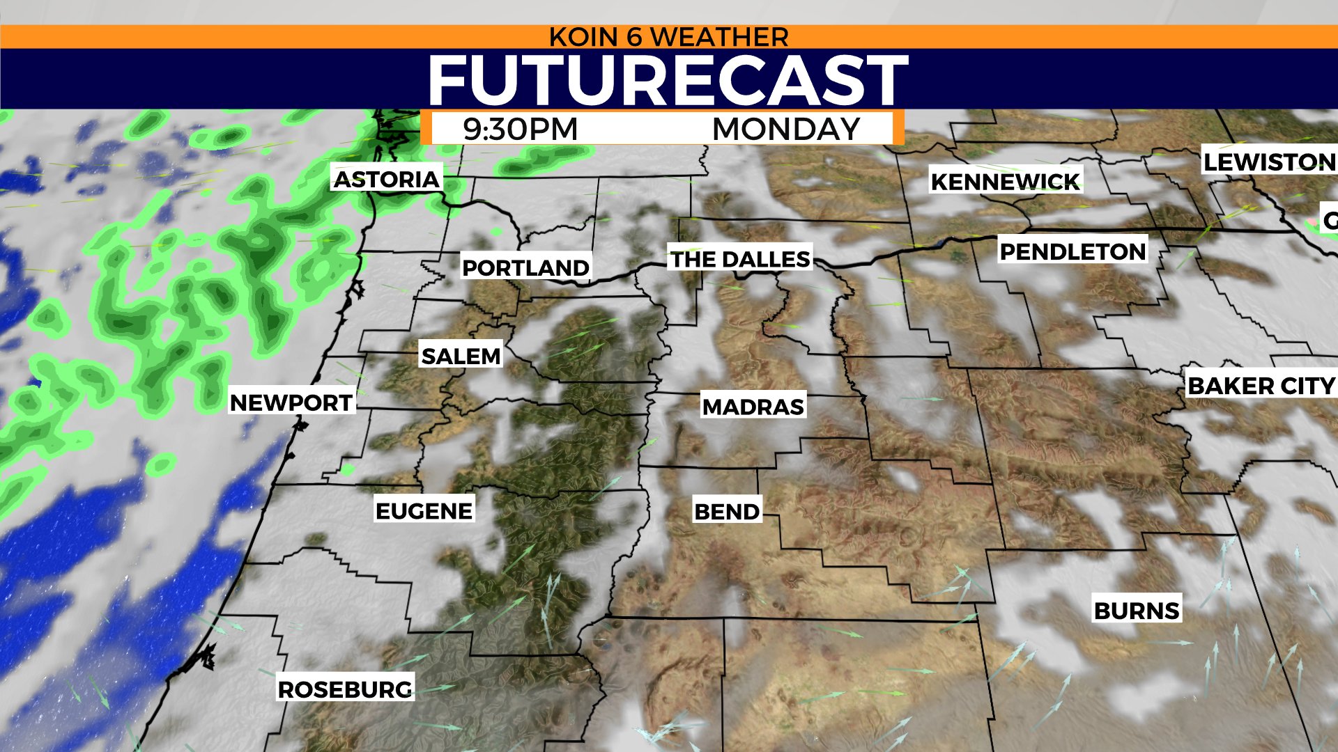
So when is the rain coming? We may have a few ambitious showers late Monday night around the 10 p.m. to midnight slot of the day. That is not the case for the Oregon coast, which should see the showers by 8 or 9 p.m. Not much happening before that, conditions hold off until late.
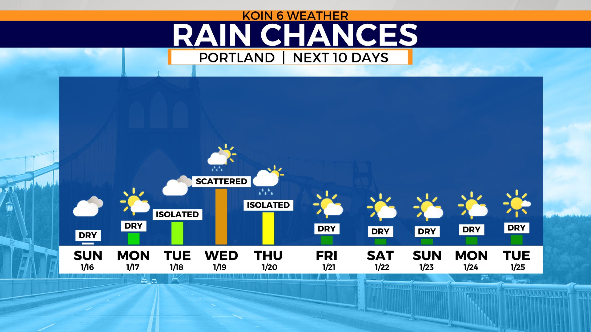
If you cycle to the final graphic, you can catch a glimpse of the long range rain chance for Portland. Right now, we are just keeping an eye on midweek. It sure looks like the trend is to be warm and dry towards the end of January. I wouldn’t put much weight into the forecast for next week, but you can at least take a peek at it.
