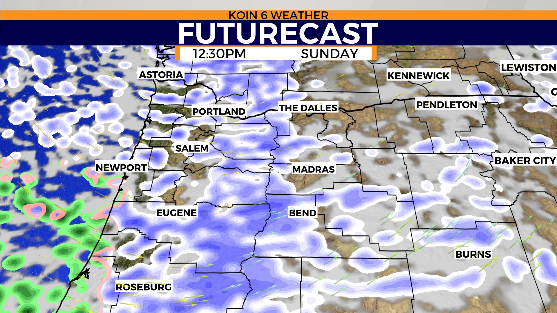
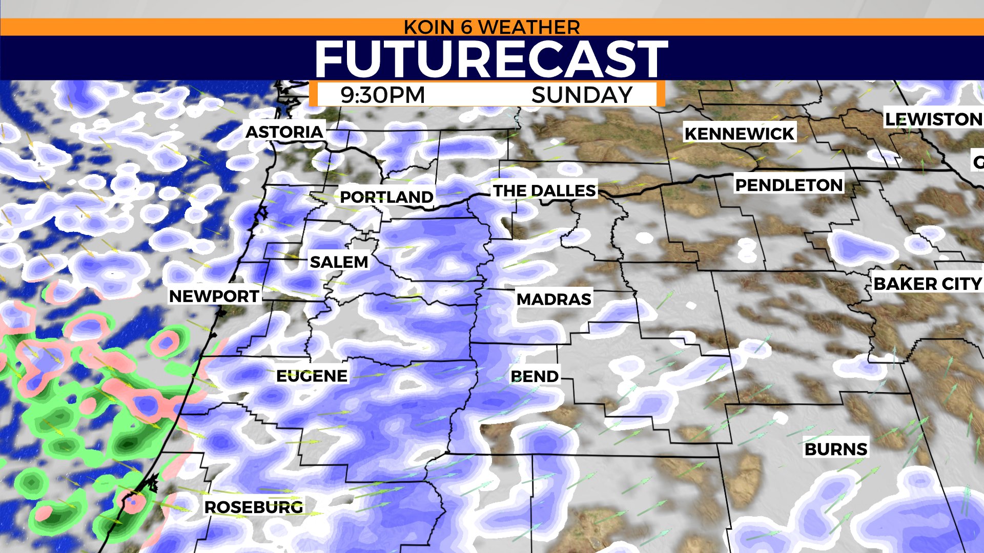
PORTLAND, Ore. (KOIN) – Area of low pressure is sinking south and we are going to have wave after wave of snow showers this Sunday. It’s likely that we have some snow already by the morning hours as snow showers started late Saturday night.
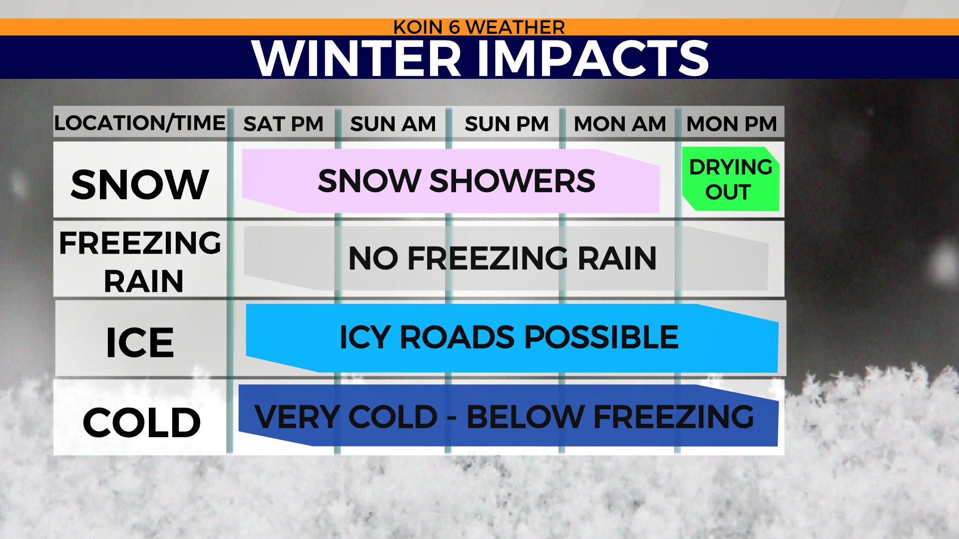
Temperatures may drop below freezing, which could mean some icy conditions by Sunday morning. If you don’t see much snow, you may have the slick road conditions. Snow is expected to be in and out through the day.
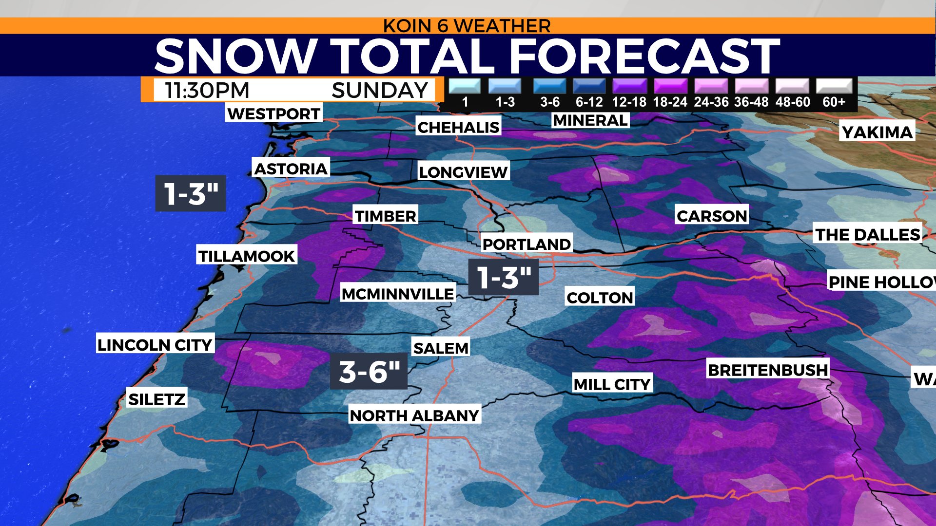
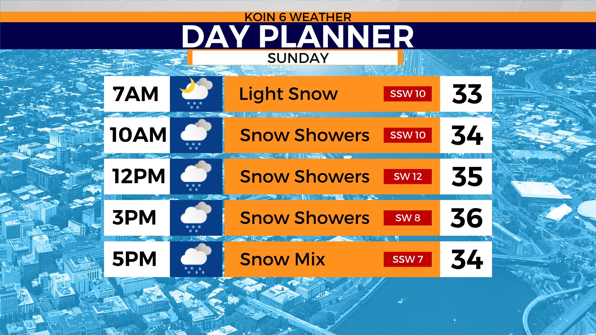
Cycle through the slideshow below to get a visualization of the scattered snow showers for the day. I want to also stress that the snow totals will depend on where those snow showers pass. Some may avoid some of the heavy bursts of snow. We are still expecting around 1 to 3 inches of snow in the Willamette Valley. Snow showers for the Oregon coast and for those east of the Cascades, too. Check out the winter impacts timeline to help plan the next 36 hours. Expecting moments below freezing and then likely well below freezing by the time we get to Monday night.
A winter storm warning is in place until 4 a.m. on Monday, which includes everybody in the section of pink in the graphic below. Snow totals should be higher around the foothills of the Cascades as the mountains help create some action.
We may see our temperatures jump to the mid 30s Sunday, but I would expect most to be hovering in the lower to mid 30s, especially if we have some snow on the ground by morning. We shouldn’t start drying out completely until after the morning hours on Monday. Take your time out on the roads!