PORTLAND, Ore. (KOIN) – Guess what, the earth is at the closest distance to the sun on Tuesday (late Monday night to be exact), to which we call perihelion. As the earth does the yearly elliptical orbit, we make this mark every year around this time. Right now is the time the earth is about 91.4 million miles from the sun. Regardless of being closer to the sun, the northern hemisphere is tilted away, leaving us dealing with winter.

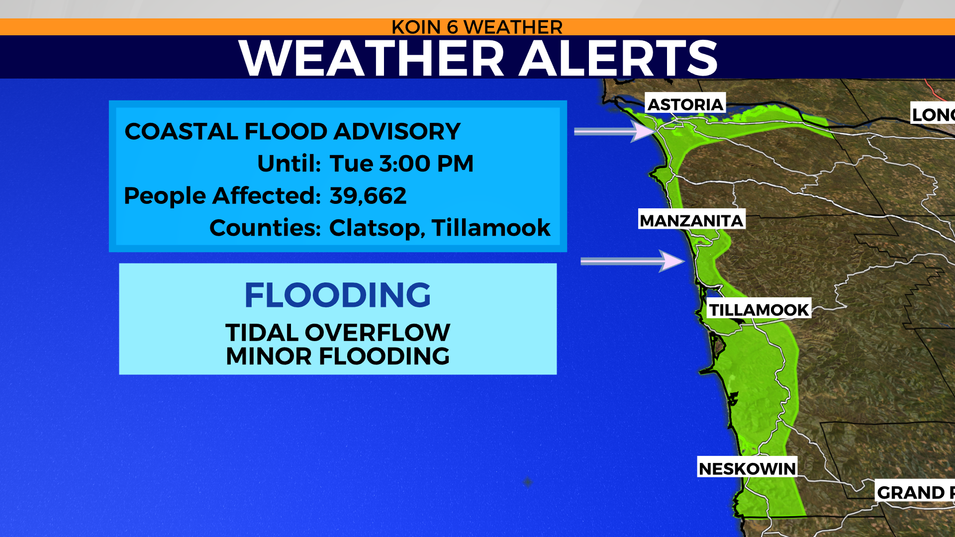
However, this also can affect the tides. Tuesday we have a coastal flood advisory for the northern Oregon coast until 3 p.m. Expecting minor flooding due to tidal overflow. You can see the tides pushing in our Seaside camera early Tuesday afternoon. We can expect conditions to improve Tuesday evening, but we may have some travel issues on some of the roads that are vulnerable to the tidal overflow.
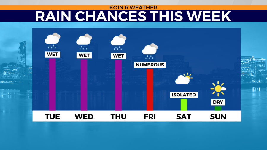
Outside of high tide, we are still dealing with a lot of water coming in and out for the week. We have another surge of moisture Tuesday night, mainly focused in areas to the south of Portland and northwest Oregon coast. Check out the rain chances this week in the graphic below. We are going to be wet for the next three days, at least, with more showers on Friday. There is a chance that we have some dry time this weekend, which will be a helpful chunk of time to help rebound from all the wet conditions.
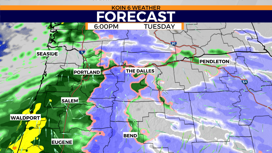
Let’s rewind and get back to the task at hand, Tuesday night’s rain and mountain snow. By the evening commute and the dinner hours, rain is back to Vancouver and Portland. Heavy showers still expected for the central Oregon coast, with light rain spreading across most of the Willamette Valley.
Compared to some of the previous rain events and mountain snow events we’ve had, this one is going to be more tame. Largest rain totals should stay south of Multnomah County Tuesday. The moisture is moving in from the southwest, which is going to allow for earlier arrival and higher rain totals. This will also be the case for the mountains, leading to more snow for Santiam Pass and the mountains passes.
Snow keeps coming down for eastern Oregon Tuesday evening, adding to the snowy travel on I-84 around Baker City. Don’t look now, but behind this event we have an atmospheric river setting up for Wednesday night into Thursday. You can see that on the second graphic in the slideshow.
As far as rain totals go Tuesday, we are still expecting an additional tenth of an inch, up to a half an inch to the south. Weather models are depicting around a quarter of an inch to half an inch from Salem south to Eugene and points in between. This should tell you that it’s not going to rain very hard Tuesday evening, just enough to keep things wet. If you have to get out for errands in the valley, you won’t have to battle anything too difficult.

If you want to travel up to the mountain or into the Gorge, you will have to deal with poor conditions. More snow expected Tuesday night, compounding with the snow that is already up there (multiple feet in short period of time).
Most of the winter alerts expire Wednesday morning, but we are anticipating another round of fresh winter alerts due to the event that should arrive Wednesday night into Thursday. We will have more on that event midweek.
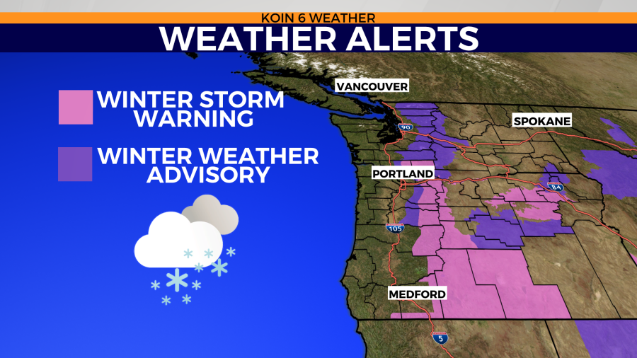


There is a winter storm warning in place until Thursday morning for Hood River, Jefferson, and Skamania counties. Do yourself a favor and swipe through the slideshow to see the conditions up at Timberline Lodge for Tuesday afternoon. Multiple feet of snow in 24 hours with a gigantic base to play with. Once the roads freshen up and we can get to the slopes, tons of recreation time available.