PORTLAND, Ore. (KOIN) – There are small weather milestones that happen each year, and right now we are celebrating our first 70-degree day in Portland.
Coming off of fall and winter, when the temperature is generally cool, it can sometimes feel really good to have a nice mild day in the early part of spring. It’s not saying much, but we hit our first 70-degree day four days earlier this year compared to last.
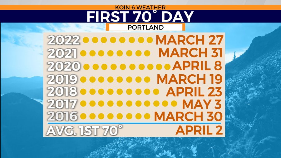
However, over the last 30-years (1991-2020), the average first 70-degree day in Portland, happens to fall on April 2. We were right in the ballpark, coming in about a week early. It isn’t out of the ordinary to see a 70-degree day this time of the year.
Check out the list of some of the recent years, going back to 2016. What is most notable, is the late April and early May observations from 2018 and 2017. Those are significantly later than our average first day. If it was 2017, we would be waiting over a month for our first 70-degree afternoon. Right now, it’s almost perfect timing for that nice spring touch because of the timing of the cherry blossoms. It’s the type of weather that pulls people out to the waterfront to see the beautiful trees. This is also the time of the year for areas like Salem and up in Washington too.
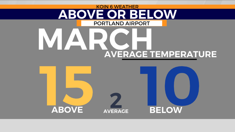
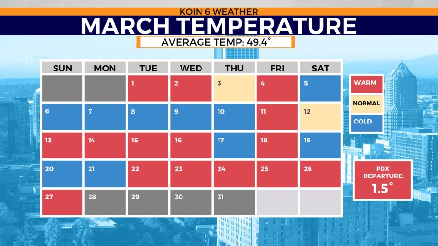
Are we just running warm this month? To some degree we are. We have had 15 days above average and 10 days below average this month. Two days have hit the average right on the mark. This is taking both the high and the low temperature into account. We have had some days where the daytime high has been below the average, but the morning temperature was so mild, it tipped the scale above. If you cycle through the slideshow below, you will find the “March Temperature” calendar. You can see how everything broke down through the month, outside of the last handful of days.
We have a streak of cool temperatures, ranging from March 5 to March 10. We are now on a similar stretch of above-average temperatures, going back to March 22. This has been a combination of warm afternoons and also warm overnight temperatures. If you are one that has to take your dog out for consistent walks, including at night, I’m sure you have felt how comfortable it has been. Right now, our average temperature is at 49.4 degrees, which is 1.5 degrees above our average. It is likely that we wrap up the month above average.
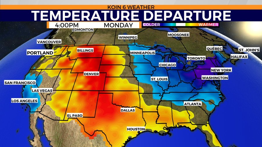
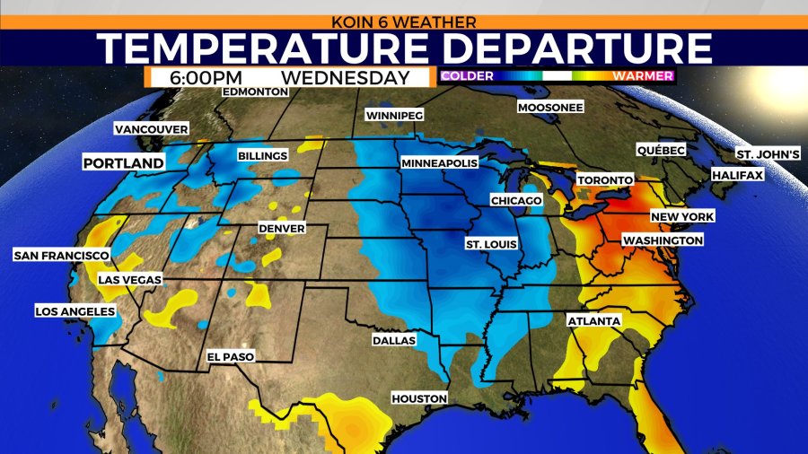
The next three days are going to be up and down as far as the temperatures go for the Willamette Valley. We should expect temperatures around average or above, before dropping to below average by midweek. If you cycle through the temperature departure graphic, you can see an idea of where the air mass is going to be warm vs cold. Today we hover around average or above. There is a large section of the Rockies that are expected to lean above average today. A pocket of blue for the Great Lakes and New England area. That is going to be temperatures that are leaning towards winter, not so much spring. Of course, our conditions are always fluid. That warm air situated over the Rockies on Monday will then jump to the Midwest by Tuesday. Eventually shifting all the way to the east coast by Wednesday. If you focus on our Wednesday forecast, you can see a pool of blue over the Pacific Northwest (PNW) too. That is the aforementioned cool down that we have coming our direction near the end of the month.
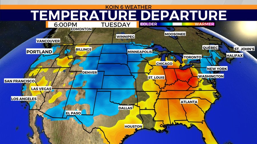
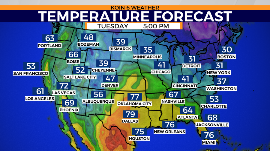
What does that actually look like as far as temperatures? You can expect today and Tuesday to be above average into the lower 60s for daytime highs. Our overnight temperatures are going to be above average too. You can also see how the Midwest and the east coast are on a wild roller coaster ride right now. Spring can definitely have those large temperature swings from one side to the next. This is also the time when severe weather can start picking up more frequently.
Lastly, if you check out the forecast on Wednesday. You will spot the cool 53 degrees coming out of Portland. This is when we have a weak system coming in from the northwest which will bring in more rain and cooler air.

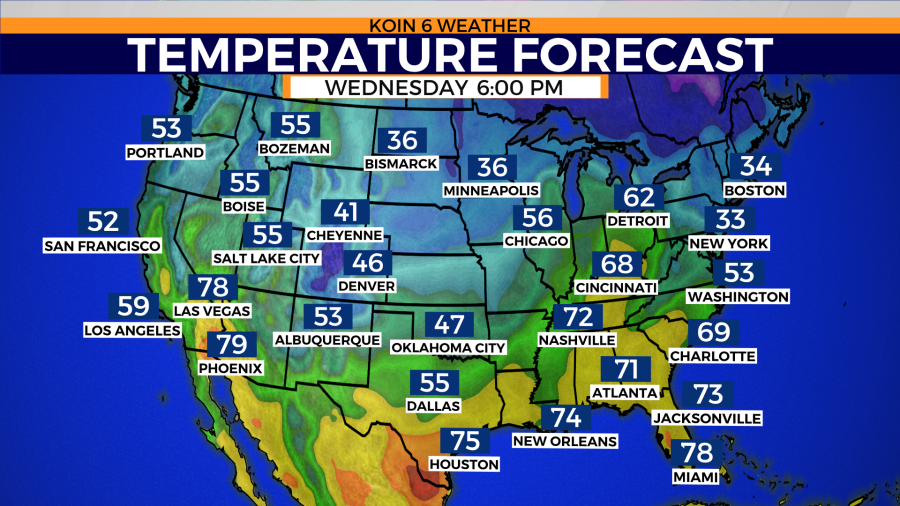
That is when we will likely pick up a few more “blue” days on the March calendar.