PORTLAND, Ore. (KOIN) — Another surge of moisture moves into the Pacific Northwest Monday as rain accumulation nears an inch for some.
Snow is also set to take aim at elevations above 2,000 feet. Snow amounts will near 3-9 inches above 2,500 feet and even greater amounts are possible above 3,500 feet.
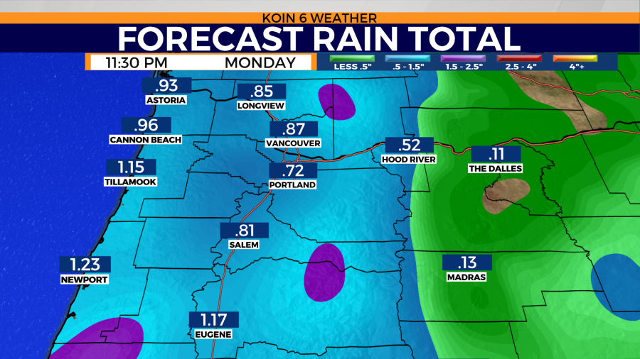
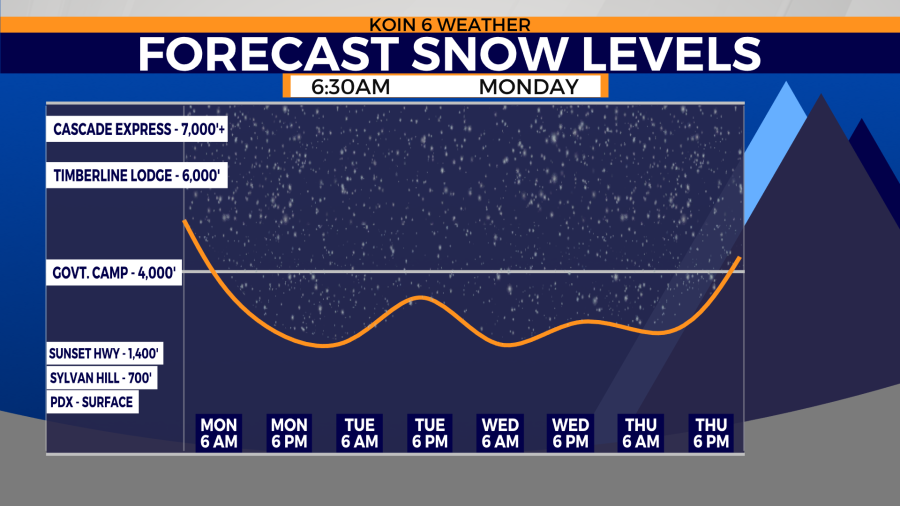
A cold front will swing through the region early Monday morning. That front will increase the rain potential and help drop the temperatures throughout the day.
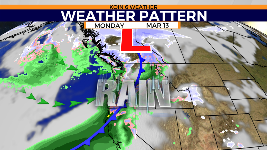
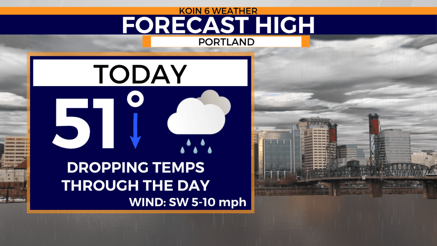
The warmest part of the day in Portland will be found around sunrise. Temperatures will continue to drop as the cold front swings through the area. Afternoon highs will only sit in the mid-40s as overnight lows fall to the upper 30s. Temperatures will not be cold enough to see snow in valley locations.
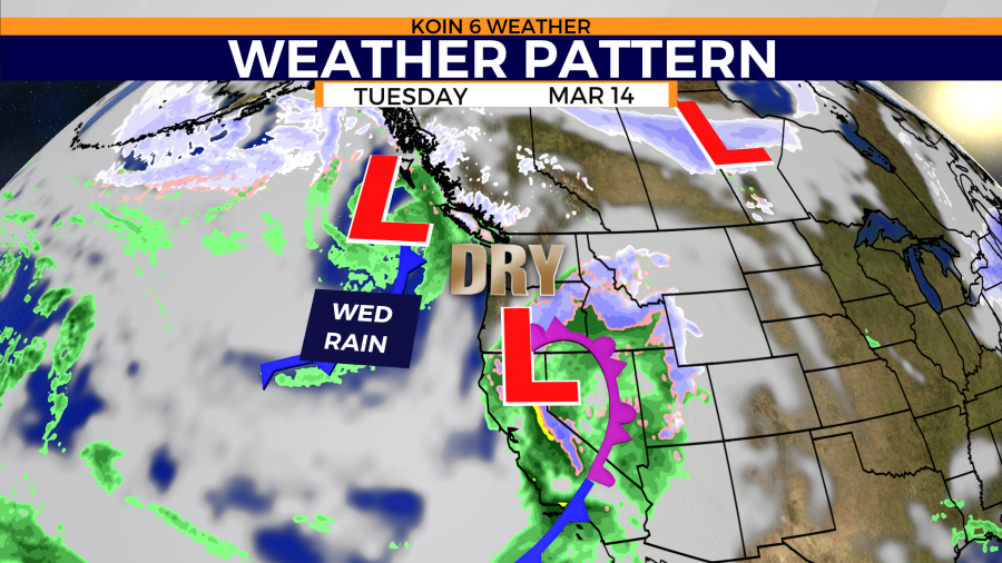
Slightly drier conditions move back into the forecasting area Tuesday. That comes as western Oregon and Washington sit between storms.
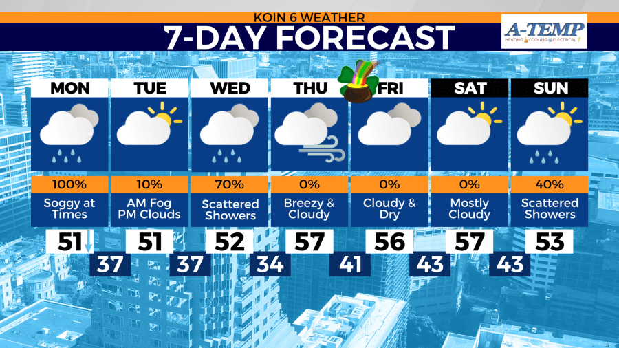
Despite cooler temperatures moving into the area Monday afternoon, highs will continue to warm through the week. Some of the warmest temperatures of the month are expected by Thursday and will last through Saturday.