PORTLAND, Ore. (KOIN) – February has been known to produce a few winter storms for the Pacific Northwest (PNW). Not just an inch or two, but some major snow events.
You may not realize, but Portland will have an average high of 54 degrees in the weather forecast by the time the month wraps up. Temperatures start warming as the day length continues to extend. That hasn’t prevented the big snowstorms from showing up though. Going back to recent years, we’ve had some of our most productive winter years coming in the month of February.
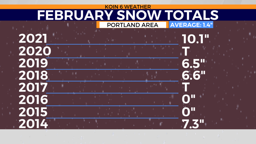
Portland didn’t record any measurable snow in January, which means the Willamette Valley is waiting on another low elevation winter storm. There’s been at least a trace of snow going back the last five years, and three of those five years have produced snow worth talking about.
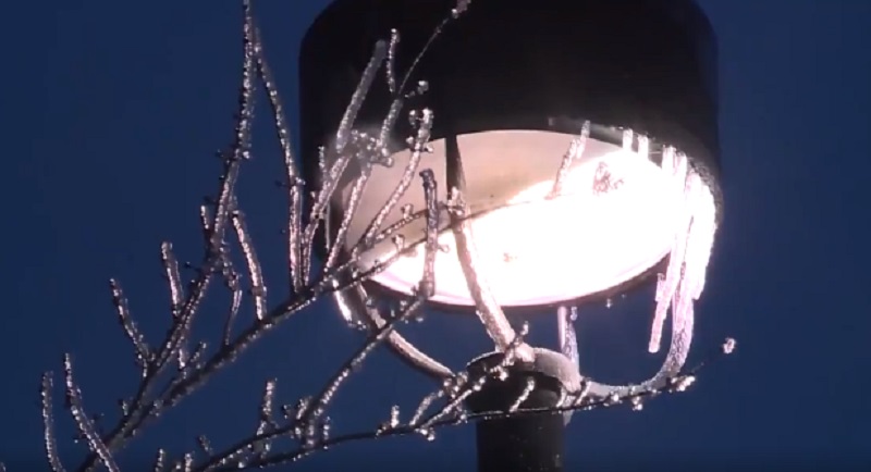
You definitely recall the snow and ice event from last year. You can go back and read about the Feb. 11-14 snow and ice storm here.
February 2021 wrapped up with 10.1 inches of snow, and both 2019 and 2018 finished with more than 6 inches of snow. Talk about a busy month of winter forecasting! But what about February 2022?
We can confidently say that the first part of the month is panning out to be slow, leaving the area mainly dry and clear of snow.
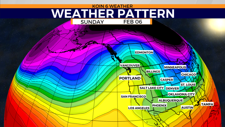
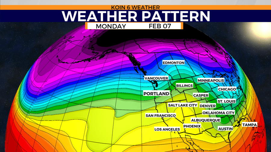
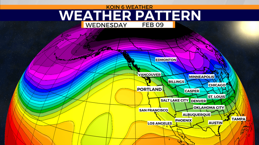
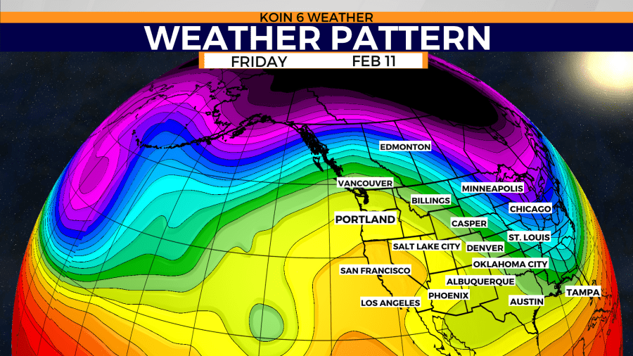
Do you recall the dry stretch that was coming off of January? We had nine days in a row that was vacant of rain. That was because of a bound and determined ridge of high pressure. That type of ridge can show up in February as well. Extended weather models are projecting a similar weather pattern for the first part of February. Swipe through the graphics below to see how the jet stream will meander over the next 11 days. After Monday, February 7, we may have a strong ridge develop to the west. That ridge eventually shifts east and holds. That would prevent winter weather from moving in for the PNW. This would also lead to another stretch of morning fog and afternoon sunshine.
However, Mother Nature has been known to throw a curveball into the equation from time to time. Right now, the likelihood of low elevation is low. A repeat of last Feb. 11-14 doesn’t seem to be in the cards at this time, but that doesn’t mean the last few weeks of February aren’t open to schedule a date for snow.
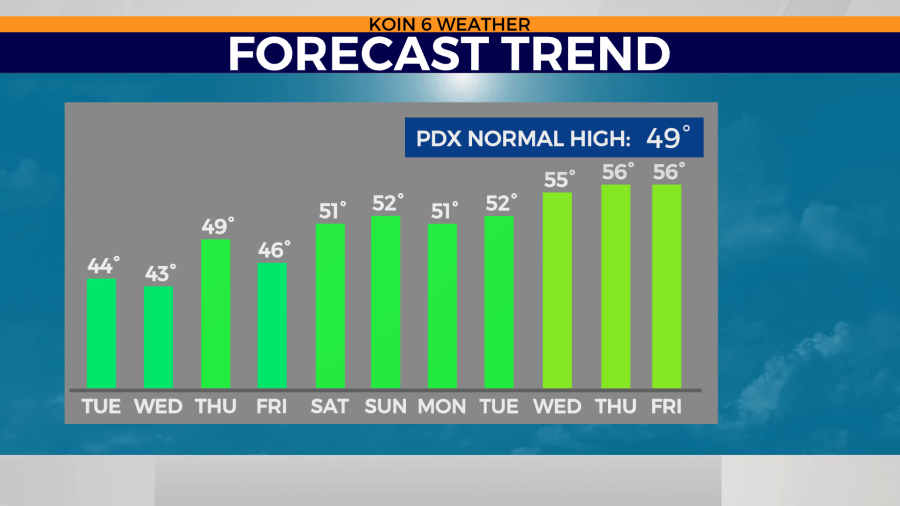
If we take the expected ridge and look at the temperatures that are associated with it, daytime highs may push the upper 50s to 60 degrees. That won’t do the trick for winter weather. That may mean an extended period of time that we do not have mountain snow too. For the remainder of this week, temperatures will hover in the mid-40s until the weekend. There have been some areas in the morning that have had freezing temperatures. Those areas are having dropping temperatures because of the clouds clearing out and the heat escaping out to the atmosphere. We haven’t had a cold air mass move in that can keep the surface and air aloft in a state of cold trance.
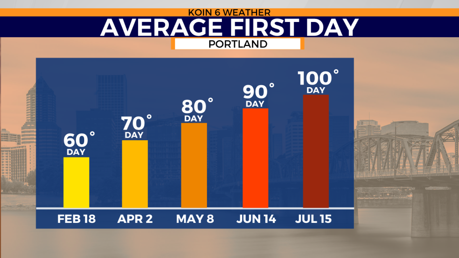
You may find it interesting that our average first day at 60 degrees or above tends to occur in February! From 1991 to 2020, the Portland airport tends to see 60 degrees around February 18. We have already hit 60 this year due to a warm record-breaking day in January.
If you were hoping for warmer temperatures this month, you’ll have to wait a little longer. For the record, if we do not record any measurable snow this month, March has been known to bring in a few snow events too!