PORTLAND, Ore. (KOIN) — After weeks of abnormally cold and snowy weather, Portland is forecast to see typical March temperatures and rainfall in the coming days.
KOIN 6 Meteorologist Kelley Bayern reports that daily highs will climb into the 50s by Saturday as a wave of storms continues to bring needed rain to the region.
“We are switching from a cold and showery pattern to a mild and wet one,” Bayern said. “A pair of moderate to strong atmospheric rivers will impact the west coast over the weekend. The first storm comes Thursday and will bring numerous showers to the area, likely picking up into the evening and overnight.”
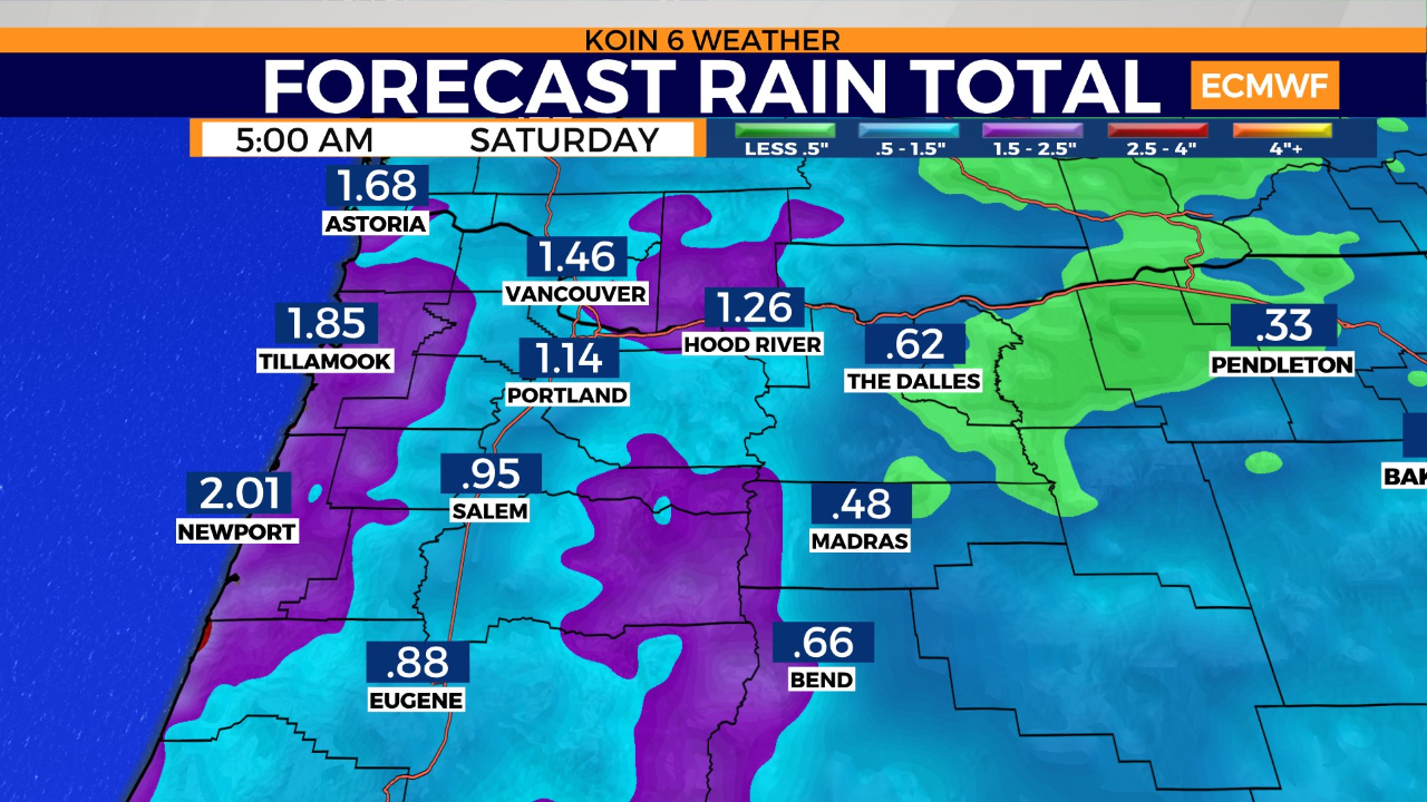
Flooding and landslides will be possible across the Coast Range and in areas of the Central and Southern Oregon coast as heavy rain will continue to impact the area through Friday. Heavy snow will also be possible in the Cascades. Rain and 50-degree temperatures are expected to linger into early next week.
“We’ll get a brief break from widespread rain on Saturday with scattered showers,” Bayern said. “Then a second atmospheric river fueled system arrives on Sunday into Monday. The Portland metro area will once again be under soggy conditions.”