Editor’s note: Latest forecast details on potential snow this weekend in Josh Cozart’s latest weather blog here.
PORTLAND, Ore. (KOIN) — Another round of dry weather is expected for western Oregon and Washington Wednesday.
Morning fog will be slow to clear as an air stagnation advisory remains along the Willamette Valley. Afternoon sunshine will help warm temperatures back into the upper 40s. The mild conditions will last into Thursday.
High pressure that’s sat over the Pacific Northwest for the last few days is on the move. A trough of low pressure will drive a cold pool of air south this weekend. That dip in the jet stream will bring colder daytime highs and early morning lows back to the region by Saturday evening.
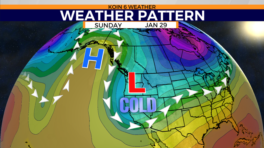
The potential for moisture is possible this weekend. That will combine with near-freezing temperatures. The forecast is still subject to change as the next major weather event remains nearly four to five days out.
Long-range weather models are beginning to agree. A few light snow flurries are possible in the Portland metro area when comparing the GFS, ECMWF, and GEFS long-range weather models come Saturday night into Sunday.
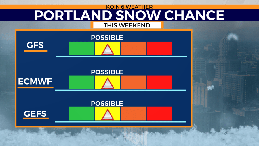
Snow accumulation is still uncertain as surface temperatures still continue to fluctuate.