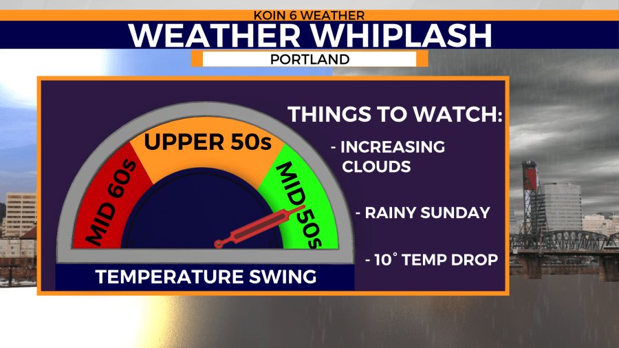
PORTLAND, Ore. (KOIN) — Saturday was Portland’s warmest day of the year with an afternoon high of 68 degrees. Sunday brings familiar weather back to western Oregon and Washington. Rainy skies and below average temperatures will keep Portland’s afternoon conditions nearly 10 degrees cooler than just 24 hours earlier.

Sunday’s rainmaker puts an end to Portland’s 3-day stretch of 60 degree temperatures. Portland has not seen this long of a stretch of mild weather with highs in the 60s for nearly 5 months. Mid-morning rain showers Sunday will put much of the Pacific Northwest on track to seeing average rainfall amounts and temperatures for the month of March.
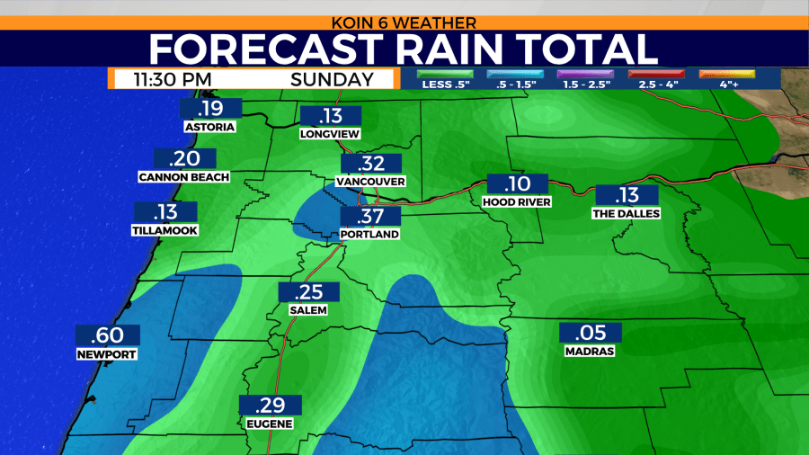
Afternoon highs will climb into the mid- to upper-50s Sunday as rain showers become heavy at times during the afternoon and evening hours.

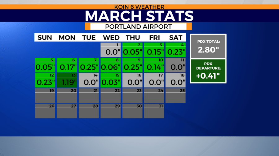
Portland’s monthly rainfall remains above average despite the last three rain-free days. Sunday’s rain showers will continue to keep rainfall totals close to normal and help keep the drought-free region around Portland’s metro area healthy.

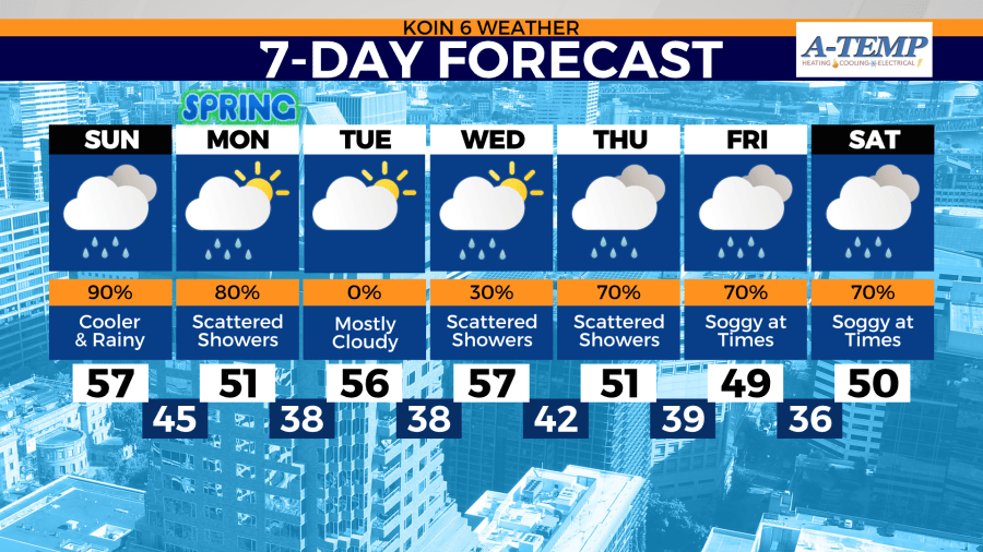
Sunday isn’t the only day with a chance of rain this week. Soggy skies are expected to stay through Monday.

Temperatures are expected to dip below average several times this week. Afternoon highs could dip nearly 10 degrees below normal by the week’s end. This comes as rain chances remain high for the region with the exception of a a drier Tuesday.
