
PORTLAND, Ore. (KOIN) — Oregon and Washington’s latest arctic blast will bring the chance of record-breaking cold and snow back to the area later this week. Both afternoon highs and early morning low records are being threatened later this week. First comes the chance of snow.
Spotty showers will begin Monday morning for the Portland metro area. Rain doesn’t become more widespread until late Monday night into Tuesday. That’s where snow elevations will start to fall to nearly 2,500 feet.

Temperatures will continue to fall through the week. Afternoon highs Wednesday will struggle to make it into the mid 40s in Portland and Vancouver. That where the snow chances close in on the I-5 corridor. Long-range weather models still disagree on the coverage and timing of the snow, but some of the first few flakes will start to fall Wednesday evening. Snow accumulation remains uncertain as of Sunday night.

Record-breaking cold is on the way after the snow flurries clear early Thursday morning. Temperatures will be cold in the wake of the snow threat Thursday. Afternoon highs will struggle to warm into the mid 30s.
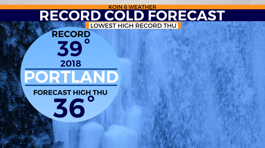
Portland has the chance to break a record for coldest daytime high temperatures with a forecast high of only 36 degrees. The record coldest afternoon highs was 39 degrees set back in 2018 for February 23.
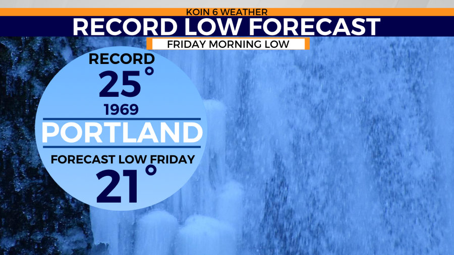
Another potential record could be broken come Friday morning. Lows are expected to fall to nearly 21 degrees at sunrise Friday. That threatens the old record of 25 degrees last set back in 1969.
Both afternoon highs and early morning lows will begin to warm by Friday afternoon. However, temperatures are expected to continue to sit below the average 52 degrees through the end of the weekend.