PORTLAND, Ore. (KOIN) — A Red Flag Warning is in effect through Saturday night across a large swath of Oregon and Washington.
Strong east winds continue to dominate the Cascade ridges all the way down to the sandy beaches. Winds of 20-30 mph with stronger gusts of 40-50 mph are possible during the morning and afternoon. Power outages have been ordered to avoid a repeat of the Labor Day Fires of 2020. Expect high temps in the low to mid 90s Saturday up and down the Willamette Valley. There is a catch, though.
Wildfire smoke will blanket most of the region, with varying depths of brown haze extending beyond the coastline. Expect air quality to evolve with the wind direction. Areas covered in dense smoke can expect cooler temps than what is forecast.
Relief from the heat and poor air quality arrives late Saturday, early Sunday. The devil’s breath will be taken over by a dominant southerly flow. Eventually, the prevailing wind will come from the west Sunday and Monday.
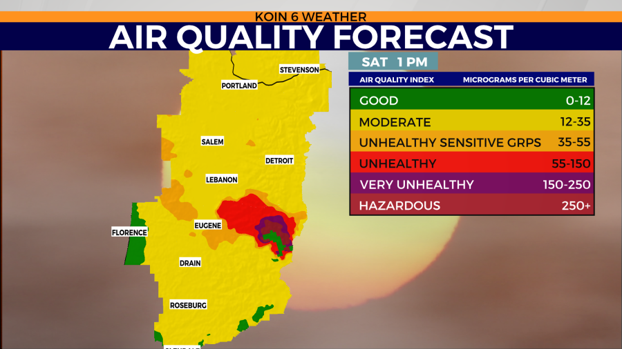
Air quality forecast for Saturday midday 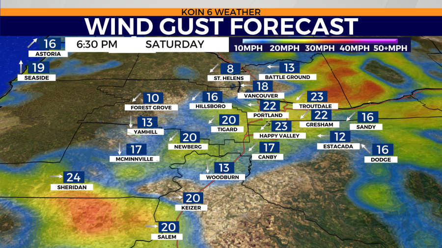
Wind gust forecast Saturday midday 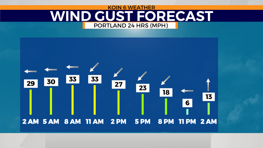
Hourly wind gust forecast Saturday for Portland 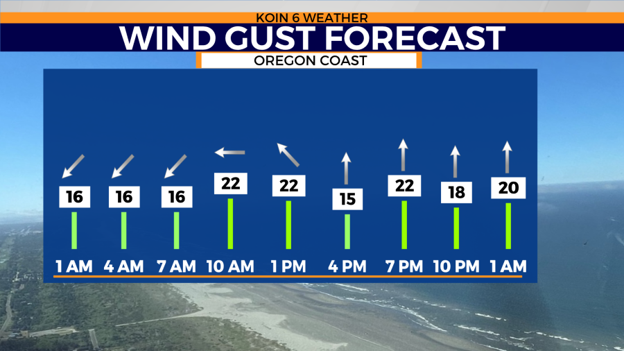
Hourly wind gust forecast Saturday for Seaside, OR 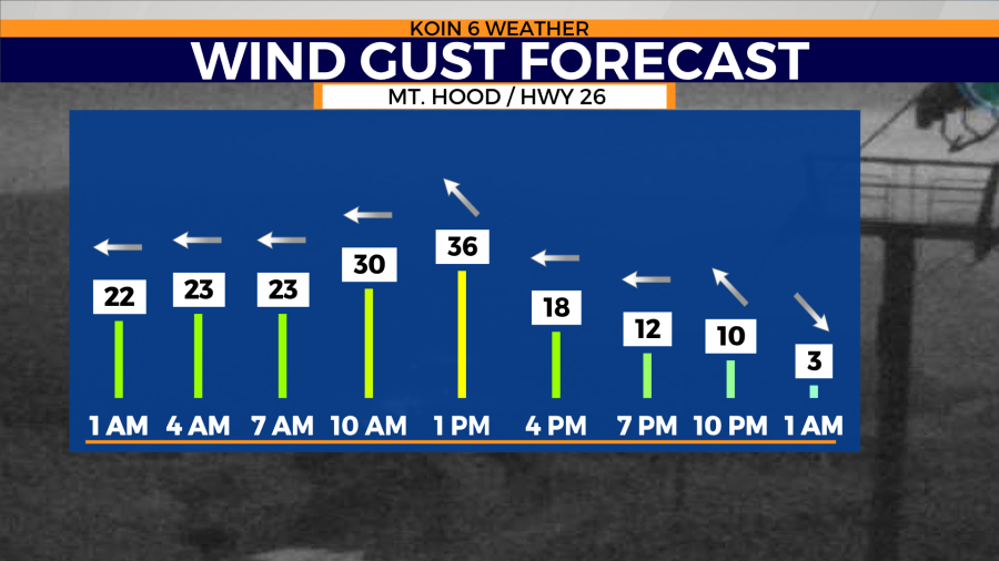
Hourly wind gust forecast Saturday for Gov. Camp, Mt. Hood area. 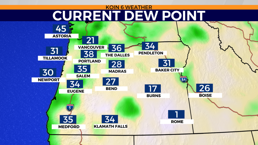
Dew points as of 1:30am Saturday. Yup, that’s dry. 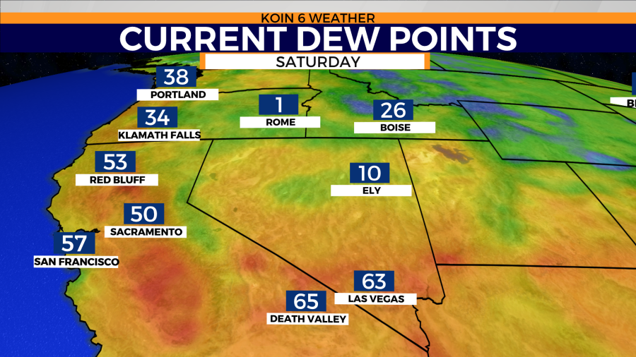
Death Valley dewpoints almost twice that of Portland. Why? Dry, east winds at PDX and a surge of moisture from Tropical Storm Kay over the South West. 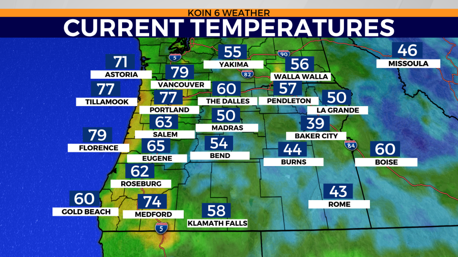
Temperatures as of 1:30am Saturday. Why the big difference from Salem to PDX? Blame it on the east wind. Wind sheltered areas were 10-15° cooler than wind battered zones 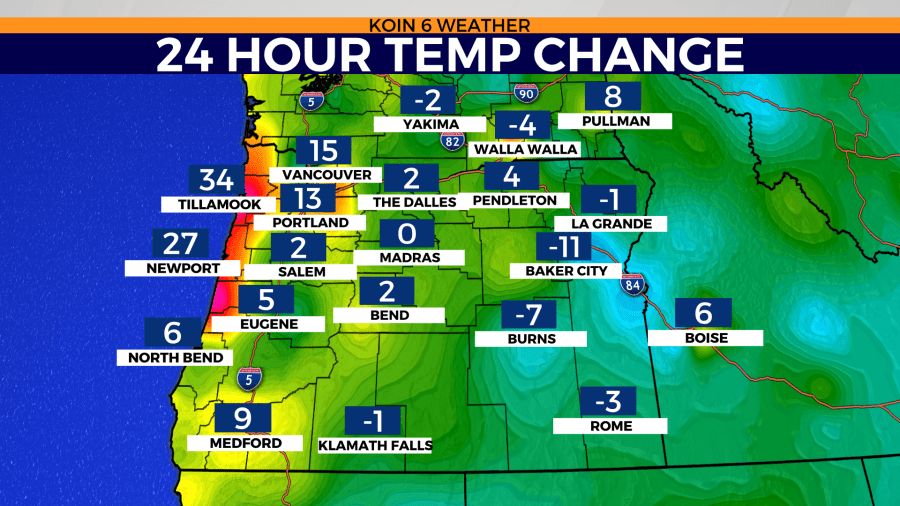
The 24 hour temperature difference from 1:30am Friday to Saturday 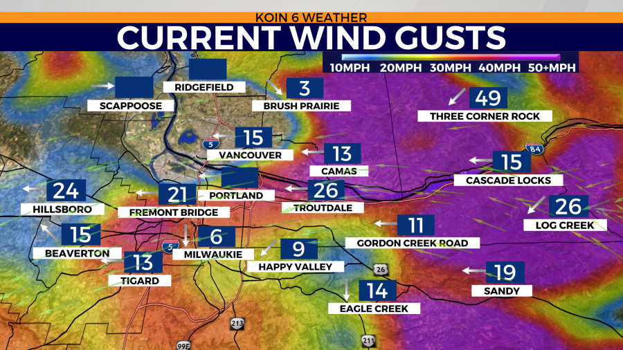
Wind gust speeds in mph as of 1:30am Saturday
Hot, dry and windy. If you didn’t know any better you would swear we’re smack down in the middle of Death Valley. Would you believe me if I told you, as of early Saturday morning, the weather in Death Valley felt like a tropical wonderland compared to parched Portland? Yup. We became the desert and the desert, well… it became a steam room thanks to the outer bands of Tropical Storm Kay. Scroll through the images above and you’ll see the comparison as of 1:30 a.m. Saturday.