PORTLAND, Ore. (KOIN) – November, December and January are the three wettest months on average for Portland.
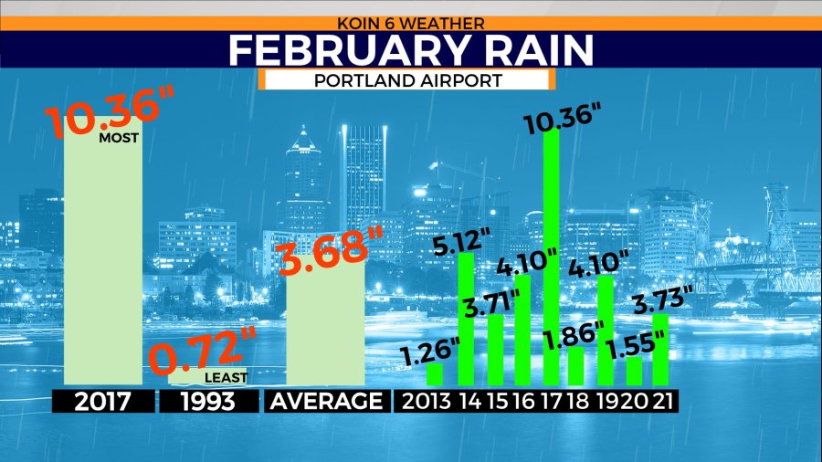
February’s weather forecast for Portland surprisingly falls short compared to the late fall and early winter months. We are going to go from an average of 5 inches of rain (January) down to 3.68 inches for the month of February. In recent years, we’ve been all over the board for the month of February.
Last year, Portland brought in 3.73 inches of rain. That is about what you can expect for February. However, you may recall 2017, when we broke the all-time record with 10.36 inches of rain. We were dealing with flooding out in Hillsboro and the rivers were tested. That tells you it can still be a very wet month out here in the Pacific Northwest (PNW). Unfortunately, we’ve had a few recent years that have also been a dud. 2020 brought in 1.55 inches of rain, 2018 brought in 1.86 inches of rain.
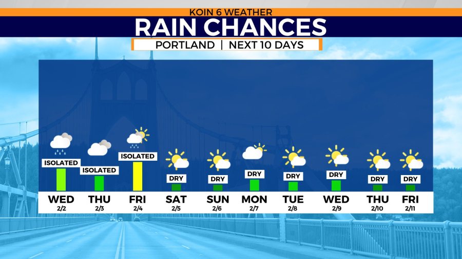
This year, we are going to start the month of February on the dry side. We may put ourselves in a bit of a hole by the time we get to Valentine’s day. Rain chances are expected to be limited to a few opportunities from now until the weekend. The showers that have developed this week have been weak and they won’t be enough to put us over the top early in the month. The extended rain chance forecast is reflecting a dry stretch of weather coming our way.
We are keeping an eye on Monday, Feb. 7, as a day that may switch over to rain. Outside of that, we have two determined and bullheaded ridges trying to develop.
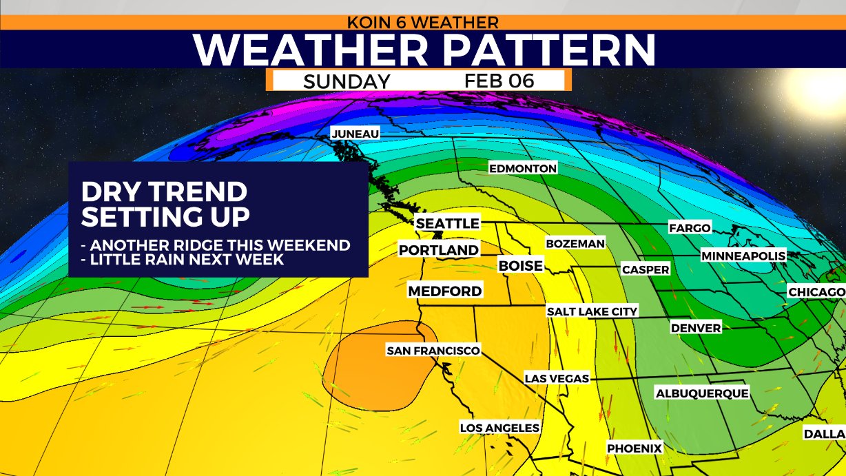
The first arrives this weekend, preventing any rain from moving through starting Saturday. Sunday the ridge will be in full force, keeping the area dry. It’s possible that this ridge trickles directly into a second and more expansive ridge by next week. As I mentioned above, there may be a quick disturbance that helps carry this first ridge east on Monday.
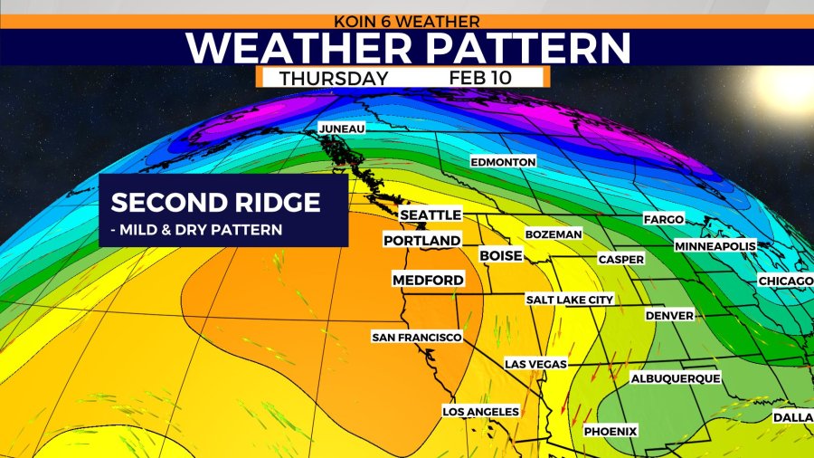
If you cycle to the next graphic in the slideshow, you will find the second ridge of high pressure that will keep conditions mild and dry. The second ridge you can tell covers a larger piece of real estate. Those types of blocking patterns can escort all the rain to the north, eventually watching it all pass over the top of us to the Midwest. If we keep that ridge in place all the way until the third week (13-19) of February, we will have some work to do.
These types of ridges can boost our temperatures, especially aloft. Right now, the forecast trend continues to advertise warmer weather by next week. Daytime highs may push the mid-50s by Wednesday. A ridge-like this may also encourage a temperature inversion. That is when the air is warmer aloft, cooler down at the valley floor. That is when we have morning fog form, with limited sunshine in the afternoon. That may cut our daytime highs down, leaving temperatures in the 40s. We will keep an eye on that because it also depends on the moisture and the wind.

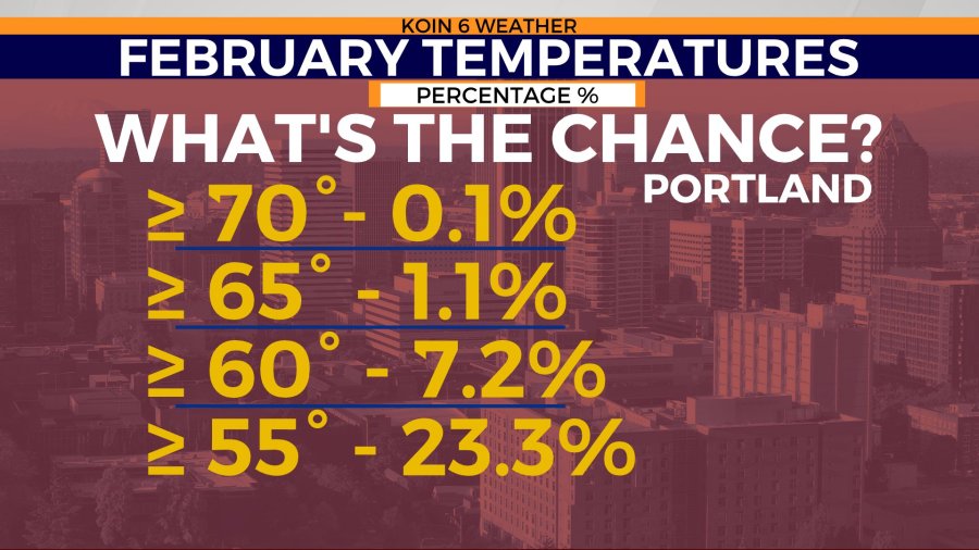
Does this mean we are going to have an early start to spring? It may feel like it for a few days, but we are still in a La Niña winter, which usually means cooler and wetter weather. If you’re curious, temperatures that top in the mid 50s, happen about 23.3 percent of the time in Portland. If we break into the 60s this month, that typically occurs 7.2 percent of the time.
Remember, it’s technically winter until Sunday, March 20.