Editor’s note: Latest weather forecast details here on the atmospheric river taking aim at the Pacific Northwest starting this Friday.
PORTLAND, Ore. (KOIN) – Atmospheric River (AR) season is taking off!
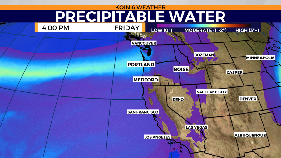
With an active jet starting to become more evident as we enter the colder months, the PNW is ready for more rain. There is a rope of moisture that is going to push over Portland come Friday. Between a strong wind and a load of moisture, this plume plans on reaching a moderate level of AR come to the end of the week. Notice that a firm band of blue and green reaching the Washington and Oregon region come Friday.
What does this mean for you? It’s going to be very wet come Friday evening (also a bit warmer).
FORECAST
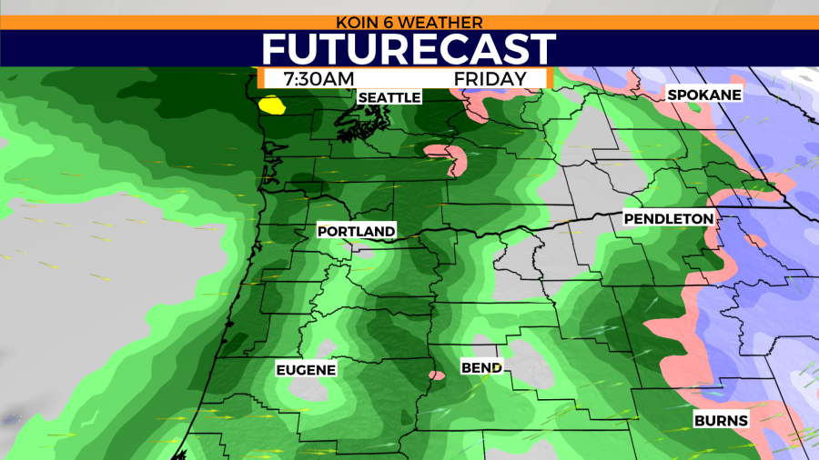
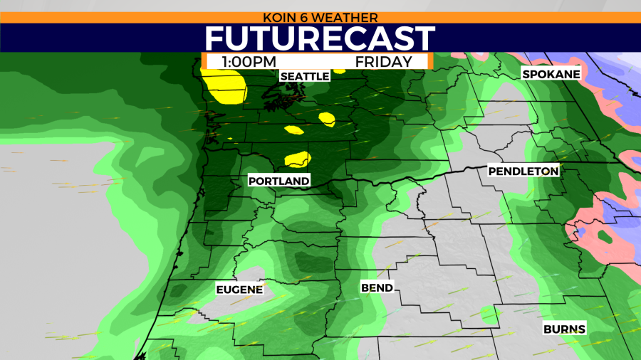
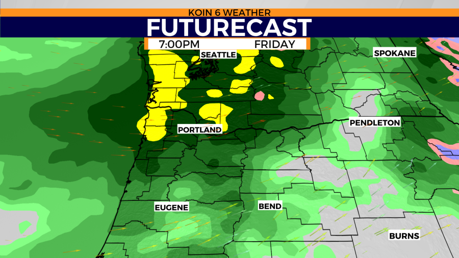
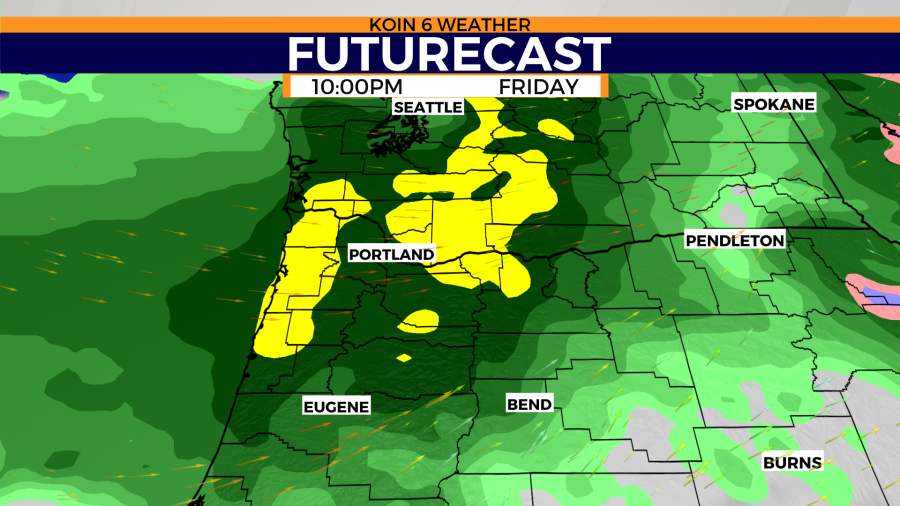
All eyes are on Friday as rain showers increase come morning. The heaviest of the rain will start up in the Olympic Peninsula, before pulling south through the course of the day. If you were traveling to Seattle on Friday, you will have a wet drive. There are sporting events occurring Friday, which are going to also be waterlogged.
The slideshow below will show the timeline for the day. As the morning reaches midday, showers will turn over to rain. At this time, it will likely be light for Portland. Southwest Washington and the northwest Oregon coast should be in the early stages of steady rain at this time. As the afternoon plays out, the rain will become more steady for the northern Willamette Valley. We are expecting a rainy commute Friday evening. Weather models are projecting the main axis of this AR over the Willamette Valley by Friday night. This is when we will have soaking rain across the whole region. This will melt snow on the slopes, and this may cause mudslides or debris issues for vulnerable terrain. Travel will be very wet by night.
ESTIMATED RAIN TOTALS
These totals are a projection of current weather data from Tuesday. Both major weather models are expecting over an inch to an inch and a half on Friday, with the potential to even jump up to nearly two inches by midnight for Cowlitz and Clark counties. The Oregon coast will pick up the largest totals, with weather models differing on the moisture that reaches the Cascades. These rain totals will rival the weaker atmospheric river from Halloween on Monday.

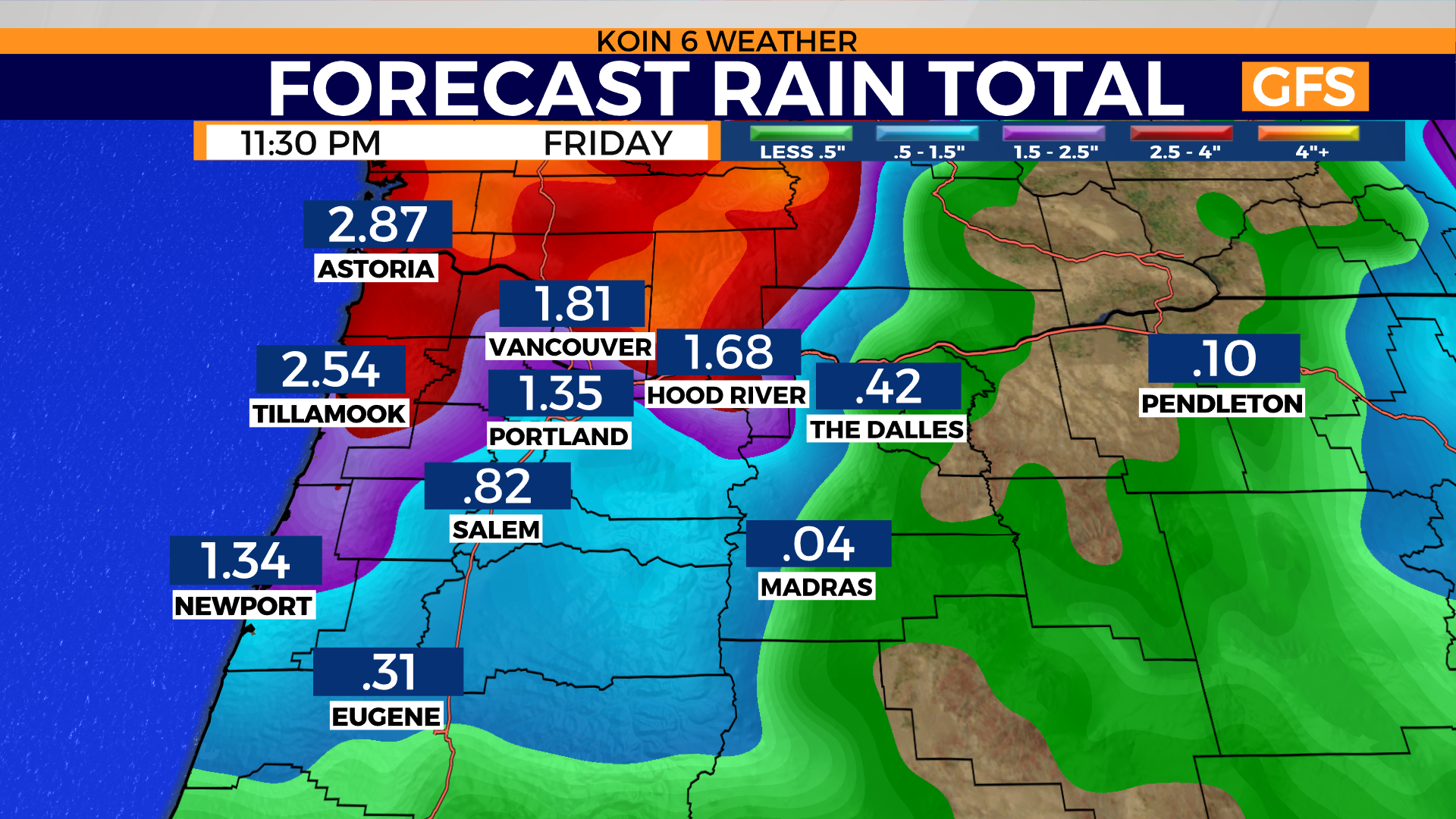
This may end up being record-breaking rainfall, as the record for the Portland airport on Friday is 1.12″ (2006)! It is these types of systems that help drive up our monthly rain totals in the PNW. This will help out areas that are dealing with drought, but it may also cause some problems too. This system will also hang around into Saturday morning for those of you in the southern valley. We will have updates to the weekend forecast as we approach this event.
