
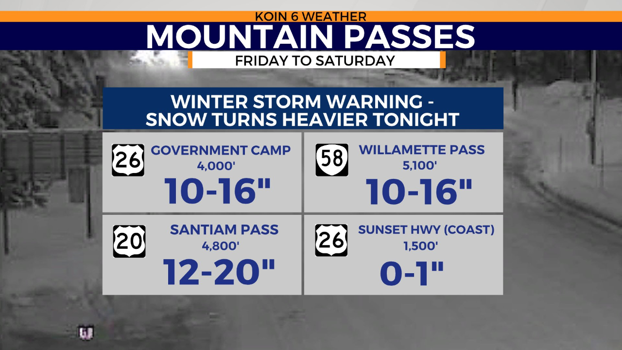
PORTLAND, Ore. (KOIN) — The first storm system of the week dropped as much as a foot of snow on Mount Hood in the last three days. A second storm will move into the area on Friday, unloading an additional 1 to 3 feet of snow on the Cascades by Sunday.
The National Weather Service has issued a 24-hour winter storm warning for elevations above 3,000 feet starting at noon on Friday. Traffic delays are expected through the Columbia River Gorge and across mountain passes starting this evening due to low visibility and snow mixed with freezing rain.
The incoming storm will also impact the Oregon coast and the Willamette Valley. KOIN 6 Meteorologist Kelley Bayern reports heavy rain and strong winds are also in the local forecast.
“Expect shower chances to increase by lunch, with heavier rain setting up this evening in Portland,” Bayern said. “Our next storm then barrels in heavy, widespread rain. We’ll be soggy across the coastline and valley. Wind gusts may top out around 50-plus mph for the central and southern coast. Thirty-mile-per-hour gusts will be possible in Portland overnight for a blustery evening.”
Next week’s forecast remains questionable, but more rain is expected on Monday. Frigid arctic air could also move into the Pacific Northwest by midweek.